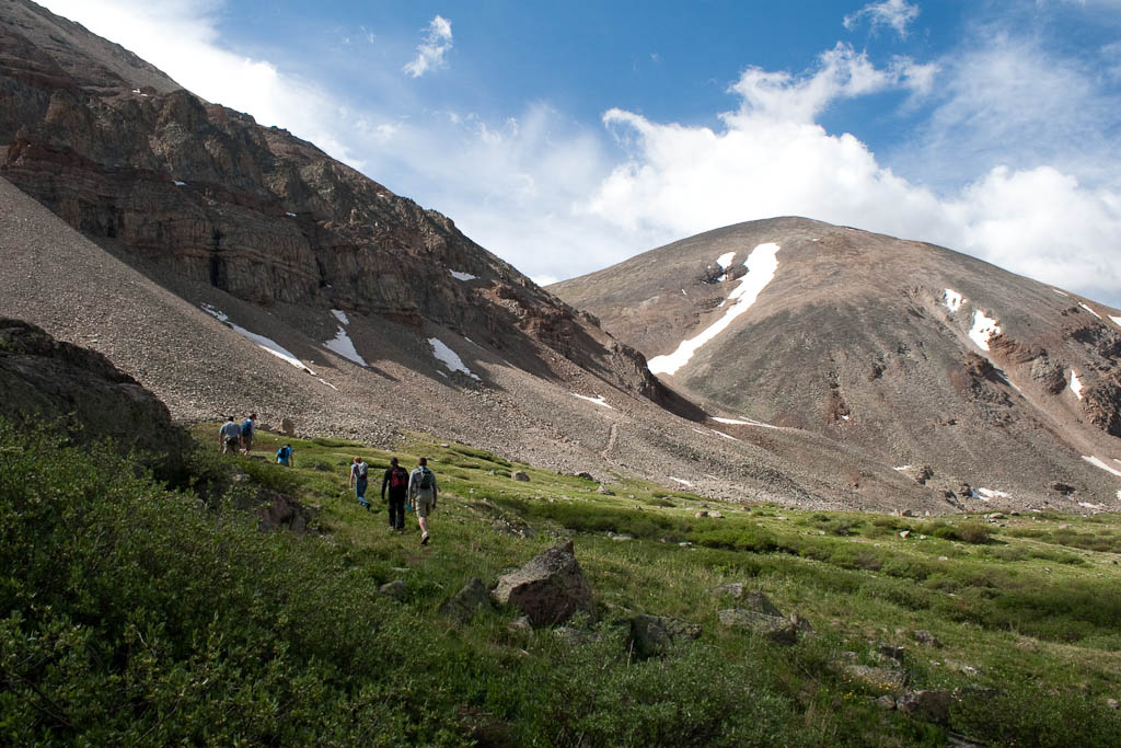
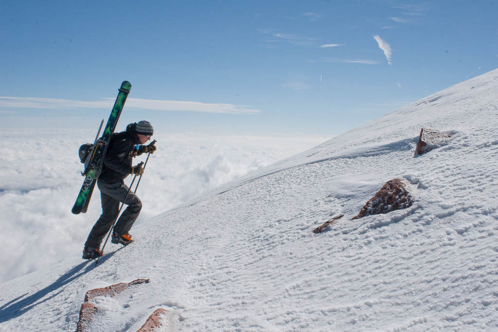
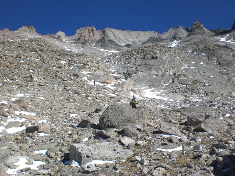
Here are a few photos Carl took from yesterday. First, a steep sidehill on the approach.
 Fortunately there were plenty of anchors on this slope.
 Shortly after this came the tree-climb:
 And now a few of me enjoying the snow:


Until next time…
Here are a few photos Carl took from yesterday. First, a steep sidehill on the approach.
Fortunately there were plenty of anchors on this slope.
Shortly after this came the tree-climb:
And now a few of me enjoying the snow:
Until next time…
Today’s summit attempt, unfortunately, was one of failure. That’s not always a bad thing, though. I usually don’t write anything about failed climbs, but today is a little different. It was just one of those days.
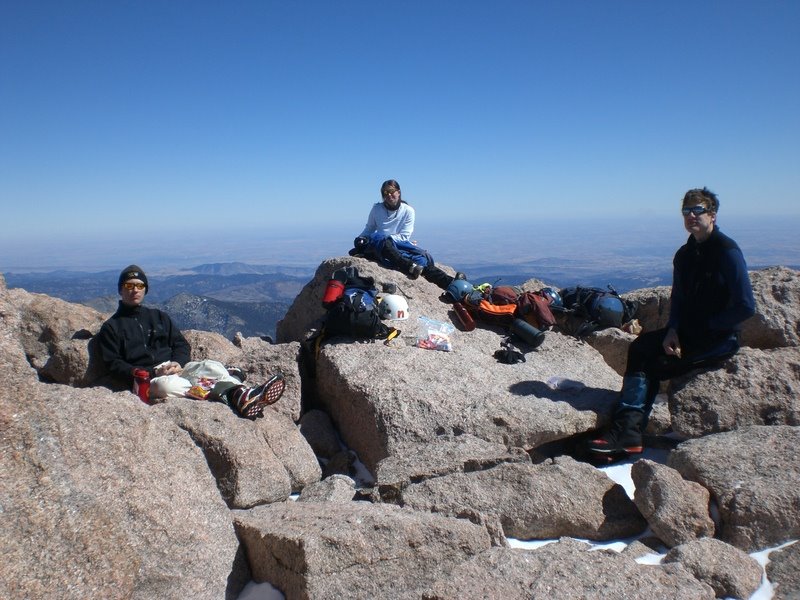
First off, the (small) cast of characters. Carl:
 And myself:
 After oversleeping by 40 minutes and incorrectly setting the coffee machine (good thing I cooked the bacon last night!), I scrambled and raced to meet Carl in Golden for the uneventful drive up to Montgomery Reservoir. Continue reading
Yesterday kicked off this year’s 14er season for me with Mt. Elbert; I’ve set a goal of skiing 10 new-to-me 14ers and after yesterday, I only have to do nine more. Of course, it’s so enjoyable (I wouldn’t say “fun” is the right word for it) that I may go over. Time will tell I suppose. Here’s the track (blue is ascent, red is descent; approximately 6 miles and 5,000′ vertical each way):
 Yesterday at 3:59am both Nate and I were sound asleep on the floor in the back of the luxurious Silver Plume Saloon. At 4:00 sharp, the alarms went off and it was time to get moving. A couple hours later we would pull into the parking lot for the South Mt Elbert Trailhead to single-digit temperatures. No time was wasted getting skinned up, and we were moving just before 7am.
 Winds were almost nonexistent before getting in the trees, and were completely calm in them.
 It was a tough temperature balance, as I had dressed for the forecast, with a high of nearly 40F and no wind. It was too warm for a shell while blazing through the trees, but a little chilly for just a t-shirt.
 Surface hoar had grown everywhere, and the snow was sparkling brilliantly (though I seem to have failed capturing it in this photo).
 After two miles along a snow-covered 4WD road, we reached the summer trailhead. There’s a small bridge here that seems to be in every TR along this trail; I’m not sure why, but here’s the mandatory bridge:
 A couple more miles and we were at treeline, with most of the rest of the route in view.
 Without any recent reports from this route, I was slightly concerned about snow coverage for the descent. This view made me pretty happy. There’s really nothing technical about this mountain, mostly skinning with a little booting over rock at times.
 That doesn’t mean the views weren’t spectacular at times though.
 Here I am, smiling for some reason.
 Box Creek Chutes is the classic descent route on Elbert, and coverage is looking pretty decent.
 We were considering that as a descent option; unfortunately some wind and clouds rolled in as we were nearing the top, and I expect the snow would’ve been rock hard and unenjoyable. There’s a good chance I’ll be back later this spring to hit Box Creek. There was a group of four Nebraskans who went up on Thursday and camped at treeline for two nights before going for the summit. I’m not sure when they started yesterday, but here they are coming down from the summit. Nate and I had another half hour or so from this point. The Nebraskan on the right looks rather nonplussed.
 It was about this point that things became significantly more challenging; the air was getting thin and the mercury was dropping. I started employing my standard step-counting technique to keep myself moving at a reasonable pace. I would lead off, take 30 or 40 steps, stop, and breathe. Then Nate would cover the same distance, we’d point at the next false summit, say “five more sets, that’s the summit.” When I saw the final false summit I told Nate not to get too dismayed when we hit that point. We got there, saw the real summit 200′ above us, confirmed with the GPS how close we were, and I called one more set of 5 (which actually turned out to be accurate this time). After an hour of high intensity interval training at 14,000′, we reached the top.
 We were both pretty tired from the climb, and instead of 40F, clear, and calm, it was probably in the 20s, overcast, and breezy. I asked Nate if he would mind not staying on top very long; turns out he had the same sentiment and was ready to strap in and go.
 Since snowboarding is clearly the most efficient method of backcountry travel, Nate kept a pole out to help him keep moving along flat spots.
 We had a decent ride down the east ridge, picking our way through the rocks. Coverage was pretty good, as I only had to take off my skis for one short section, although I did do a bit of billygoating through sparser sections. It was a mix of soft sastrugi, rockhard windslab, and difficult (but manageable) breakable crust. Nate would later remark that he’d never turned into snow like that. I shot back, “you still haven’t.” We didn’t stop to take photos on the way down, as it was pretty straight forward and uninteresting. The aspens at the bottom were brutally tight, and I was wishing for the relative openness of the NE ridge’s runout. An hour and fifteen minutes after leaving the top (a mere fifth of the time spent on the ascent) we were back to the parking lot. Exhausted, we threw everything back in the car, had a beer, and were off.
 I’m not sure what’s next, but there are quite a few options and I’ve got a project to work on.
I got some photos from Nate, so here they are. The first is me at Chasm View.
 The next is me running up a steep section in the Ledges.
And finally a summit shot.

“I want to drink SO MUCH BEER.”
It’s early Saturday morning and Nate is talking about how many pitchers he’s going to order when we get to the Dark Horse. Most of Denver is still asleep.

To be fair, it had already been a long day at that point. I’d been up since 11:15pm (after a 4 hour nap). Nate had the luxury of sleeping in an extra half hour. We were on our way down from the summit of Longs Peak, after sprinting up the Homestretch to catch sunrise by less than a minute.
It was a great morning. Despite only getting a few hours of sleep and waking up before most people we know had even gone to bed, we were able to keep a fast, comfortable pace all the way to the top. Here’s Nate enjoying the view as well as his chapstick during sunrise. One person passed us on the way up and was waiting for the sun to come up on top, but had to head down before it did, as he was getting too cold to stand around despite the total lack of wind.

And a look over to Meeker.
Yeah!
The view to the Northwest.

The view across the Narrows on the way down. We would pass a couple people through here, but not enough to cause any slowdowns.

When we hit the Trough, we saw the train of people who’s headlights we saw marching up towards the keyhole a couple hours prior. 30 minutes later on the way down and we would’ve hit a major logjam. I counted 48 people in this photo, and the top of the trough isn’t even visible. There are dozens upon dozens of people below us.
We were asked by countless people, “how much longer to the top?” Nate told one guy who asked low in the trough “about an hour.” He was dismayed as he had been told an hour by the guy who left ahead of us roughly half an hour earlier. Nate’s guess was accurate (if not on the low side) based on the guy’s current pace, but of course not what he wanted to hear. The estimates of course got longer as we progressed, until we neared the keyhole and the response became “about as long as it’s taken you to get this far.” This is really not what people wanted to hear. It actually became entertaining to be the mountain’s unofficial demoralizers to people with shiny new gear and absolutely no idea what they were doing.
We had a blast scrambling down, and racing up small rock formations that were conducive to sprint-scrambling (or as Nate would call it, “spiderman shit”). One person even remarked that Nate was “dancing on the rock.”
The boulder field was an absolute blast, and we discussed the intricacies of what differentiates leaps, bounds, and simple jumps, of course with countless examples. Of course, at what point can you draw the line between a “leap” and a mere “bound?” If you take a leap but shorten it by a millimeter each time and continue repeating, at some point it will cease to be a leap. But where? Just look at statistical usage of the word “leap,” decide using that average, end of story. Oh snap, philosophers! Did Mike just totally school you with his statistically-based descriptivist approach to semantics? IT APPEARS THAT HE TOTALLY DID!! It also appears that he’s speaking in the third person because he’s so impressed with his awesome self!
[thanks to Ryan North for inspiring this passage]
After the boulder field, we tried to keep up a good pace as both of us wanted to be done, and go get our beer and burger at the Dark Horse. Hey look, a heap of rocks!

And a look back at Chasm View.

Sun’s out, guns out!
 Yeah!
Yeah!
Time counting stops other than the summit was 7:40. Total time right at 8:20, which is substantially faster than I’ve ever done the trip, and my average heart-rate was only 118.
The Dark Horse was great, with a hickory bacon cheeseburger w/ fries for only $5. I love that place.
Last year was Mt. Democrat, a pretty easy hike. This year was Mt. Sherman, which is similarly easy (if not easier). It was chosen for the sake of a girl who bailed at the last minute. Next year we’ll be forced to move on to more difficult ones, which is fine by me. This was about as leisurely a hike as is possible; I felt no effects from thin air (including breathing hard), which has never happened before. This is mind boggling as we were all up pretty late enjoying the camp fire. Anyway, on to the pictures.
We left Denver about 4:30 on Friday, which was a terrible idea. I-70 was a parking lot. A few hours later we grabbed dinner in Leadville, and eventually found the road to the trailhead. It was getting late, but there was plenty of light left for setting up the tent, and taking a couple photos.
 The weather was great that night. Cool, but not cold. The company around the campfire was great, of course.
 We were up at the crack of 8:30 the next morning and got a super-alpine start around 9:45, just in time to catch several people on their way down the mountain. Here’s the motley crew heading off.
 As usual, the alpine meadow was beautiful. It was extra green thanks to all the moisture we’ve gotten this spring.
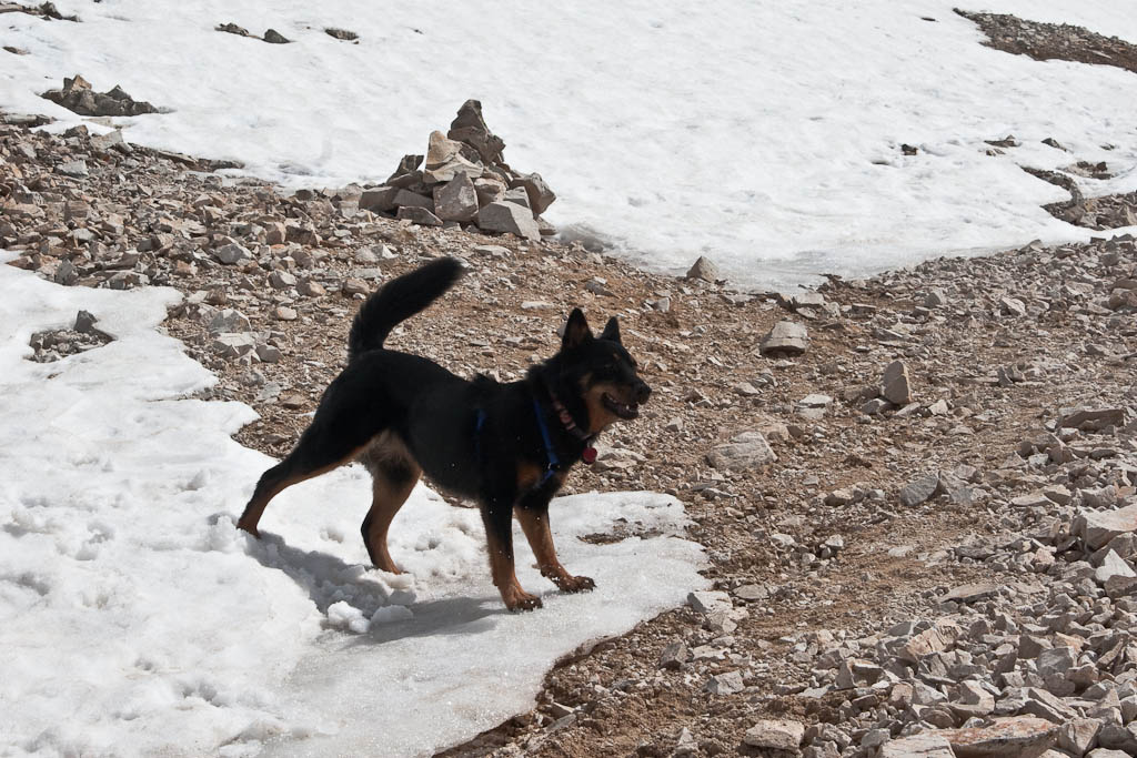
 As we got up to the ridge, the dogs found a few snow patches to play in. Dogs don’t get enough credit on the intelligence side. They love snow as much as I do, and there’s got to be something going on there.
 This one is from the summit ridge. Not sure of the elevation, probably somewhere around 13,500′.
 An hour and a half of leisurely hiking and we were on top. Someone had taped a miniature American flag to the summit post.
 Nate neglected to bring a jacket, and it was cold and windy on top, so Andrew and Katy helped him keep warm.
 It felt amazing up there, like standing inside a windy refrigerator. Most other people up there didn’t appreciate it the way I did. After hanging out on top for a while, some rain showed up on nearby mountaintops, so I decided it was time to go. I stashed my camera and moved, so no pictures were taken until I got back to the sunny meadow. There was a stream we crossed at the very beginning, and Scout and I were a ways ahead of the group when we got there, so we decided to soak our feet in the ice cold snow runoff.
 I could’ve hung out here all day. Great view, cold stream (20 degrees warmer would’ve been nice, to be honest), and the sounds of nature added up for a serene break spot.

The rest of the folks showed up a few minutes later, and we walked a couple more minutes to the cars, where Nate and Matt had been waiting after practically running down the mountain. We went back to camp, and celebrated with beer, burgers, and hot dogs. Matt had 5, it was ridiculous.
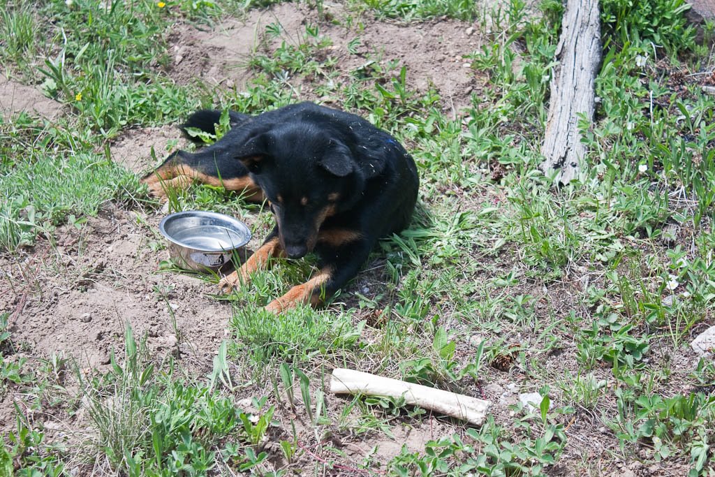
 Scout was absolutely exhausted. I put a bowl of food in front of her and she just dipped her head in and nibbled. She’s just
now starting to get back to full energy. I don’t know where I’ll take her next, but I’m sure she’ll be similarly worn out.
 All in all, a great couple days. I’ve got a couple big days planned, just not sure when those will happen. Tenmile Traverse anyone?
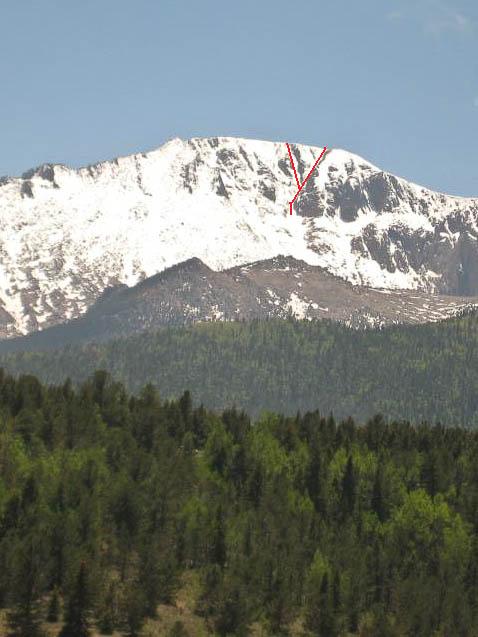
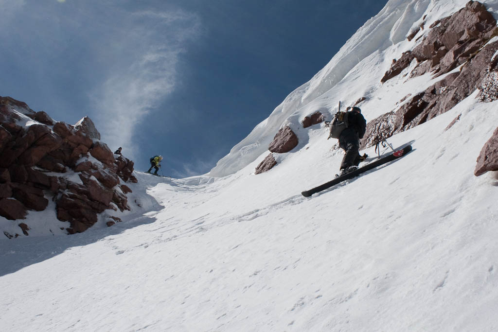
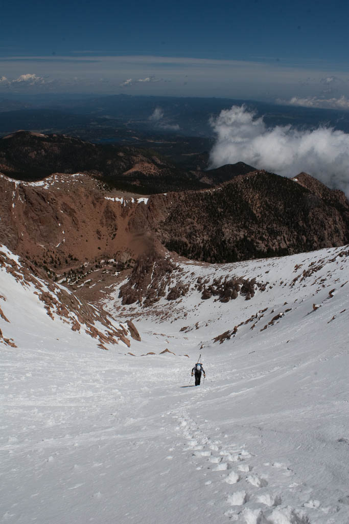
I thought my skis had been hung up for the year after the trip to Quandary last month. Luckily, I was wrong. Carl emailed on Thursday looking for a partner to ski the Y Couloir on Pikes, which was in good condition thanks to all the cool, wet weather the front range has been receiving lately. We were after the East branch, which is on the left in this photo. It’s skied less frequently than the West branch due to a more difficult entrance and a rock band about 500′ in that frequently requires downclimbing. The reward is a more sheltered and aesthetic line.
 It was another early morning at 4:45, although that’s relatively late for June skiing. The plan was to drive to the top, ski down, and climb back up. We were stopped a half mile from the summit by a thin sheet of ice on the road.
 This was no deterrent though. We all loaded up and made the rest of the trip to the top on foot. There was a pretty obvious rain crust, and we all hoped our line was sheltered from the rain.
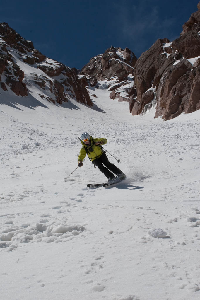
 Everyone else was wearing typical black/gray technical clothing. I was a little brighter and more colorful.
 The undercast was quite a sight, as it always is.
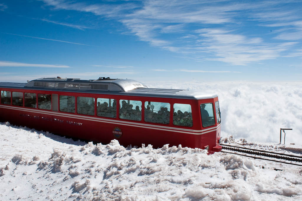
 This is such an amazing place.
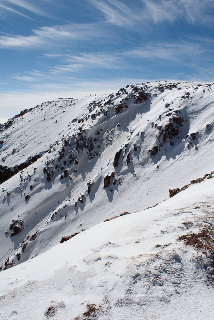 Despite getting up to 80 in town that day, things were a little different at 14,000′. A high around 30 and a cold morning with strong winds made it such that quite a few tourists probably didn’t bother to exit the train.
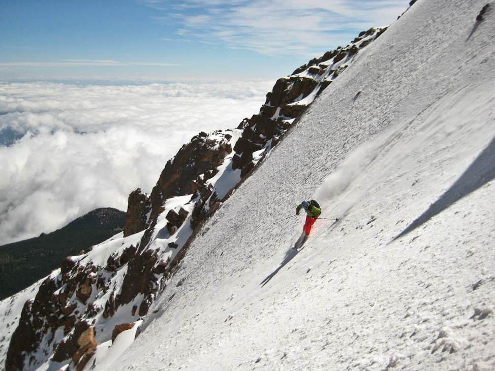
 The entrance was exciting. Carl aired into it, and hopefully the picture of that will turn up in a day or two. Here’s me shortly after dropping in.
 And here’s Caroline getting ready to drop. She was hesitant, but did fine.
 Here’s a great shot Carl took from a little way down the line. So much fun.
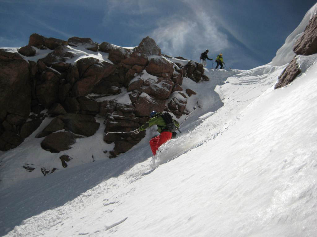
 Lucky for us, the rock band had a line on skier’s right that was filled in enough to ski through. It was a fun little high-speed maneuver.

 Here’s Caroline enjoying the last couple turns of the day.
 We stopped skiing when it stopped being fun. The snow was softening significantly and the terrain was flattening out, so we traded our skis for crampons and started heading back up.
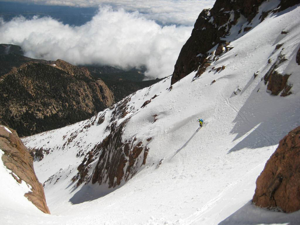
 Such a beautiful place.
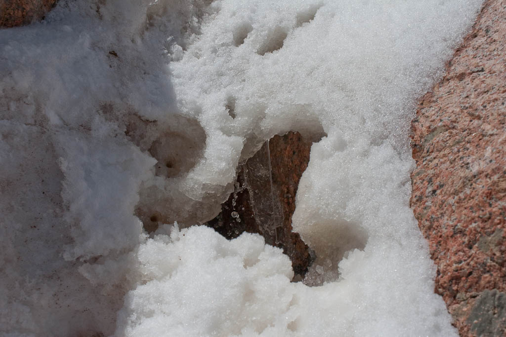
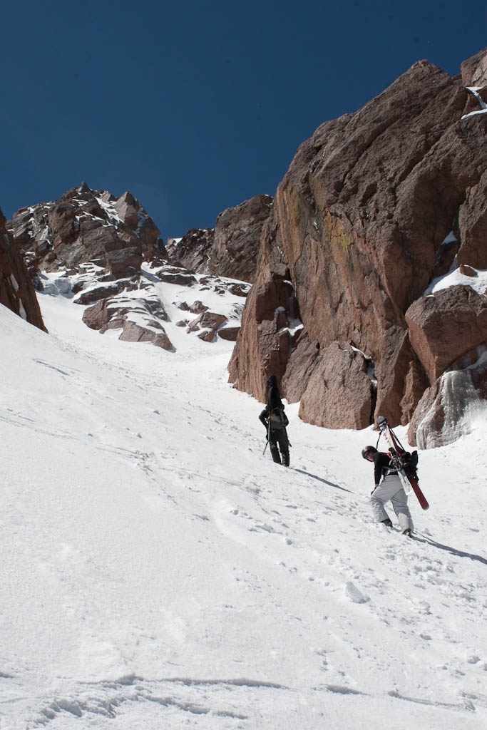 It was cooking in the couloir – about 50F, very intense sun, and no wind. I found a mini under-snow waterfall at the rock bands, which told me it was time to get moving quickly. Free water in the snowpack can be very dangerous. In sections, the bootpack up had meltwater pooling in the footprints, small natural sluffs were coming down the rocks, and a couple ice- and rock-fall incidents telling us we should get out of there. I put a chunk of snow in my helmet to help cool me off and went.
 We all made it out in good time. Here’s Caroline pulling herself out of the couloir. In about three vertical feet, it went from roasting with no wind back to 30F and windy. It’s amazing what a terrain feature can do.
 Success!
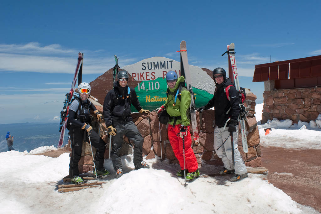 I couldn’t have chosen a better way to end the ski season. Until October…
It was a blast but I’m also glad it’s over with. As some of you may know, this Sunday was the Colfax Marathon. I signed up for the half with Nate a few months ago when it was BOGO, and have been half-assedly getting ready for it. That, along with the ill-fated Rainier trip, kept me from getting to the mountains much for a while. I decided to go climb and ski Quandary the day before the race.
Friday night I got to sleep around 10:30, which was a little late given the 3am wakeup call Saturday had in store. Got up, loaded the car, met up with Hans, Mel, Owen, and Aaron at the Morrison Park ‘n’ Ride about 4:15 and we were off. It was raining in Denver, and we were hoping for better conditions in the mountains. We got them.
 It was horrendously foggy on the mountain though, and as we approached this CMC group (who absolutely trashed the snowpack by glissading and postholing everywhere), we were getting drenched with sweat. High humidity in the Colorado mountains, especially on spring snow climbs, is exceptionally rare. It was fairly miserable, although it was surreal not being able to see very far around you.
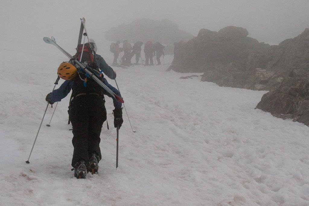 The snow was extremely dusty, and got worse as the day went on due to accelerated melt. Total melt-off is going to be quick this year.
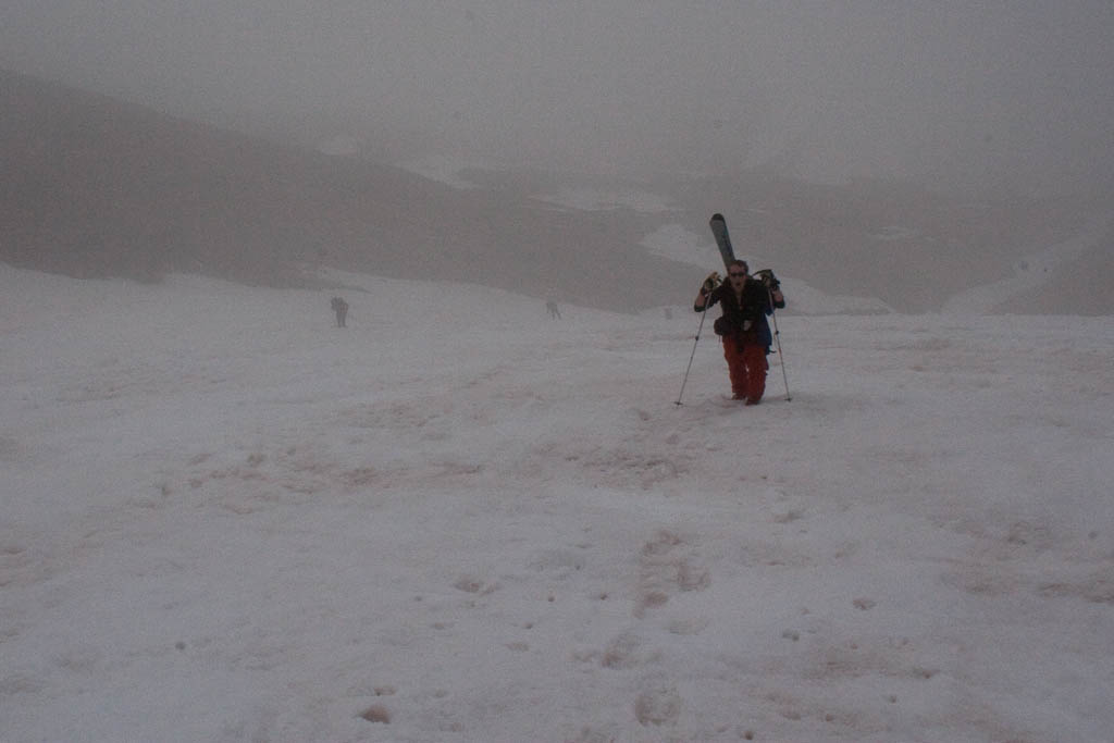 Once we were above the fog, the views were very cool. There was little to no breeze early, so it just sat in the valleys.
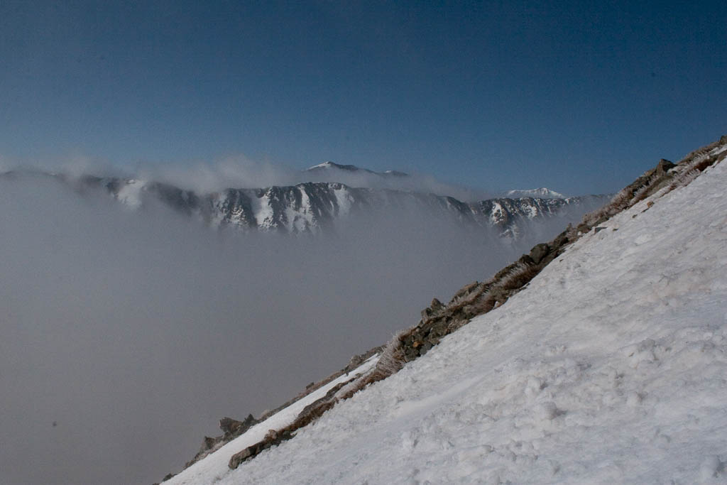 Even once we were largely out of the fog, occasional light breezes would push it above us.
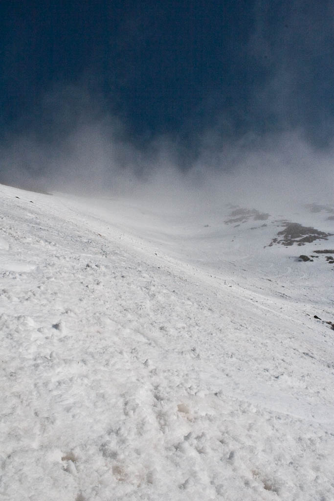 Where are we, British Columbia?
 A couple hours after starting, we topped out to a beautiful morning. While waiting for the snow to soften up, I took a nice nap. Very refreshing, and necessary for the ski that was about to come.
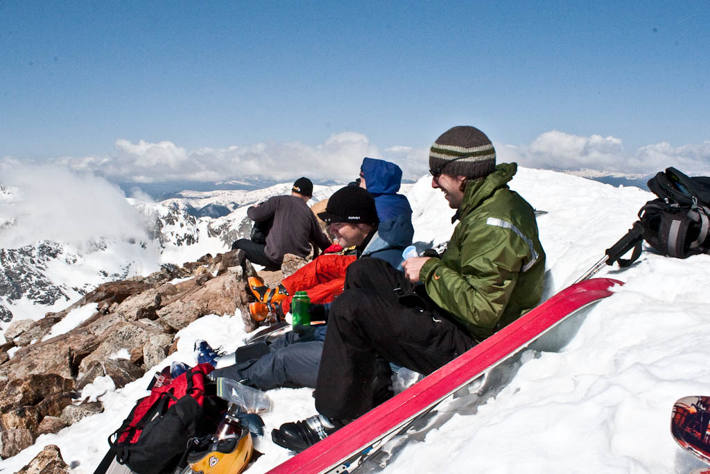 It turns out we waited too long. When the snow was nice on the summit, it was a horrible slushfest down low. I failed to lock the toe on my Dynafits, and a stationary jump turn resulted in one ski popping off and careening down the mountain a couple hundred feet. I’m told photos of that will be following. I didn’t get any ski photos because I was too busy either enjoying the snow, or being miserable and fighting through it. Having to cross multiple glissade tracks and countless trashed areas didn’t help (thanks a lot, CMC).
We finally made it back down to the car and headed in to Breckenridge for lunch. I had a massive calzone at Eric’s, and was still back to hungry by the time I got home. I cooked up a big plate of pasta and hit the sack at 6:30.
After an amazing evening’s sleep, the alarms went off, again, at 3am. I downed some extra strong coffee, cooked a solid breakfast, got my bag together, and biked down to City Park for the 6am start to the race. I had a strong start to the race, down under a 7:30 pace. I figured it was just excitement and I’d settle down to my 8:00 target, which would get me done just under 1:45. To my surprise, I kept it up through miles 3, 4, 5…soon I was 8.5 miles in with a 7:24 average pace. I kept it up and not much later I was finished, an hour and 38 minutes after starting. 13.1 miles is now my personal record distance, and to do it with 7:27 miles felt great.
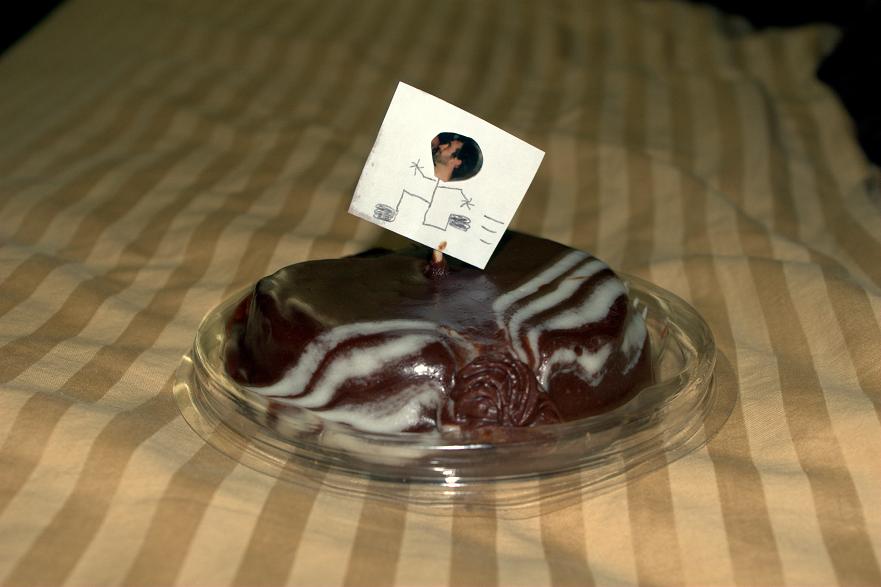
After grabbing food and my bag, I went back to the finish to shout at Nate for his finish. He met his goal of sub-two hours, and it was off to the beer garden for some seemingly alcohol-free Michelob Ultra. Shortly thereafter, Amy picked me up for breakfast, and brought me a mini-cake with a great little flag. Thanks hon:
The results:
Overall: 85/2294
Age group: 18/167
Sex: 72/846
Chip time: 1:38:35
Gun time: 1:38:38
I got Carl’s photos from this weekend not long ago, so here they are.
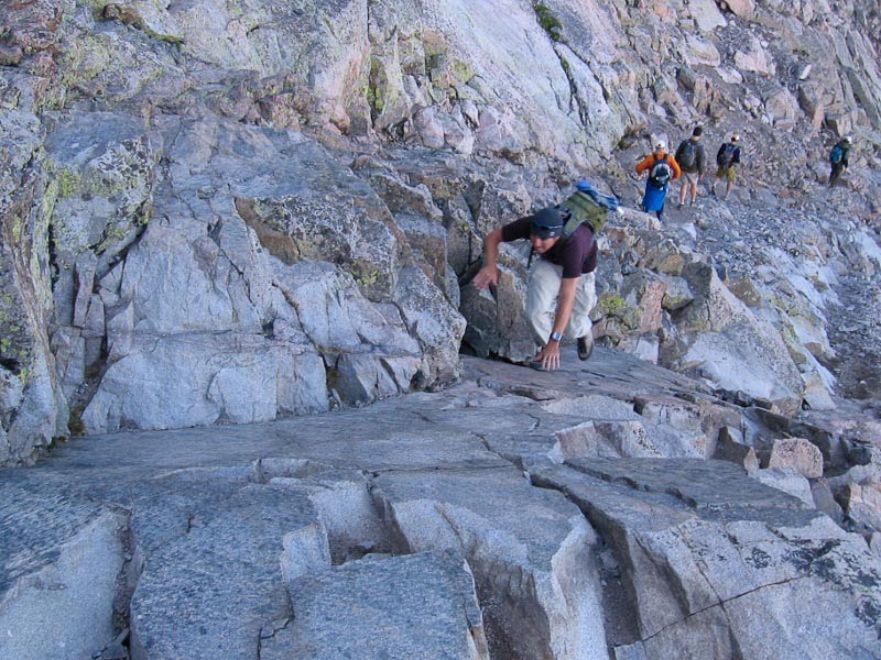
The direct approach to the Trough that Kiefer and I took.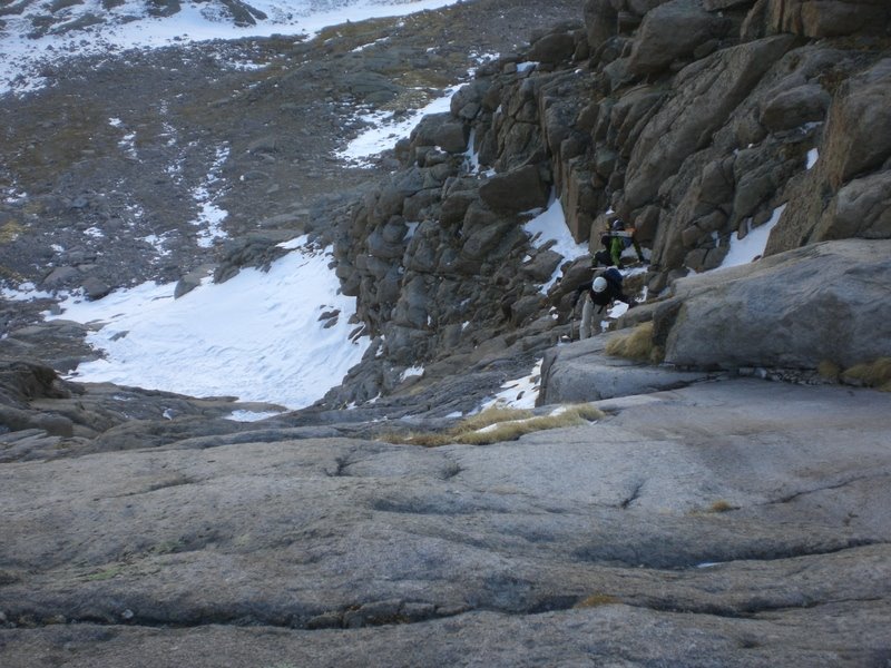 It was substantially more difficult than the class 2 bypass on climber’s left (from where this photo was taken). Doing it in ski boots and with skis on my back (which restricted movement pretty heavily) made it a pretty major challenge.
 Looking down the Trough. Prakesh is the small dot climbing up.
 Here’s me, crossing the Narrows for the first time that day. It was somewhat precarious in ski boots.
 Due to not carrying skis or wearing ski boots, Kiefer, Stephanie, and Sean were able to make the summit a little before Carl and I were. Here’s them, making the top.
 And here’s me, starting the Homestretch. The near-total lack of snow made this extremely difficult with ski boots on.
 Kiefer, Stephanie, and Sean enduring the harsh winter weather.
 Carl’s view, getting ready to plod down a few hundred feet to our skis.
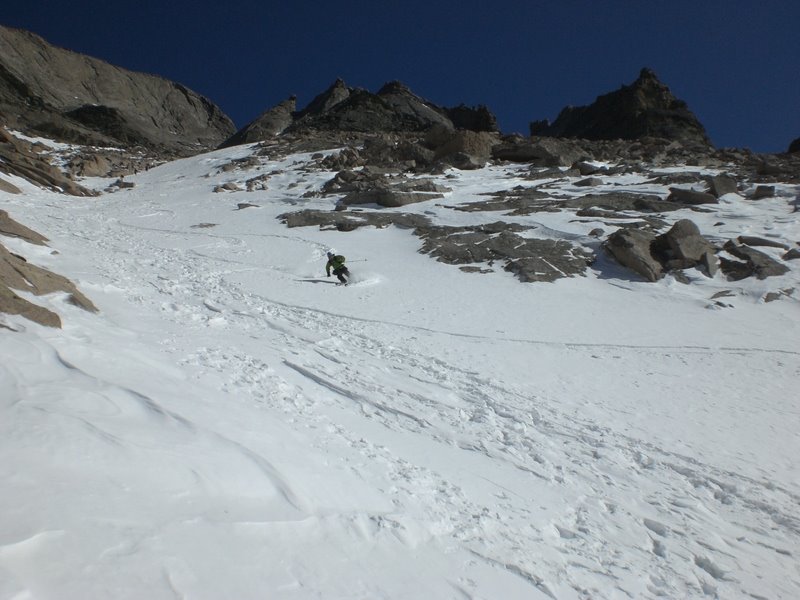
 Me, skiing down the trough. This might be the first real shot of me skiing this year, and it looks good despite exhaustion and funky snow.
 And finally, the hike out from the bottom of the Trough to the point where the snow picked up again.
Saturday March 14, 2009
Longs Peak via The Trough, 14,259′
12 miles RT, approximately 5,200′ of elevation gain
Car to car time: 12:45
For a few years now, this route has been on my hit list. Yes, I’ve climbed the mountain a few times before, but always in summer or fall, and never with skis. When I saw a group was forming a few days prior, I checked the weather and jumped on it. In the days leading up, the forecast called for a high in the high-20s around 13,000′ and a 10% chance of snow. On Friday, it was calling for 29F and no snow or wind…perfect.
Friday night, I ate, and ate, and kept on eating until I was stuffed and it was time for bed, around 8:30. At 2:30 the next morning, I’m awakened by my alarm. Sigh…time to get up. Fortunately I had packed the car the night before, so all I had to do was get dressed, eat, and go. I was on the road just after 3am, and pulled into the Glacier Gorge parking lot right around 5. At 5:10, the hudge group (of 6) was off!
An hour and a half later, it started to get light. It was nice to kill the headlamps, and to be able to enjoy our beautiful surroundings.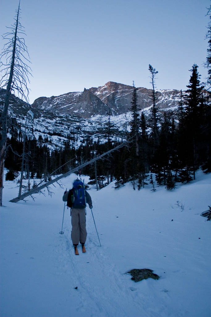 The sun was making its presence known, though I knew it would be a while until we got any direct sunshine.
 We took occasional short breaks, which were helpful in keeping energy up for the long approach.
 When I don’t get out like this for a while, I can forget why it’s so amazing. I remembered yesterday morning why I love it so much.
 We made great time on the approach. Here’s the group past Black Lake, which only took about 2 and a half hours to get to.
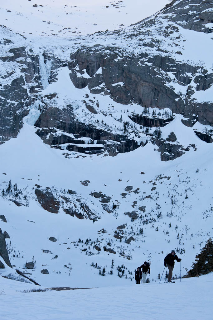 From the same spot. Rocky Mountain National Park is truly amazing.
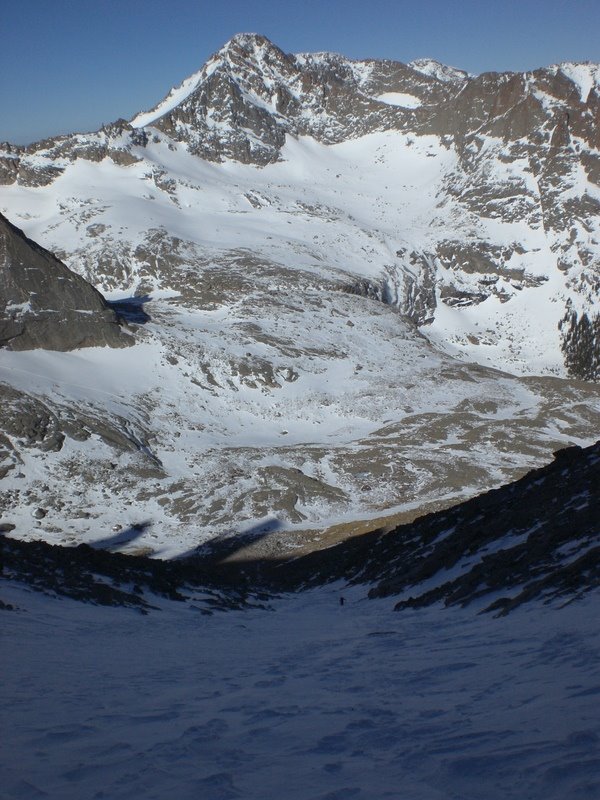
 Not much later we got our first view of the objective. Longs is the big rectangular protrusion, with the Trough cutting down below it. Keyboard of the Winds is just to the right of it.
 Here’s the group nearing the end of the approach.
 There were several bighorn sheep waiting here, not particularly concerned about us. In this same spot on the way out, a big herd (15-20) ran by. It’s amazing how nimble these things are.
 I believe that’s McHenry’s on the left and Arrowhead on the right. I could be entirely wrong though. What really matters is how gorgeous it was. Not a cloud in the deep blue sky. The air was crystal clear and crisp.
 This is where the group split briefly. Carl went left of here and had a super-easy time. Stephanie and Sean went to the right and had to backtrack a ways. Kiefer and I went straight through here, and it was a disaster. I was drytooling with my whippet to get through here. Carl got some photos from up above, which I can’t wait to see.
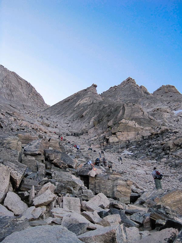
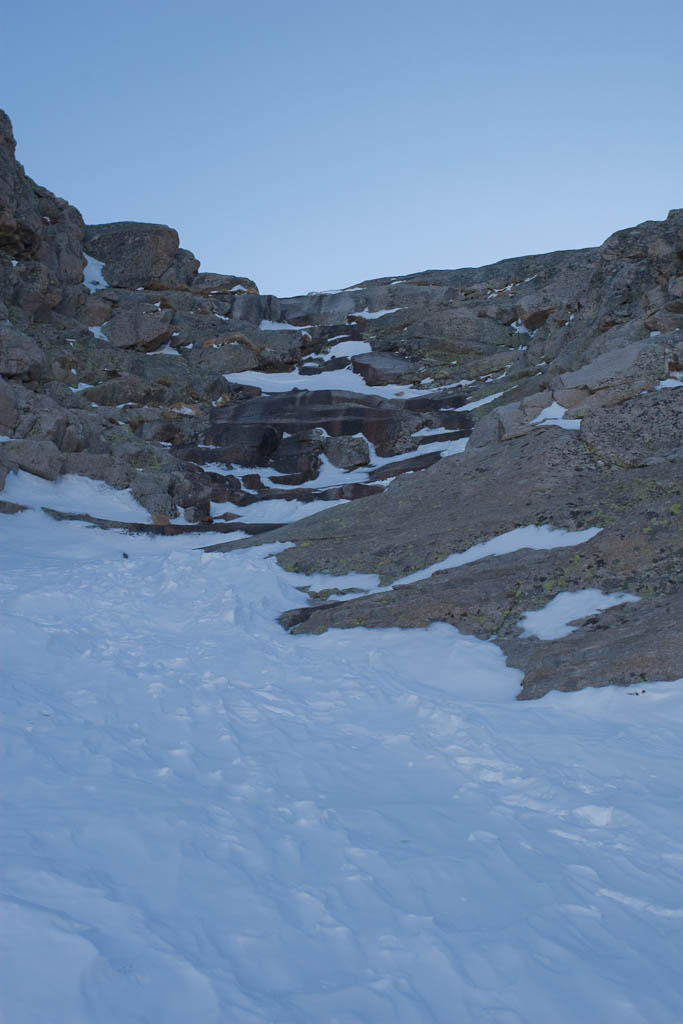 Immediately after that section, we hit the Trough and the real climb began. There was good styrofoam snow most of the way up, though at the top it became extremely rocky. The average pitch of the Trough is 30 degrees, so a pretty mellow climb in good conditions. It’s long though, at about 2,200′. Here’s Sean, enjoying the great snow.
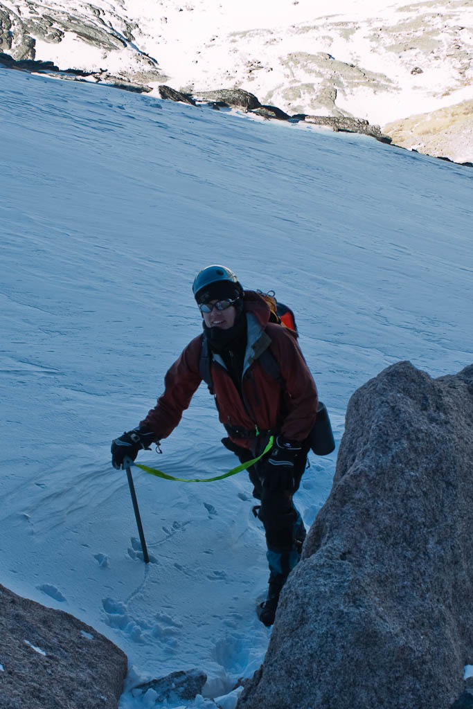 And Carl.
 We carried our skis to roughly 13,250′, about 600′ from the top of the Trough. That was the end of the skiable snow, and it was great to get them off our backs.
 At 10:52, the sun finally crested the ridge. It was a very welcome sight, and great to get a little bit of warmth finally.
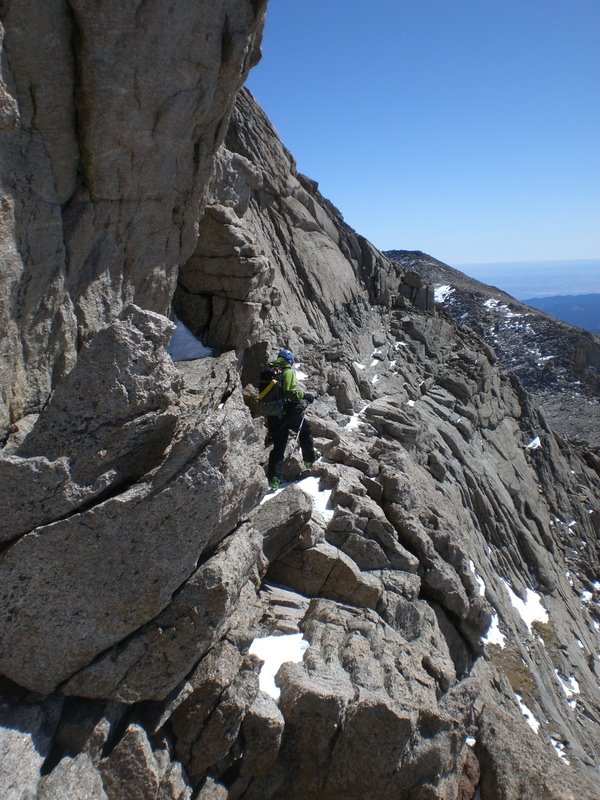
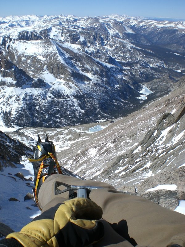
 At the top of the Trough is a chock stone that I remembered (from my first two trips up here) as near-vertical. Turns out it’s not, and I scrambled up it with crampons on without an issue (and it was nearly devoid of snow). We took a break here before taking off the crampons, and heading for the narrows. This is the most exposed portion of the route, but wasn’t too bad.
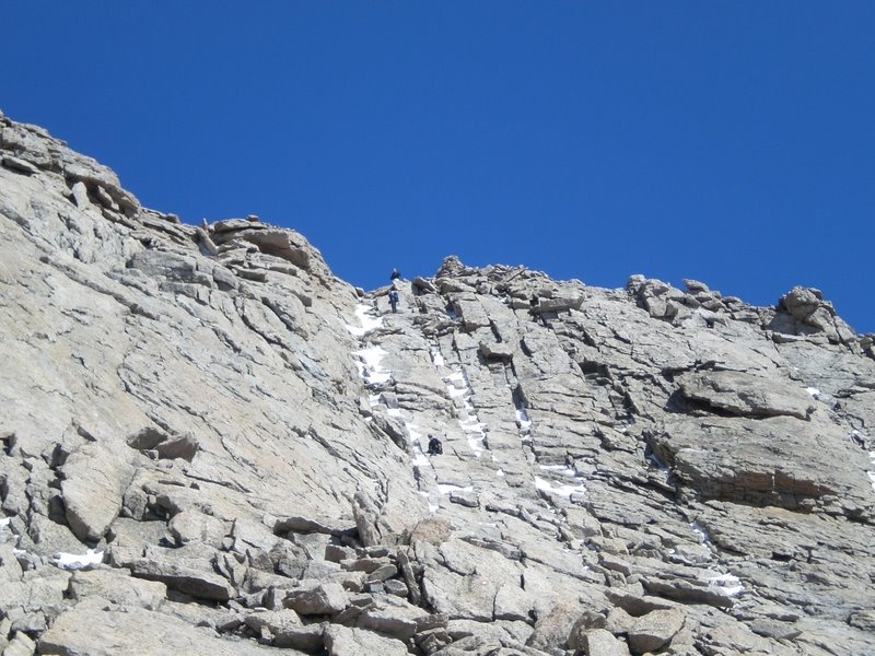
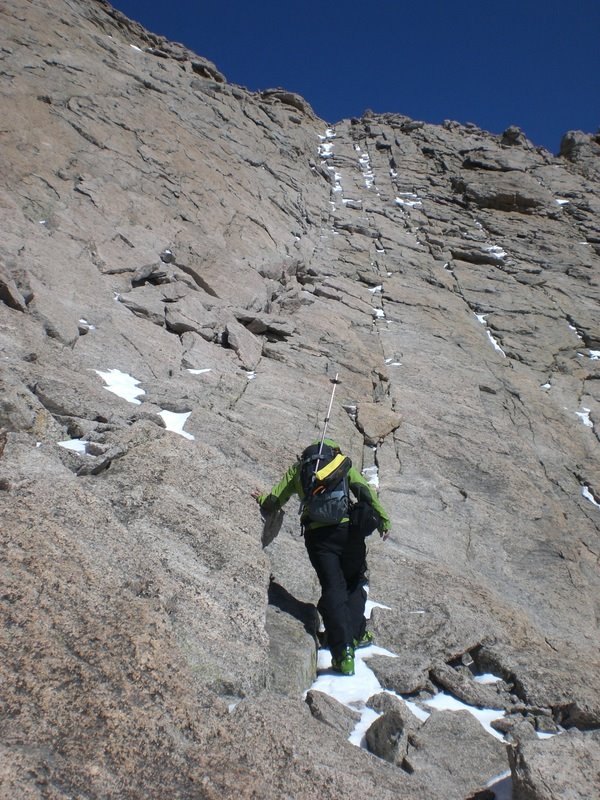
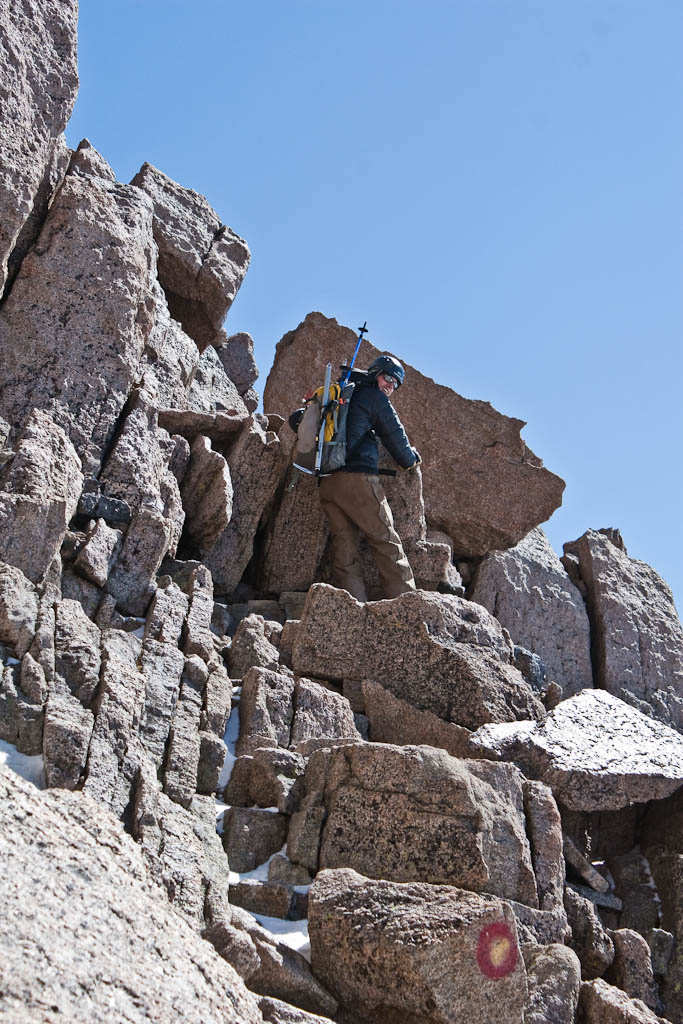 The Homestretch was absolutely miserable in ski boots. What can nearly be walked up in the summer (wearing trail runners) was a fight for survival in AT boots. If it had been snowy (as it is most winters, and as it appeared a few weeks ago) it would have been a straightforward climb up. Nevertheless, at 1:15pm, we hit the summit.
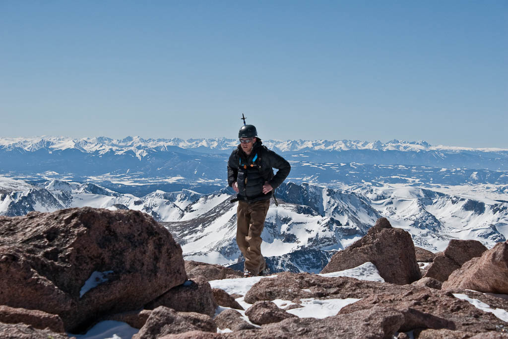 Sean and Kiefer had been there for a little while, enjoying the absolutely perfect weather. Around 30 degrees, calm winds, and not a cloud in the sky.
 Some summit shots, from roughly the same point (because I was exhausted).
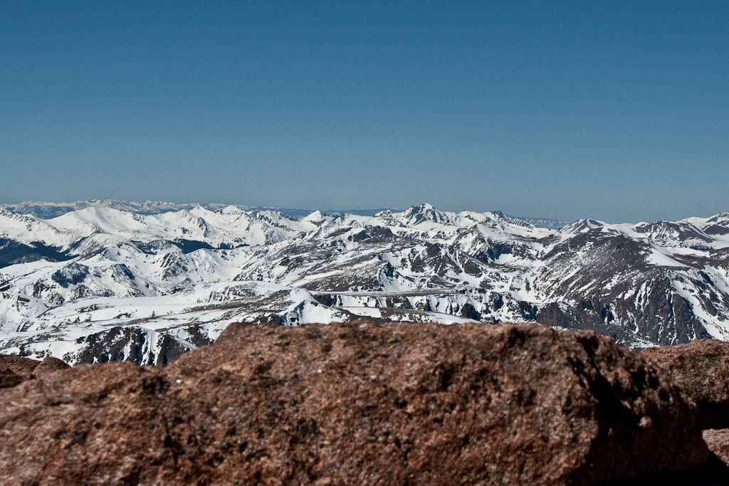 It’s amazing how big and flat the summit is. We discussed how awesome it would be if there were a summit cone instead of the huge plateau.
 Carl touching the official summit.
 Meeker, to the south.
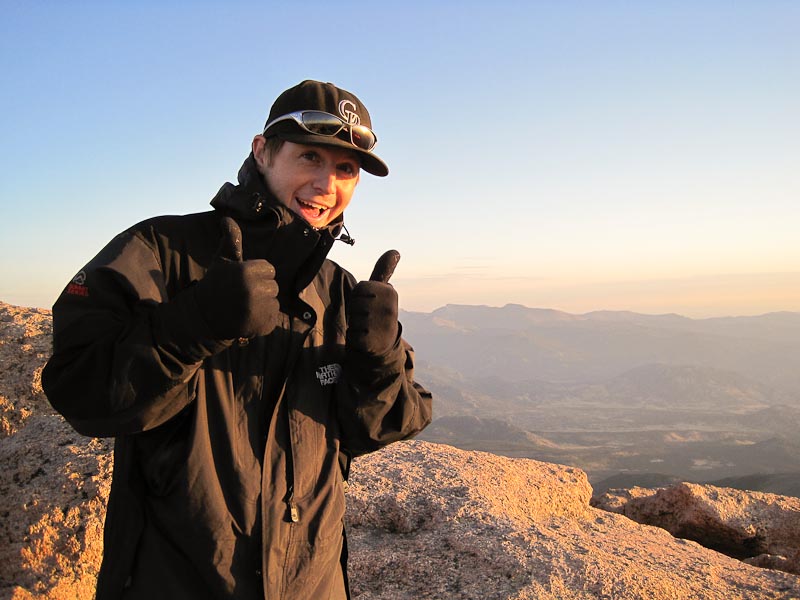
 Me.
Me. Look how extreme I am!
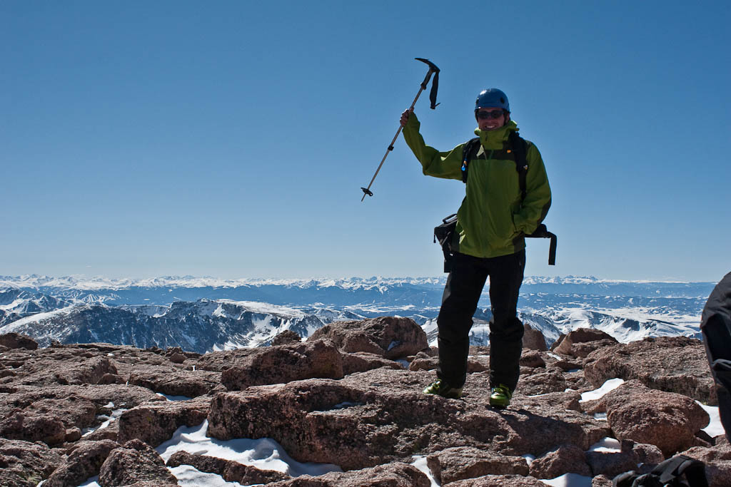 The descent back to the Trough was miserable. The homestretch took forever, and the narrow, off-camber ledges of the narrows were much more apparent in my exhaustion. I moved slowly, as I didn’t have the energy to be both quick and safe. Finally, we made it back down to the snow, and everything was right with the world.
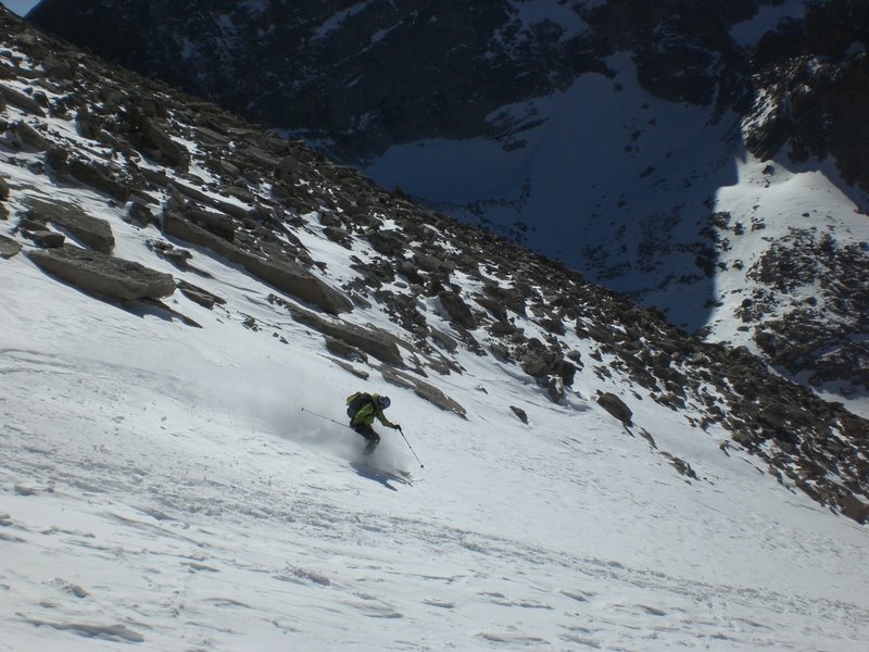
 Shortly thereafter, we got to our skis. The snow was pretty funky. It was a mix of powder, sastrugi, ice hardpack, and breakable crust. Unfortunately, it randomly varied on each portion of the line as well as in vertical space. Fun, but not fast or easy.


 At the bottom, we had to take our skis off and carry them a mile or so over rocks and dirt. Once we were finally able to put them on, all was right with the world. I have no more photos from this point, but hopefully will get some from Carl.
The lakes were semi-unpleasant. Long, flat stretches that we had to pole across. I stayed extremely close to the edge, as I heard some popping and cracking as I went over some sections. It seemed like forever, but we eventually got to the trees. It was fast and fun, with enough random obstacles (that were entirely inconsequential on the ascent) to keep things interesting. After ducking fallen trees, jumping rocks, and dropping small cornices for half an hour, we finally were back to the parking lot. It was 5:55pm, a full twelve hours and forty-five minutes after we left. I’m glad to have done it, but that’s one trip I’ll probably never repeat.
