Mt. Bierstadt, 10/01/05

Originally posted 10/01/05

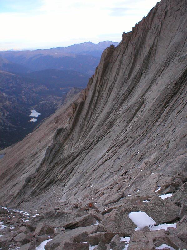
Early this morning I set off to an attempt at two 14ers at once. Mt. Evans and Mt. Bierstadt are very close to each other, and can easily be done together. To do this, you hike up to the top of Bierstadt (class 2 hike, about 3 miles to the top), then cross the sawtooth (Bierstadt is the peak on the right, sawtooth is class 3 climbing):

After you cross the sawtooth, it’s mostly easy stuff from there – head east a mile or two, regain some elevation, and you’re there. Then come back and take an easier and shorter way down, bushwhack through a giant willow field, and you’re home.

I got in the car about 3:40, and headed off to Georgetown, CO. Uneventful drive so far. Once you get into Georgetown, you head up Guanella pass. I don’t have any pictures of it, but to say that the road is in godawful condition is putting it lightly. There are frequent 1′ deep, 3′ diameter potholes. Some bigger, some smaller, but LOTS of them. Apparently they realized this is a problem and decided to shred the road and have been doing “construction” for a couple years now. Still no new pavement, just shitty old potholey road, and dirt. Dirt with gigantic potholes. After 12 miles of that, I got to the parking lot.

Left the trailhead at 5:30, and when I was nearing the summit, my knee started hurting. Not sure why – I didn’t twist it or anything. It hurt a little yesterday but I shrugged it off as not-a-problem. I pushed on to the top anyway. No register that I saw, but I did find the USGS marker:

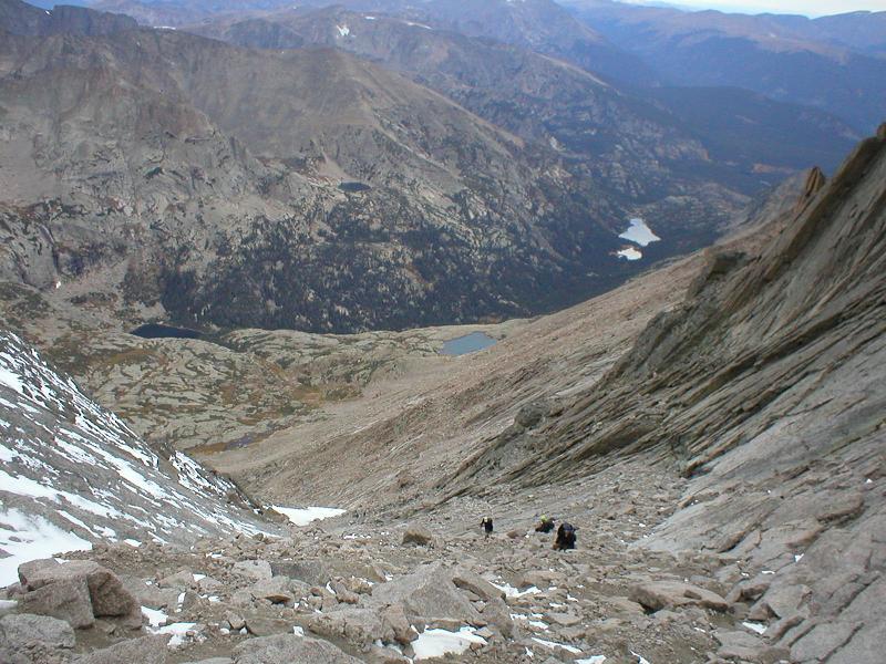
My knee kept hurting more, so I sat down, ate some food, drank some water, and took some ibuprofin. I looked over to the sawtooth, but didn’t think to get a picture of it from that perspective. “Discretion is the better part of valor” popped into my mind, and I almost immediately knew I wasn’t going to be crossing over today. It wasn’t worth possibly being stuck or falling off the mountain and dying (there are pretty major drops off both sides) to risk it, so I sat back for a few minutes, took in the scenery, and took some pictures:

A real, genuine lens flare, not added in PS:

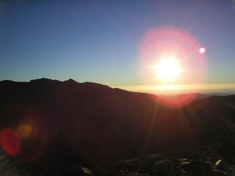
The Mt. Evans ranger station is the little verticle spike a little left-of-center in the picture.

Here to the west you see Grey’s and Torries peaks (the double one with the saddle). Those are pretty easy, although there’s a more difficult (fun) way to go up that I will possibly be attempting in the next few weeks, depending on weather, school, work, etc.

Looking south, you can see Pikes Peak. That’s down by CO Springs and involves a 26 mile hike round-trip, so I may be doing that one the next time I go visit my parents, which is another 2 hours south of CO springs (go down one day, hike it, sleep in the car, finish the trip – or just do it all at once, we’ll see).

I took a picture of Long’s Peak from the summit, but it’s really small and far away and hard to see.

You may have wondered why my finger was in the picture of the sawtooth up above. Well, this is why:

When I got back to the bottom, my knee was feeling better, so I decided to go bushwhacking in the willows and head over towards the hike up evans. As I was heading over to get up the much easier, not-sawtooth way, I realized I didn’t have enough water left to do it. Apparently I had forgotten to take the camelbak bladder out of the bag when I filled it, which cut its volume by at least 1/2. At this point, I had no choice but to turn around and head back to the car.

So only one successful summit today, and an easy one at that – only about 4 hours start to finish. As disappointed as I am, it’s better to still be alive. I’m sure I’ll end up doing Evans this winter with snowshoes, which will be nice since the snow gets up above the willow height. Those things are THICK and in many places up over 6′ tall. That’s going to be an 8 mile round-trip hike. Should be fun.

Next week: who the hell knows (if anything at all)
Week after: Possibly Pikes Peak, possibly something else.

Longs Peak – 9/24/05

Originally written 9/24/05

All pictures taken from the summit down. I left the trailhead at 2:35am, so it was dark all the way up.

So I did something that could be considered ridiculous. After proving that I am better than a 14,259′ mountain, I decided to do it again. Last time it took exactly 5 hours trailhead -> summit. My goal for this round was 3.5h to the top.

Well, that didn’t happen. The mountain tried to kill me.

At the top of the trough, there’s a final section you have to go through. It’s probably 60 degrees, and is wedged between two rocks at an angle to each other. There are some handholds, but they were full of ice. The genius I was, I tried to go the normal way. Almost made it, but I ended up falling on my back and sliding back down, headfirst for probably 15′. I thought I was going to die, but something stopped me. My headlamp got knocked off. This is the view from roughly where I fell to:

Pretty, isn’t it? Well, this is the direction I was headed (the icy chute on the left of this pic):

This is where that chute continues (that’s where I was wandering around lost for 30 minutes last week):

Now, this scared the hell out of me. I wasn’t even sure I wanted to go on, but I found another way around to get on top of the section that almost killed me.

In the narrows, there’s a cool thing called the “black hearse,” it’s a rock formation that looks like…duh…a hearse. It’s about 2,000′ below me here (in the middle of the pic):

I also saw a weasel (on the way back down):

What the hell is that thing doing up there?

I almost gave up at the homestretch, but I kept pushing through and was rewarded with this, after a climb of four hours and twenty minutes – far slower than my goal, but acceptable considering I almost died:

I gave the ozone layer a good punch to teach nature for trying to kill me. On a side note, those self-heating coffees apparently don’t work at 14,000′. Pissed me off.

On the way back down, I had to cross a section of that ice chute that was covered in about 1/2″ of pure ice – no dirt, snow, just a couple tiny rocks peeking through here and there, ended up sliding on my ass trying not to swing around too much on it:

Fun!

Finally, I got back to the keyhole around 9 (note the killing fields behind me):

2.5 hours later, at 11:33 (8h58m) I was back at the bottom. I’ve got a shitload more pictures of the mountain, other mountains, trees, etc. Even a picture of a vole, although that was so small it didn’t come out too well. I’ll upload more pictures if anyone wants to see them.

Probably gonna be at least a few weeks until I do this sort of shit again.

A couple scenics:

Longs Peak – 9/17/05

Originally written 9/17/05

Last night, I woke up at 11pm to go climb this mountain. It’s in Rocky Mountain National Park, just outside of Estes Park, CO. It’s the highest mountain in the park, at 14,259′. It’s 7.5 miles each way.


I left the trailhead at 1:25am, at an altitude of 9,405′. As you can see, there were a few people who got out before I did. It starts with a couple miles of hiking through a forest. Very nice and a great way to start the hike, as the trees keep the wind off you, and the path is rocky, although not nearly as bad as the rest of the way.

Once you get above the timberline, the wind starts to pick up. I thought it was pretty bad. It gets rockier, and you hike for a few more miles. A little later, you get to what’s called the Boulder Field. Pretty steep, the trail disappears, and you have to scramble up a bunch of car-sized boulders. I was there somewhere around 4am, took the picture on the way down. This is maybe 1/2 way down the field. I had passed all 6 people ahead of me by the time I started in here.


At the top of the Boulder Field is “the keyhole.” I was here about 4:30. The wind up there is absolutely insane – there is no refuge from it except the little hut on the left side of it. I stopped for too long here and was getting really, really cold. The wind almost forced me back, but I decided to just go for it.


After this, it turns from a tough hike to a moderate climb. The mountain drops off a couple thousand feet on the other side of the keyhole, you go down, and follow around the mountain for maybe a mile of climbing at 35-45 degrees in ice and snow. It’s considered the worst part of the whole way. Get past that and you’ve got a few hundred yards of “the narrows,” a walkway that ranges from 10-20″ wide above a very, very, very big drop. Screw up too bad here and you’re dead. After that, the “homestretch,” a few hundred feet in a crack in the mountain, pretty steep and you’re at 14,000 feet at this point. No pictures for these parts, because I was more concerned about staying alive. Also, it was very dark most of the way, so pictures wouldn’t have been very useful anyway.

I got to the summit at 6:25am, only a minute or two ahead of the sunrise. The wind was absolutely brutal, so I only stayed long enough to sign the summit register and snap a couple pics with my phone (it was easier to get to than my camera), then I got the hell off and came back down the mountain. I was the first one up today, which was pretty cool. Passed a few people through the long, steep climb on the way down. Here’s a shitty pic of the sunrise from 14,259′.


When I got back down to the keyhole, I rested and talked to people about the conditions. There were probably 30 people muddling around there, trying to decide if they wanted to go on or just turn around. Most turned around.


Total time was 8:57. 5 hours up, 3:57 down. Total average of 1.67mph, which isn’t bad compared to average speeds for other people.

Everything is sore, it hurts to move, and I’ve got way too many pages to write for school on monday.