Second Annual 14er on the 4th!

Last year was Mt. Democrat, a pretty easy hike. This year was Mt. Sherman, which is similarly easy (if not easier). It was chosen for the sake of a girl who bailed at the last minute. Next year we’ll be forced to move on to more difficult ones, which is fine by me. This was about as leisurely a hike as is possible; I felt no effects from thin air (including breathing hard), which has never happened before. This is mind boggling as we were all up pretty late enjoying the camp fire. Anyway, on to the pictures.

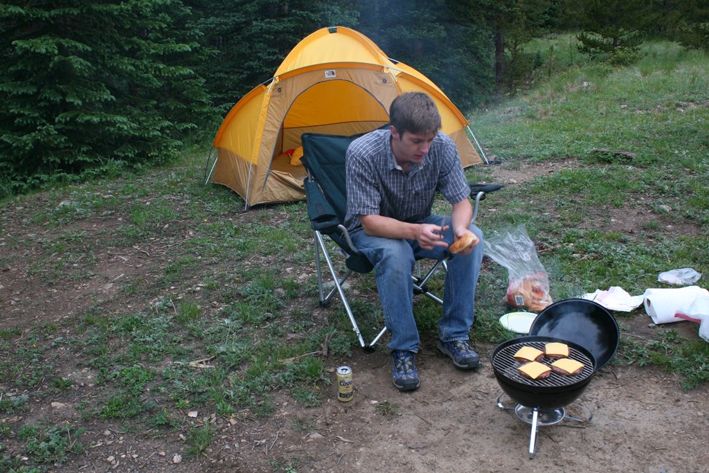
We left Denver about 4:30 on Friday, which was a terrible idea. I-70 was a parking lot. A few hours later we grabbed dinner in Leadville, and eventually found the road to the trailhead. It was getting late, but there was plenty of light left for setting up the tent, and taking a couple photos.

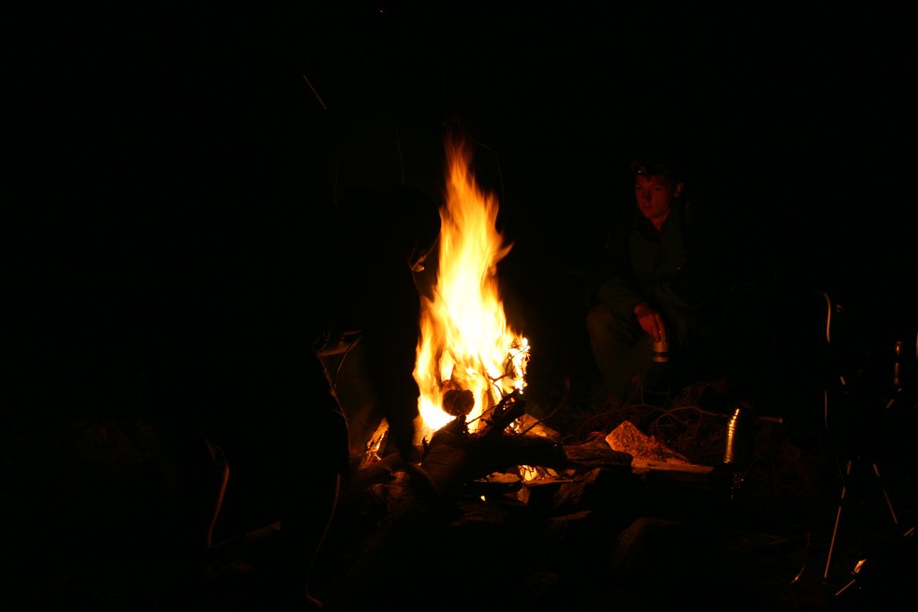
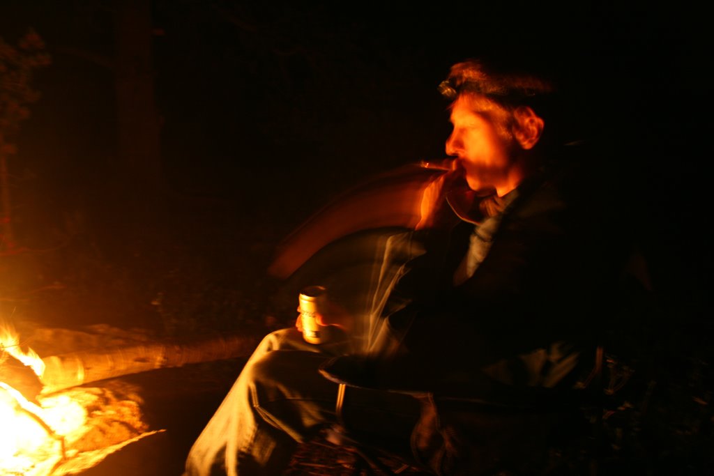
The weather was great that night. Cool, but not cold. The company around the campfire was great, of course.

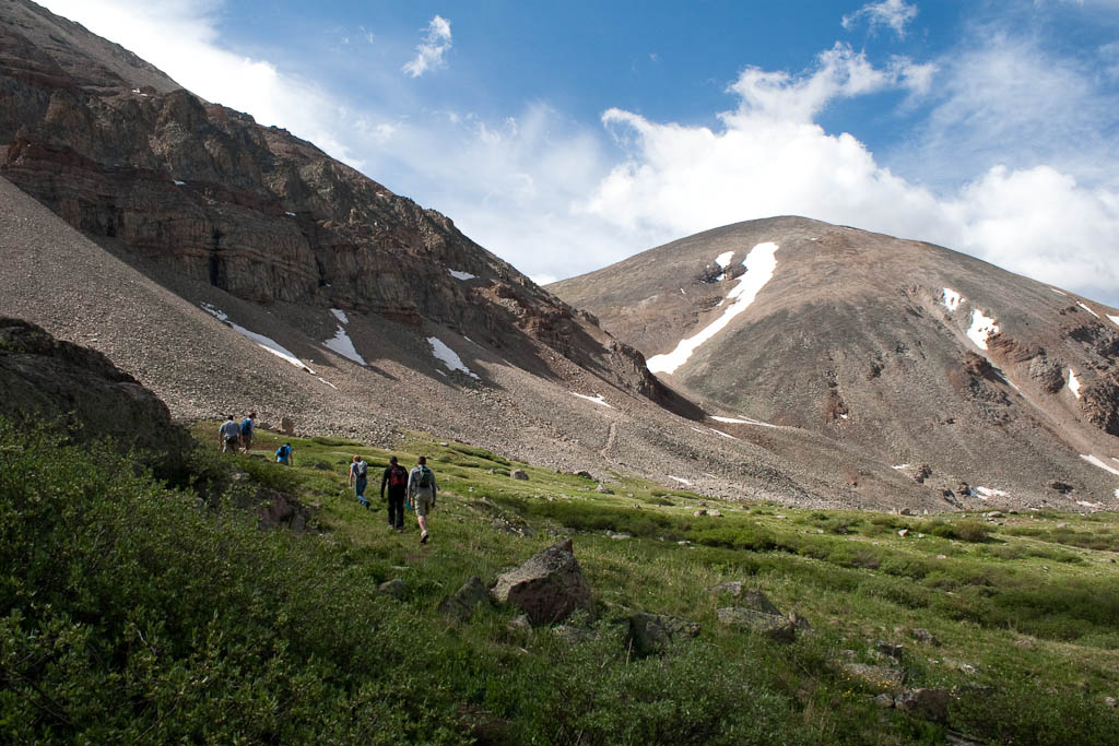
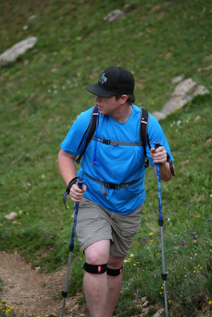
We were up at the crack of 8:30 the next morning and got a super-alpine start around 9:45, just in time to catch several people on their way down the mountain. Here’s the motley crew heading off.

As usual, the alpine meadow was beautiful. It was extra green thanks to all the moisture we’ve gotten this spring.

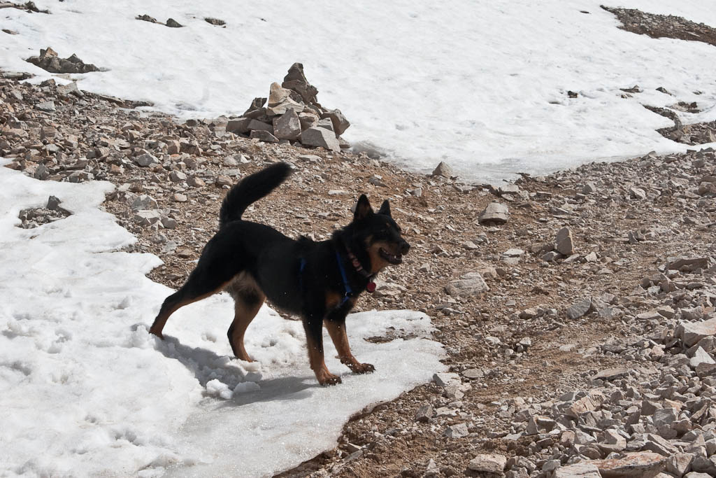
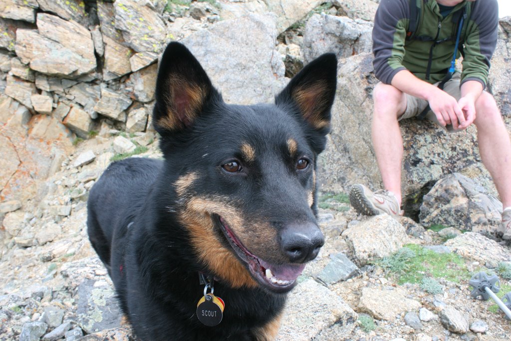
As we got up to the ridge, the dogs found a few snow patches to play in. Dogs don’t get enough credit on the intelligence side. They love snow as much as I do, and there’s got to be something going on there.

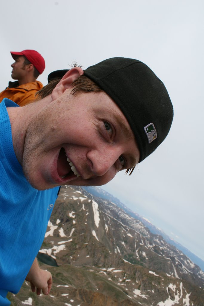
This one is from the summit ridge. Not sure of the elevation, probably somewhere around 13,500′.
An hour and a half of leisurely hiking and we were on top. Someone had taped a miniature American flag to the summit post.
Nate neglected to bring a jacket, and it was cold and windy on top, so Andrew and Katy helped him keep warm.

It felt amazing up there, like standing inside a windy refrigerator. Most other people up there didn’t appreciate it the way I did. After hanging out on top for a while, some rain showed up on nearby mountaintops, so I decided it was time to go. I stashed my camera and moved, so no pictures were taken until I got back to the sunny meadow. There was a stream we crossed at the very beginning, and Scout and I were a ways ahead of the group when we got there, so we decided to soak our feet in the ice cold snow runoff.

I could’ve hung out here all day. Great view, cold stream (20 degrees warmer would’ve been nice, to be honest), and the sounds of nature added up for a serene break spot.


The rest of the folks showed up a few minutes later, and we walked a couple more minutes to the cars, where Nate and Matt had been waiting after practically running down the mountain. We went back to camp, and celebrated with beer, burgers, and hot dogs. Matt had 5, it was ridiculous.

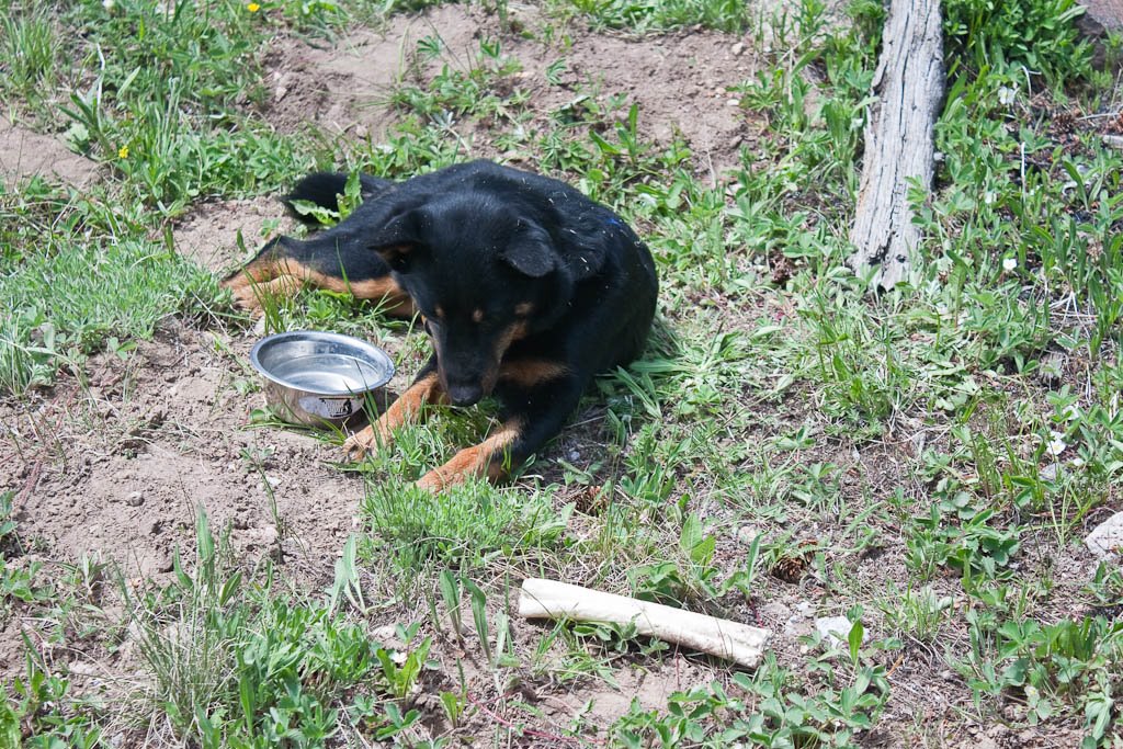
Scout was absolutely exhausted. I put a bowl of food in front of her and she just dipped her head in and nibbled. She’s just
now starting to get back to full energy. I don’t know where I’ll take her next, but I’m sure she’ll be similarly worn out.

All in all, a great couple days. I’ve got a couple big days planned, just not sure when those will happen. Tenmile Traverse anyone?

Mt. Massive – July 26, 2008

8 miles RT, approx. 3,950′ of elevation gain. Just under six hours camp to camp.

Last weekend, it was decided to head up outside of Leadville, camp a night, then hike Mt. Massive in the morning. It was Nate’s turn to drive, so he picked me up from work and we took off for the mountains.

It was pouring rain most of the way up (which is all good and well, but it still hasn’t rained in Denver all summer), leading to some concern that we’d be miserable setting up camp, having dinner, etc. Fortunately it stopped as we got there, and it was nice and cool. As we got to the trailhead, an unnecessary river crossing was made, twice. The water was up to the bottom of the doors on Nate’s Cherokee. On to the pictures:

Scout hanging out while we set up camp.

The main beverage for the evening:

The view from camp:
Andrew getting dinner going:
Andrew drinking, Nate screwing around with the fire:
Andrew enjoying a Backwoods:
On to the morning. There were Columbines everywhere – more here in one day than I’d ever seen combined.
Marmots:

Not marmots:

Another marmot, captured with my new lens:


Not a bad view.

Summit.
After hanging out and eating Doritos on the summit for half an hour or so, we headed back down, grilled up a few more burgers, and took off.

Independence Day 14er

This is my first TR with my new (to me) Canon 30D. I really like the pictures compared to my old P&S.

Independence Day this year was spent on a 14er (again) and fun (more so than last year). Lacking this time were skis. We brought everything based on some photos from a week ago showing substantial snow left, nearly top-to-bottom. Unfortunately, we drove up and immediately saw that our intended line had substantially melted out.

Our group was myself, Nate, Matt, Katrina, and Andrew. Friday morning we all woke up at 3am (except Andrew, who lives in Glenwood), got ready, and piled into my car around 4. We were heading up to Kite Lake to hike Mt. Democrat, then have some beer and BBQ burgers. We picked up Matt along the way, then headed for the hills.

As you can see, the car was pretty full.

The plan was to meet there at 6am then head out. Andrew’s always late so we weren’t too concerned when we got there a little before 6:45. He wasn’t there yet, so we started unpacking and got ready to head out.

The view from the parking lot, showing a distressing lack of snow:

Unpacking:

Nate ready to go:

Since I was driving and had to be not drunk for the drive home, I got the party started with Silver Bullet #1 at 7am. We finally got sick of waiting for Andrew and left at 7:30. There’s no cell service so there was no way to try to reach him, so we just left, hoping he’d show since he had the grill.

And up we go:

Taking a quick break:

Nate’s very sweaty back:


The dogs were really enjoying themselves.


Matt and Nate pushed on to the summit while I hung back with Katrina. I arrived a minute or two behind them, where they were already celebrating.


We all grabbed a seat and had a couple beers, when a sudden, evil chill filled the air. Andrew had arrived:


He had overslept and started at the trailhead at 8:45. He summitted at 9:45. Andrew has picked up some speed in the past year for sure.

Even one of the dogs was taking part in the fun:

Just hanging out:

Before we left for the summit, it was time for a quick restroom break. Andrew of course had to find the most ridiculously scenic spot to go.


We booked it down, then fired up the grill and had a few beers, just joking around for a few hours. The drive home was uneventful (fortunately) despite my exhaustion. Everyone else in the car passed out. Made it home, smeared some aloe on our horrible sunburns, I hopped in the shower and passed out.

The burn on my shoulders has since blistered. My forehead is bright red, hopefully things will cool off a little before I have to bike to work tomorrow – I don’t think it’d feel too good otherwise.

Capitol Peak – 7/30/07

July 30, 2007
Capitol Peak
14,something’

Did not make the summit here.

I got to the trailhead about 7:30pm the night before. I hiked in the 7-odd miles to the lake at the base of the mountain, threw down a sleeping pad and bag, and got to sleep sometime after 11pm. It was cold. I woke up at 4am and was moving in about 10 minutes.

View from pretty high up:

The summit ridge. I turned back from where I took this picture because it was getting late:

Taken on the way back down:

I was exhausted and slept a long, long time when I got home.

Missouri Mountain – 7/4/07

July 4, 2007
Missouri Mountain
14,067′

This is where it gets really stupid.

Andrew and I left Denver, at probably 2 in the morning, it might’ve been a little earlier. I’d been here before in early spring, but was turned back by a combination of exhaustion and an incoming blizzard.

The objective:

Skis? Are these guys out of their friggin’ minds? (The answer is yes.)

Incredible views when you get to the top of the ridge.

Andrew on the summit, wondering just how stupid what we’re about to do is:

Me, already knowing:

Remember, this is the 4th of July:

The snow was good for a couple hundred feet, but then it was completely unconsolidated. We were sinking knee-deep with our feet on in heavy, heavy slush. That lead to this:

Yes, it’s as steep as it looks.

On the way home a tire blew out. I was pissed.

Mt. Democrat – 6/16/07

June 16, 2007
Mt. Democrat
14,286′

The lifts had stopped turning a few weeks before, but my friend Andrew and I weren’t done skiing. Word was that snow here was pretty solid, so we set off early in the morning to hit a 14er and do some skiing. I’d been here before, but Andrew hadn’t. This was his second 14er.

They don’t call it Kite Lake for nothing:

Andrew slogging up the rock pile:

The flat valley in the distance is where South Park, CO is. It’s gorgeous down there, but the wind really rips in the winter.

Me:

Eating a bag of fish on the summit:

Getting started:

Enjoying the corn:

Andrew ripping down a nice steep section:

Fun was had by all. The snow eventually ran out and we had a mile or so hike out over sharp rocks.

Quandary Peak – 3/17/07

Originally written 3/18/07

Start time: 3/17/07 6:15am
People: Myself, and my friend Andrew.
RT Distance: 7.1 miles (per gps)

It’s been a while since I’ve summitted a 14er – or anything that didn’t have a chairlift most of the way up. With this being the last weekend of winter for the year, I needed to get out and do at least one calendar-winter 14er. I woke up at 3am, we met in Morrison at 4:30, and blasted up the hill.

It was still dark out when we started, but the sun was right behind us. About 15 minutes in, we were treated to this:

The snow was pretty frozen early on, which, while not as important to me since I was skinning up, was very important to my friend who was still postholing every once in a while. After we got past treeline, things got pretty solid. Now for some pictures:

One ptarmigan of many who were wandering around on the snow. This one let me get within about 6 feet before it scuttled away:

Me and my bitchin’ goggles:

Me skinning up the mountain:

Andrew hiking up (no AT bindings):

Once we hit about 13,500′, the going got a little slow. I was out in front of Andrew and some guy who was hiking up and had left a little before we did. They looked like Tim and Gerard on Everest – Beyond the Limit at the end. I wasn’t doing a ton better, and didn’t think to get any pictures of it. I got to the top about 20 seconds after two people who’d climbed Cristo. The wind was insane. Now for the summit photos:

Andrew:

Me:

Me having fun leaning into the wind:

After screwing around on the summit for half an hour or so, we took off. The ski down was great up top, mediocre in the middle, and horrendous at the bottom. Both of us were falling 3′ into the snow – with our skis on. Nice, eh?

Me:

Andrew:

Around treeline we stopped under some trees and made some black & tans. Hit the spot for sure:

The end.

Next time: Dead Dog Couloir

Mt. Elbert – 9/30/06

Originally written 10/1/06

Yesterday, I hiked up Mt. Elbert (14,433). It just happens to be the highest point in Colorado, and the second highest in the continental US (Mt. Whitney, in California, is 64′ higher).

According to guidebooks, the trip is 9 miles round trip, and comes with 4,700′ of elevation gain.

I’d been planning on going to the Great American Beer Festival on Friday night, which would have cancelled this trip, but I got blown off and decided to go enjoy what may have been the last non-winter conditions weekend of the year. We got a bunch of snow last weekend, but a warm week melted off a bunch of it, making for great conditions. The air was damn-near still up until the last couple hundred vertical feet, where it was a gentle breeze. There wasn’t a cloud in the sky, so I did get a bit of a sunburn.

Here’s a view of the mountain from a couple miles down the road (took it on the way out):

Now, 4,700′ over 4.5 miles each way isn’t all that bad. A decent slope for sure, but not too bad. The thing is, at least according to my GPS, I only gained about 500′ during the two mile walk to treeline. That left almost 4000′ in 2.5 miles. That’s pretty damn steep. These pictures are representative of the average slope up:

Heading up was tiring, but the number of false summits was mentally exhausting. Three or four times, I would look up, see what I thought was the top, but eventually see a point rise up over the crest of where I was going. Sigh. I finally reached a point that looked familiar from the research I’d done on the hike:

That’s the final summit ridge. Seeing that definitely raised my spirits.

View from the summit:
La Plata Peak:

Mt. Massive – if you truncated the mountain at 14,000′, the resulting plateau would be over half a square mile. It’s got more area over 14,000′ than anywhere else in the lower 48:

More mountains:

And of course my awesome dog:

And me:

The trail after treeline took me two hours to go up. I went down that same section in 45 minutes by running/plunge-stepping down through the snow fields. Damn that’s fun.

No idea what will be next, or when. Heavy storms could delay things indefinately, or we might have nice warm weather for a few more weeks, allowing for a few more easy hikes before I have to break out the snowshoes.

Mt. Democrat – 9/16/06

Originally written 9/16/06

Mt. Democrat, 14,148′

I woke up at 4am this morning to go get up some mountains. Although I planned on climbing Democrat, Lincoln, and Bross (all 14ers), the conditions were a bit much. I checked the forecast and it called for 60mph wind gusts at 12,000, plus a decent amount of snow.

Got there about 7:30, threw on my boots, made sure I had everything ready, etc. I noted that the outside temp was 31, around 12,000′. Scout got impatient while I was doing this.

It was cold and windy, and the terrain was killing my speed enough as it was (4-6″ loose rocks, slick with a layer of wet snow on top), so I didn’t take any more pictures until I reached the summit. Sorry. It was pretty dark gray, with sustained winds at a mere 15-20mph.

I passed a huge group of people on the way up, no idea what sort of group it was but I’m guessing they’d planned this well in advance, otherwise they probably wouldn’t have voluntarily come out in the storm that was going on. Higher up, there was a good 6″ of snow covering everything, getting deeper (and wiping out footprints in a matter of minutes) constantly.

It started getting really windy up top, gusts that were 60mph easily. Here’s Scout not being too happy about the weather:

Like I said, I’d planned on hitting the adjacent 14ers. I would’ve been able to handle them, as I had the proper clothing to completely seal up against the elements (including facemask). Unfortunately, my dog wasn’t having fun anymore, and I have no intention of dragging her along when she’s already miserable. At least I’ve learned that in the future, if conditions are going to be bad, I’ve got to leave her home. I love having her along, but I also want her to have fun when we go.

After a long, slow slog through the wind and snow, we made it up to the top. The clouds opened up a bit right when I got there, making for some impressive views.

Picture of us with the summit in the background (on the way down). Notice the ice in her whiskers:

Here’s a picture of the lake for which the trailhead is named, Kite Lake:

The view from a little farther down showed that I was right to head down. Judging by the intensity of the snow blowing around, winds were at least 30mph sustained. My dog would have been hating every second.

Next week…something. What exactly, I’m not sure. Mt. Elbert maybe. Hopefully there won’t be near-whiteout conditions, and it’ll be a little more fun with a better view of the changing aspens.