Geohashing Pendleton Mountain

First, I would like to thank xkcd for coming up with a phenomenal Spontaneous Adventure Generator. For those who would like details on how it works, look here; for those who just want the gist, it basically takes your location, the date, and the value of the Dow Jones Industrial Average at its most recent opening, encodes the values, and then converts that to new coordinates. This means that for every single day, you’ll get a randomized location that’s reasonably close to you, and with the exception of weekends, there’s no way to know where it is in advance.

Yesterday morning I saw this post, which led to research, and which led further to realizing that geohashing is a legitimate way to kill some time, and that there are tools out there to make it easier to determine the day’s location. I found that West Denver’s location for today (Denver is split into two major areas because of the way the process works) was about 5 minutes from the top of a mountain. This mountain turns out to be called Pendleton, and there is zero information about it out there, which isn’t surprising since it’s “only” at 12,275′. If there’s one thing I’ve learned in CO, it’s that once you get down below 14,000′, no one seems to care anymore. After hours of planning, I found a route that would work, though no trail was expected. I was able to convince Nate to come along for this boondoggle, and picked him up at 7am.

An hour and a half later, we were starting from Guanella Pass Road, a few miles from the road closure (which has been closed for several months now, due to a rock slide). This is the view from the car, with nary a trail or road in sight.


Nate was characteristically excited to get started.


I was just glad to be out in the mountains. There’s not much like a mountain boondoggle to clear your head.


For a while we were practically crawling, as it was steep, fairly loose, and full of underbrush.


It made for some decent photos at least.


Aaaaannd…more bushwhacking.


Eventually things started to open up a little, though not entirely.


This pipe was riveted together from sheet metal. Unreal.


After more trudging through the snow and downed trees, we at last hit treeline.


My GPS’ compass was acting weird, which led to a bit of meandering through the alpine tundra.


At long last, the point was reached. Note that the elevation shown is off; the correct elevation is roughly 12,135′.


Hero shot!


The summit of Pendleton Mountain was only a few hundred feet away, so off we went; and a minute or two later, we were there. The register was much like the one I found on Mount Goliath a few years ago, a simple mason jar left by Gerry Roach. This one was left in 2006, with fewer than 10 people checking in since.


It’s ok, we’re from the internet.


America’s finest beer, two non-consecutive years over a spread of 114 years.


I can say with near-certainty that no one has ever had pants as bright as mine on this mountain.


What separates cool, historic structures from old crap? If it’s fallen down, it’s old crap.


There are apparently no photos from much farther down, as we were just wanting to get down and back to the car. We followed a trail for a while, but eventually had to bushwhack down the steep, loose crap that we had to fight our way up through. It certainly was a boondoggle, but what an adventure!

Back to Longs Peak

“I want to drink SO MUCH BEER.”

It’s early Saturday morning and Nate is talking about how many pitchers he’s going to order when we get to the Dark Horse. Most of Denver is still asleep.


To be fair, it had already been a long day at that point. I’d been up since 11:15pm (after a 4 hour nap). Nate had the luxury of sleeping in an extra half hour. We were on our way down from the summit of Longs Peak, after sprinting up the Homestretch to catch sunrise by less than a minute.

It was a great morning. Despite only getting a few hours of sleep and waking up before most people we know had even gone to bed, we were able to keep a fast, comfortable pace all the way to the top. Here’s Nate enjoying the view as well as his chapstick during sunrise. One person passed us on the way up and was waiting for the sun to come up on top, but had to head down before it did, as he was getting too cold to stand around despite the total lack of wind.


And a look over to Meeker.


Yeah!


The view to the Northwest.


The view across the Narrows on the way down. We would pass a couple people through here, but not enough to cause any slowdowns.


When we hit the Trough, we saw the train of people who’s headlights we saw marching up towards the keyhole a couple hours prior. 30 minutes later on the way down and we would’ve hit a major logjam. I counted 48 people in this photo, and the top of the trough isn’t even visible. There are dozens upon dozens of people below us.


We were asked by countless people, “how much longer to the top?” Nate told one guy who asked low in the trough “about an hour.” He was dismayed as he had been told an hour by the guy who left ahead of us roughly half an hour earlier. Nate’s guess was accurate (if not on the low side) based on the guy’s current pace, but of course not what he wanted to hear. The estimates of course got longer as we progressed, until we neared the keyhole and the response became “about as long as it’s taken you to get this far.” This is really not what people wanted to hear. It actually became entertaining to be the mountain’s unofficial demoralizers to people with shiny new gear and absolutely no idea what they were doing.

We had a blast scrambling down, and racing up small rock formations that were conducive to sprint-scrambling (or as Nate would call it, “spiderman shit”). One person even remarked that Nate was “dancing on the rock.”

The boulder field was an absolute blast, and we discussed the intricacies of what differentiates leaps, bounds, and simple jumps, of course with countless examples. Of course, at what point can you draw the line between a “leap” and a mere “bound?” If you take a leap but shorten it by a millimeter each time and continue repeating, at some point it will cease to be a leap. But where? Just look at statistical usage of the word “leap,” decide using that average, end of story. Oh snap, philosophers! Did Mike just totally school you with his statistically-based descriptivist approach to semantics? IT APPEARS THAT HE TOTALLY DID!! It also appears that he’s speaking in the third person because he’s so impressed with his awesome self!
[thanks to Ryan North for inspiring this passage]

After the boulder field, we tried to keep up a good pace as both of us wanted to be done, and go get our beer and burger at the Dark Horse. Hey look, a heap of rocks!


And a look back at Chasm View.


Sun’s out, guns out!

Yeah!

Time counting stops other than the summit was 7:40. Total time right at 8:20, which is substantially faster than I’ve ever done the trip, and my average heart-rate was only 118.

The Dark Horse was great, with a hickory bacon cheeseburger w/ fries for only $5. I love that place.

Tenmile Traverse

I feel like I’ve been hit by a bus. That’s because yesterday, I set off to do the Tenmile Traverse. The traverse starts in Frisco where you head up Peak 1, then continue along all the numbered peaks in the range until you get to Peak 10 in Breckenridge and descend back to town. I was successful in my attempt, with 17.5 miles and over 8,000′ of climbing completed in 10:15, but it was such an amazing experience that photographs and numbers can’t adequately describe it. I hope that I’m able to come close.

This is a day that’s been in the works for some time. I thought about it last year, then planned to do it on my birthday last month. It was put off until now due to conflicting scheduling, and I’m glad it did, because yesterday couldn’t have been more perfect.

It started like any other long day in the mountains. I woke up to the sound of two alarms going off almost simultaneously at the ridiculous time of 2:15am. Scout didn’t realize it was that early, and so was excited to get up and run outside as if it were any other morning. I moved a little more slowly, getting dressed, making two big breakfasts (one to eat at home, one to eat at the trailhead) and tea for the drive. It was right around 3am when I hit the road, and 4:30 when I pulled into the parking lot.

As I was eating breakfast #2 I talked to a guy in a group of 5 who was also getting ready to head out. Turns out they were also there for the traverse. I had hoped for solitude for the day, but figured a little occasional company wouldn’t be so bad. We all started for Peak 1 about 10 before 5, meaning there would be plenty of time to get above treeline for sunrise.


I got ahead of the group in the trees and opened up some distance, and was really able to enjoy the serenity of the pre-dawn morning.


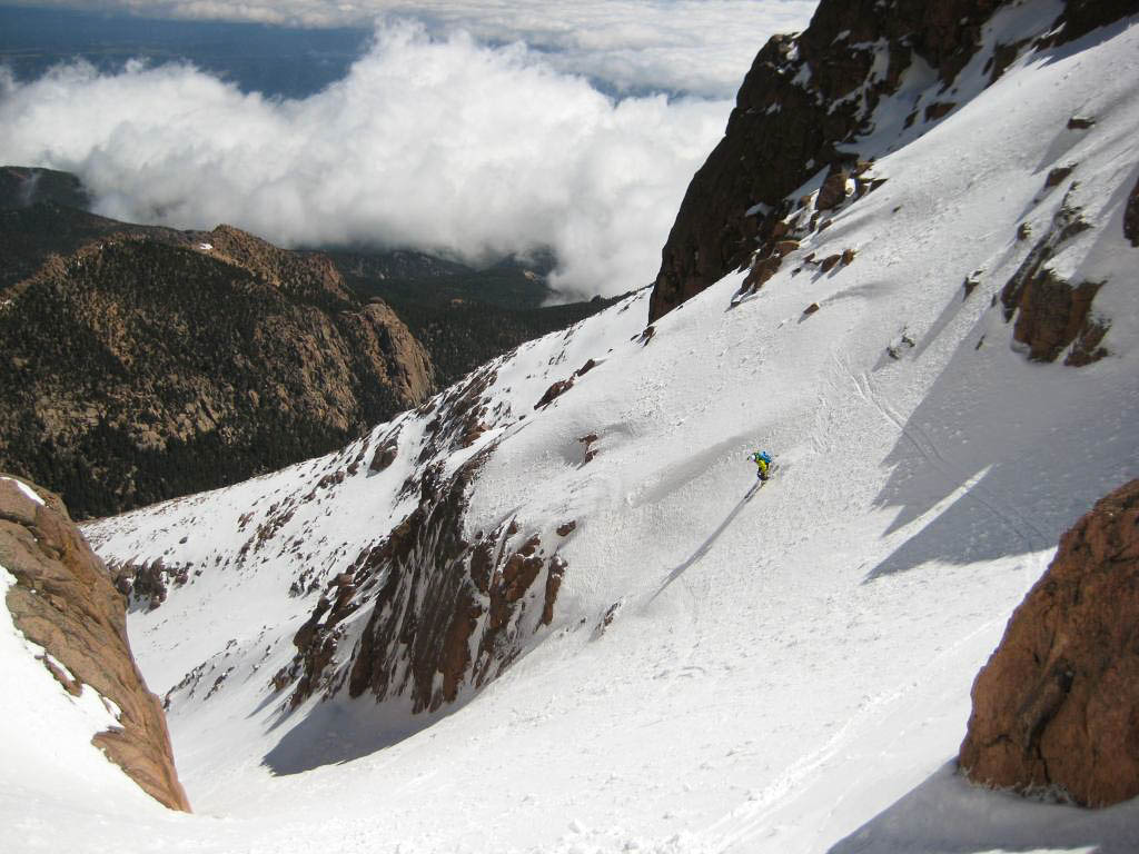
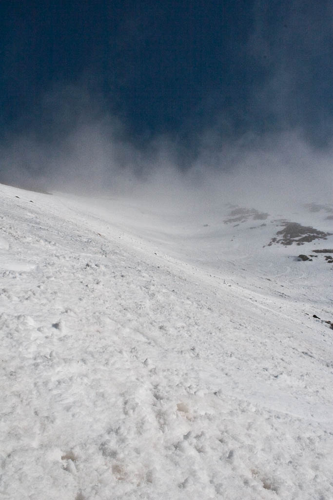
It’s unfortunate that camera sensors have such a limited dynamic range compared to the human eye. These pictures just can’t compare to actually being there.


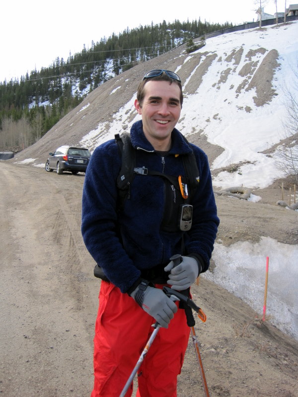
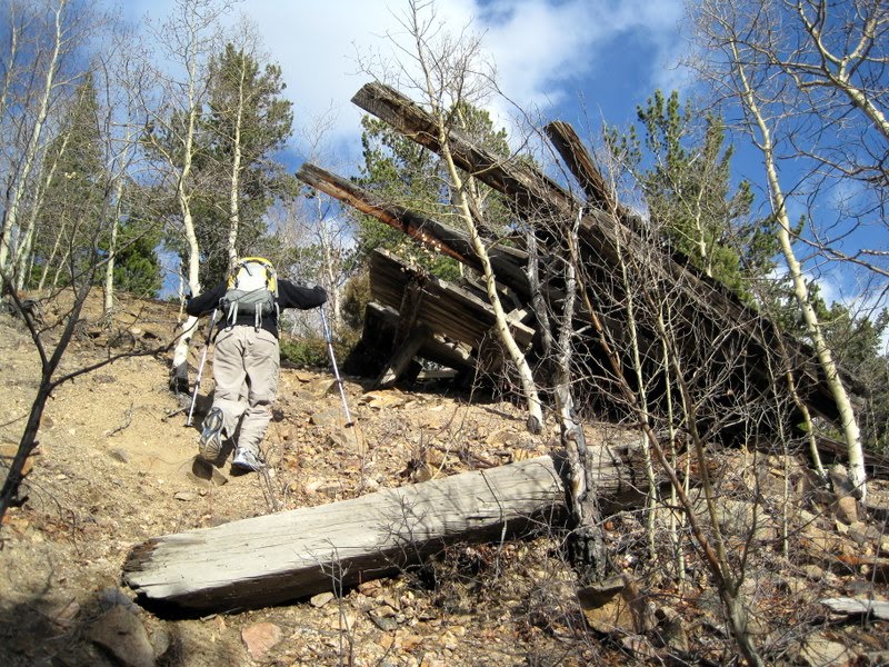
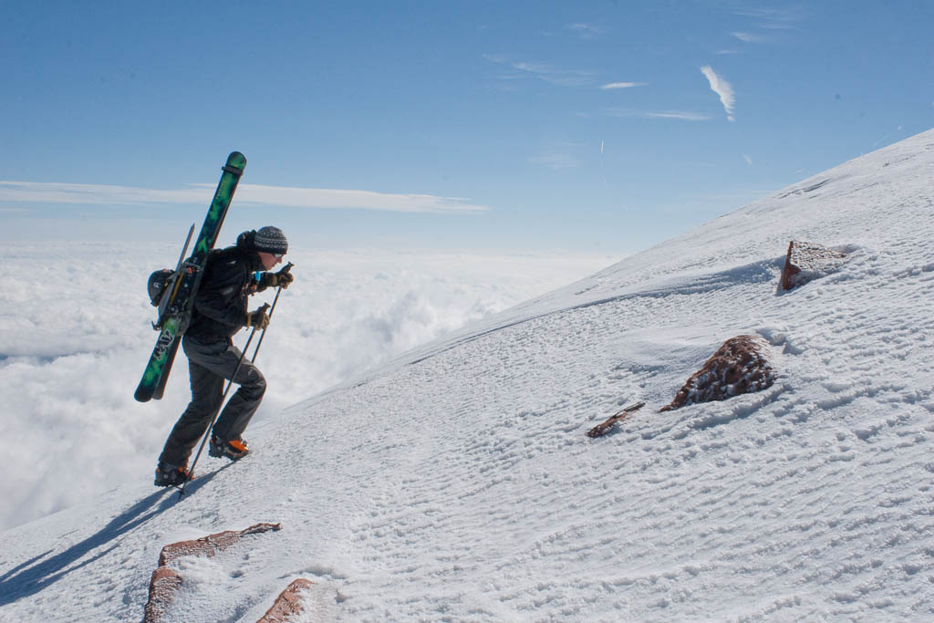
Better images can be had with better equipment, but I was traveling light this day, only a 12 pound pack including food and water. I wanted to enjoy the experience, rather than suffer by hauling several extra pounds up and down the mountains of the Tenmile Range.

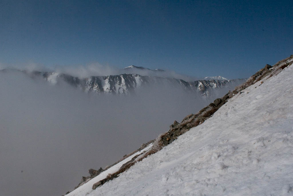
By this point I truly was enjoying the whole experience, but that’s nothing out of the ordinary. Being alone above treeline before sunrise is always great. Soon enough, the first of 10 objectives came into view.


The sun hit on the approach to Peak 1, which made for some great views.


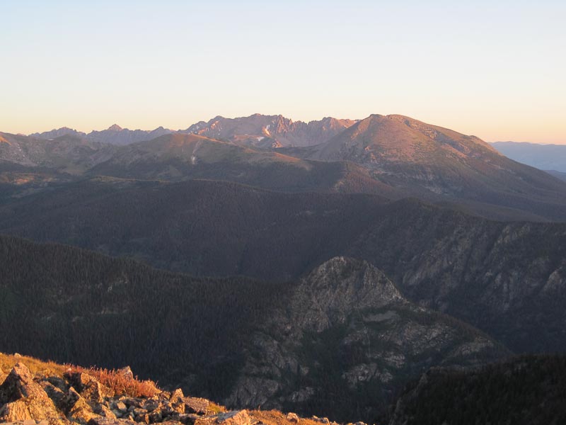
Doing something like this really makes you realize how close together so many of the ranges in the state are. Here are the Gore getting some alpenglow.

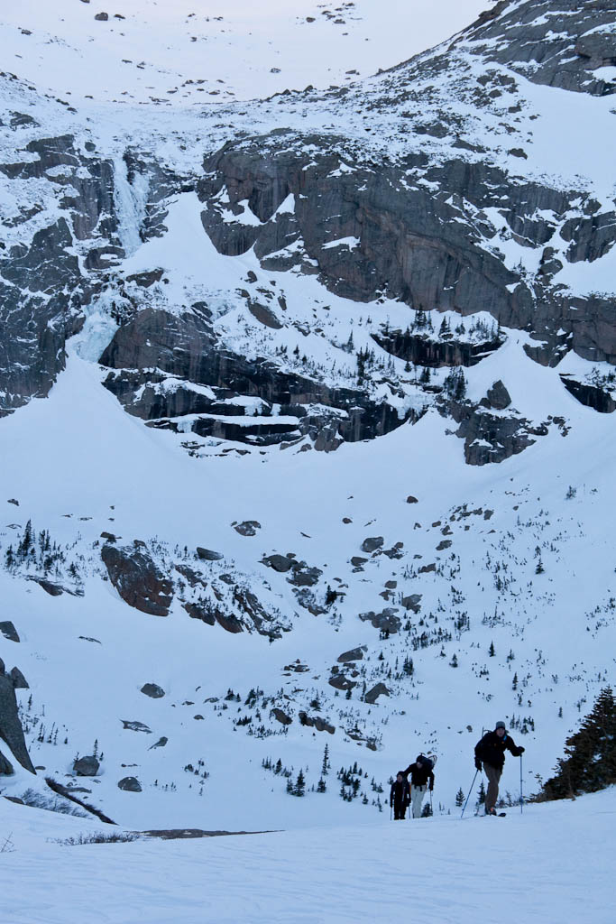
And the group that was also attempting the traverse this day. They were fairly loud, and I was amazed how well sound travels up in the mountains when the air is still.

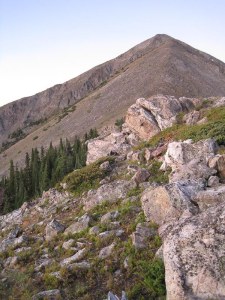
And finally, Peak 1 bathed in alpenglow. This was a substantial hike, and isn’t a bad target in and of itself, at about 3,500′ of elevation gain.


A couple hours in, the summit was reached.

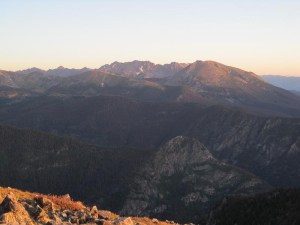
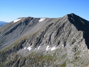
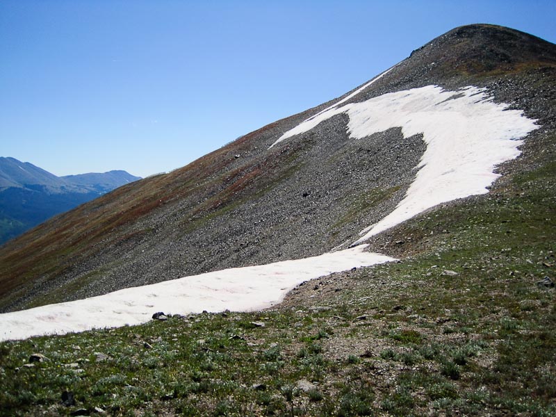
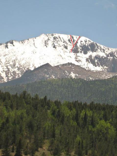
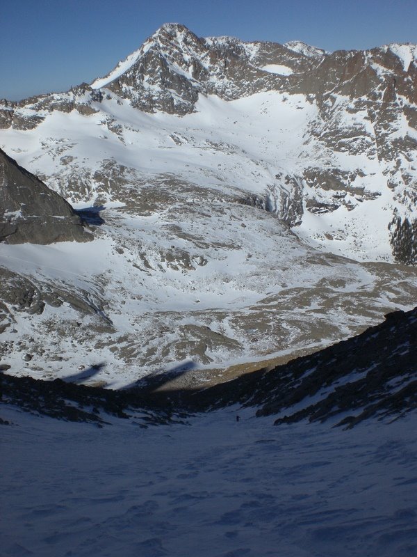
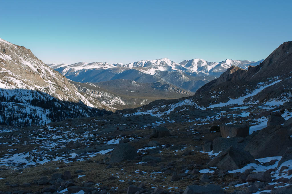
Peak 1 was a great warmup for what was to come. Peak 10 is visible here, far off in the distance on the left side of the picture. The coming ridgeline on the way to peaks 2, 3, an
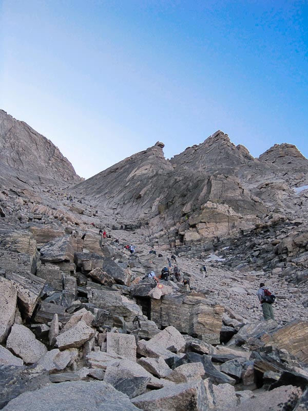
d 4 is the most difficult portion of the traverse. It’s said that it can be kept to class 3, but my route had some solid class 4 (though I was able to avoid anything class 5).


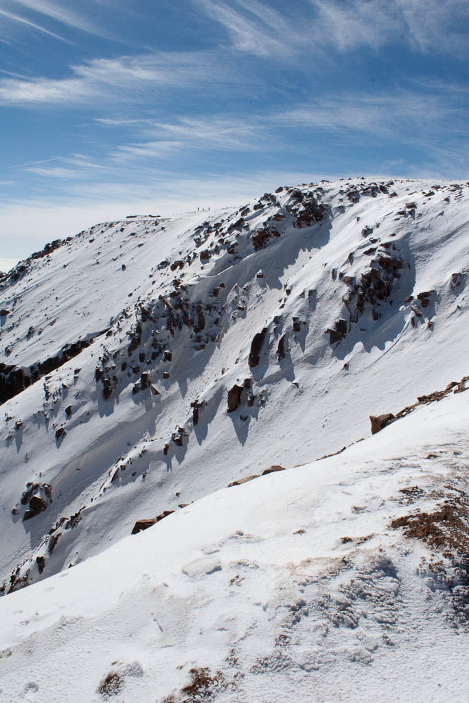
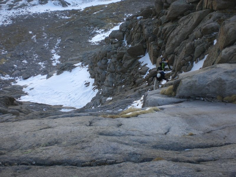
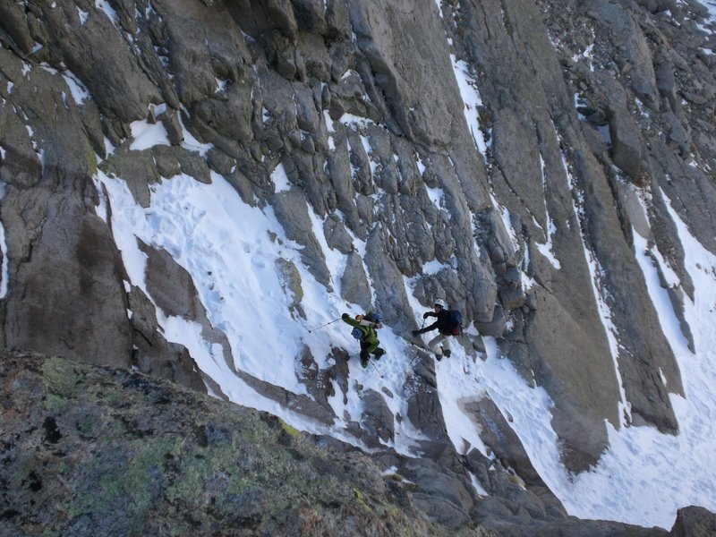
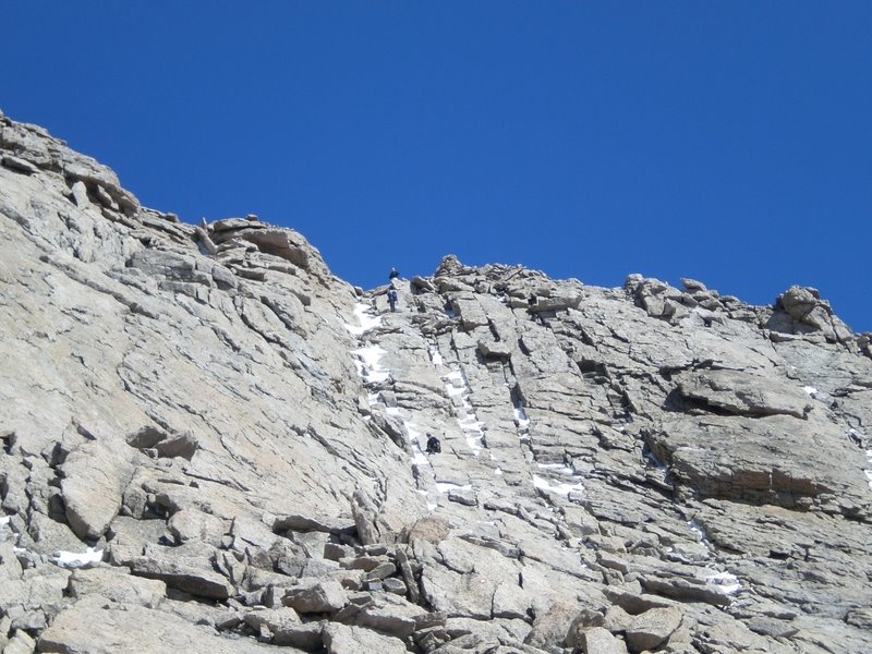
The ridge from 1 to 2 was largely uneventful (though still a fun scramble), and there are no photos here of it. Visible here is “the dragon,” along the ridge from 2 to 3. It is the most technically demanding section of the day.

Here’s a look back. I started off on the west side and looked a few times for exits onto the top of the ridge. It was an unbelievably fun (though stressful) section, and I’m glad the group was there to help with routefinding through it. No good pictures from the dragon as I was focusing on getting through it, plus the lack of color variation made most of the photos worthless.


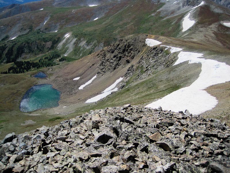
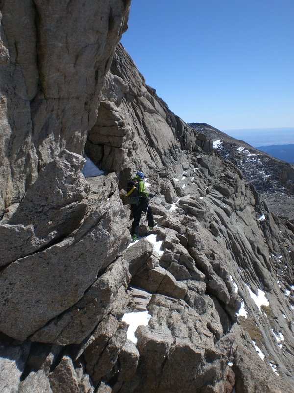
This is taken from the summit of Peak 3, showing the immediate change in terrain after reaching Peak 4. This ridge was less difficult than the preceeding two, but there were still a lot more “you fall you die” moments than I was expecting. The ridge up to 4 was generally a couple feet wide, but with vertical drop offs on either side. It was fun, but became very mentally draining by the end.


And at long last, Peak 4 and its accompanying gentle, rolling terrain was reached. This was a huge relief, making the coming easy tundra walk far more rewarding than it otherwise would have been.


I set off for Peak 5, leaving the other group behind for the rest of the day. I would not be within shouting range of anyone else that day until I was heading back down into Breckenridge in the afternoon. I finally had the solitude I wanted.

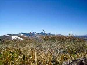
I didn’t even stop moving while going over Peak 5, as it was little more than a small bump along the ridge without anything of real interest. The following photo was taken between peaks 5 and 6. It was the most blissful, serene moment in the mountains I’ve ever experienced. There was a small dip, filled with short grass blowing in the constant, moderate breeze in the ridge. The lighting was perfect, and it was silent except for the wind. I had no choice but to sit down and simply experience it for a few minutes. The beauty of the morning, the camaraderie seen through the difficult sections, and the danger of the climb all came together and hit me at once. I felt like I could have stayed there forever.


Sadly, I had to get up and keep moving. Things started to get more physically demanding again after Peak 6. Peak 7 was not terribly steep, and hitting the ski area boundary gave a mental boost as I knew I was getting closer to the end.


This shows Peak 8, with the melted-out run known as Whale’s Tail. It’s a blast in good conditions. The climb up to 8 wasn’t very difficult, as I’d done it dozens of times in the past carrying skis over my shoulder.


This is Lake Chutes from the top of Peak 8. It’s beautiful in the winter, and just as beautiful in the summer. It was nice to be covering terrain that I was familiar with, as I was starting to wear out from the long day.


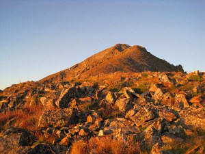
This is Peak 9, with the summit being the small bump on the left. I was noticeably slower here. The miles and several thousand feet of climbing were adding up and taking their toll on me. The various emotions of the day were piling up as well, and I’m glad it was an easy walk up so that I didn’t have to be 100% focused on the task at hand.


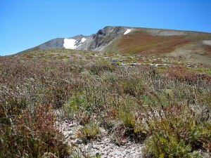
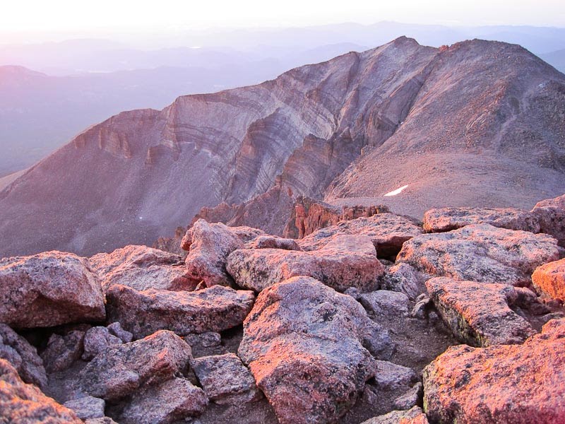
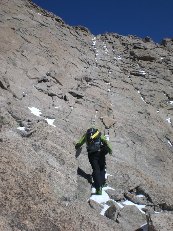
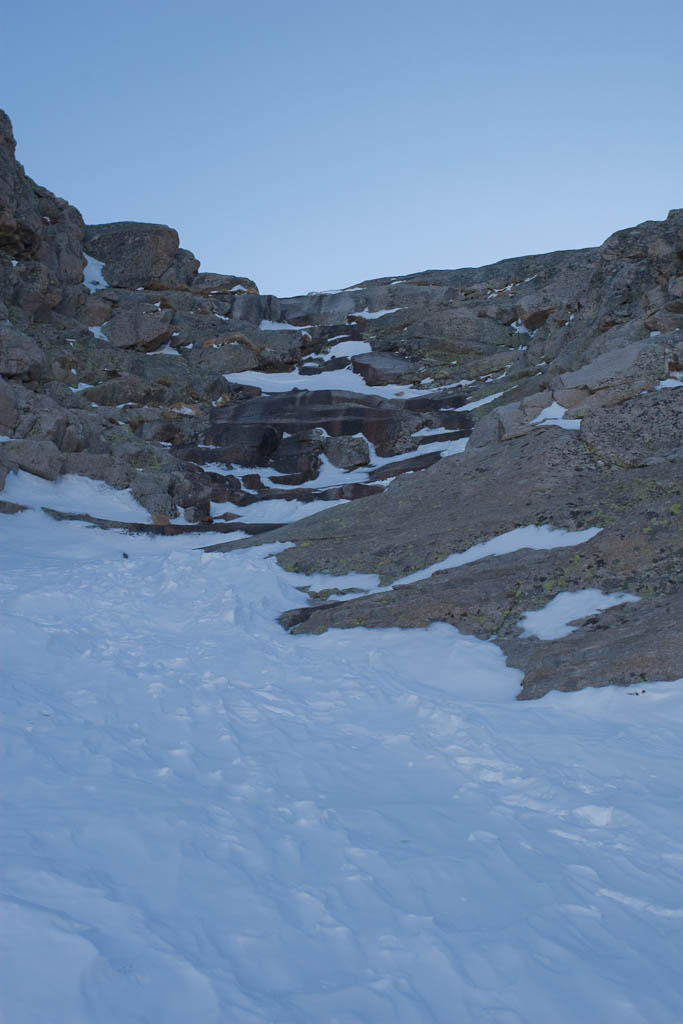
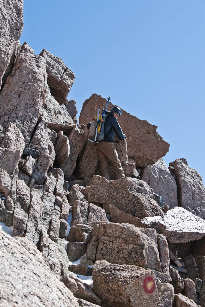
This sight was far more demoralizing than inspiring. I’ve gone 12 miles and climbed over 7,000′, I’m exhausted, only have one mountain left, and it’s not only the highest in elevation (and one of only two over 13,000′, at 13,633′), but is covered in loose, crappy, sharp rock.


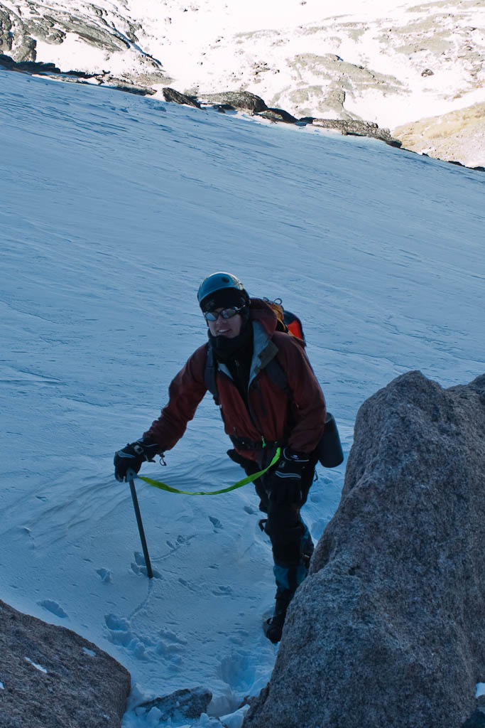
Rock that looks a little something like this. I got my only real injury here, when a loose rock smashed a finger. My fingertip was immediately red, and there’s a chance I’ll be losing another nail. Fortunately nothing’s broken. It was a hard 700′ of climbing, and despite my growing exhaustion and slowing pace, failure never even crossed my mind. I had come this far, and I would make it to the top no matter how tired I was.


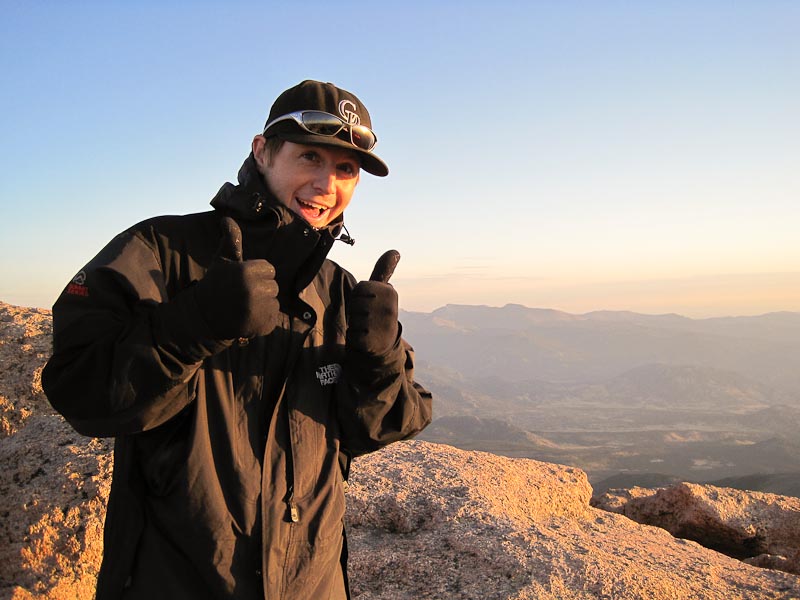
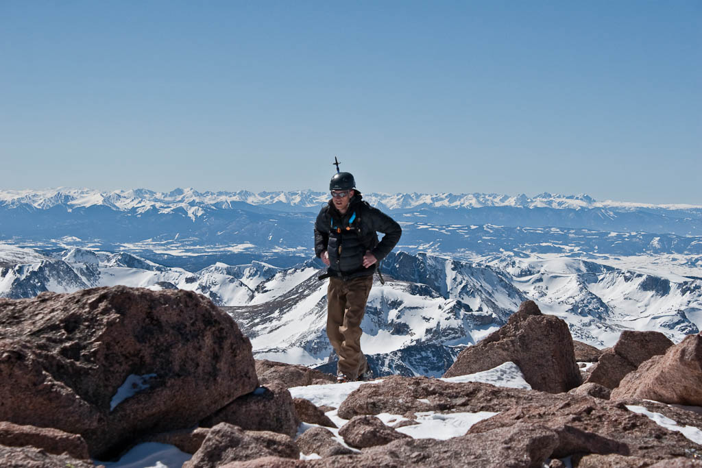
An hour after leaving Peak 9, I made it. I was overjoyed, having done something of this difficulty in a single attempt. Yet almost immediately, I realized that reaching the final summit was not all that spectacular – that the journey is what really mattered, and is one of the major things I would take back from this day. I only stayed on top long enough to eat something and snap a couple pictures before heading down to town.


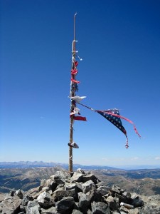
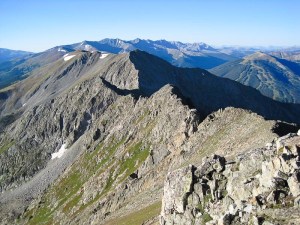
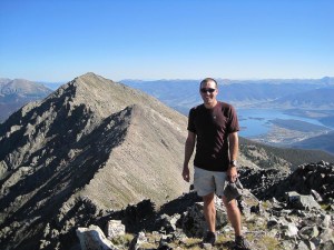
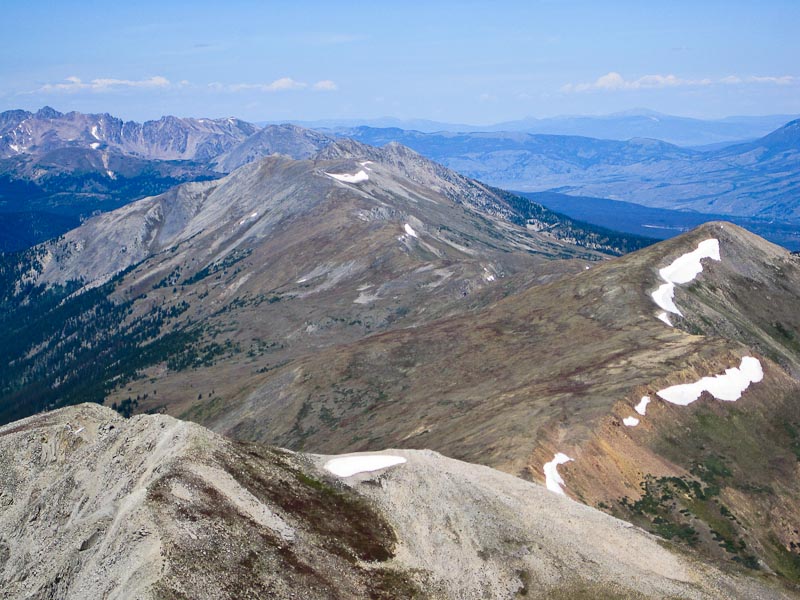
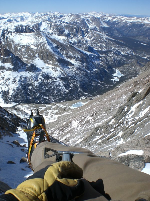
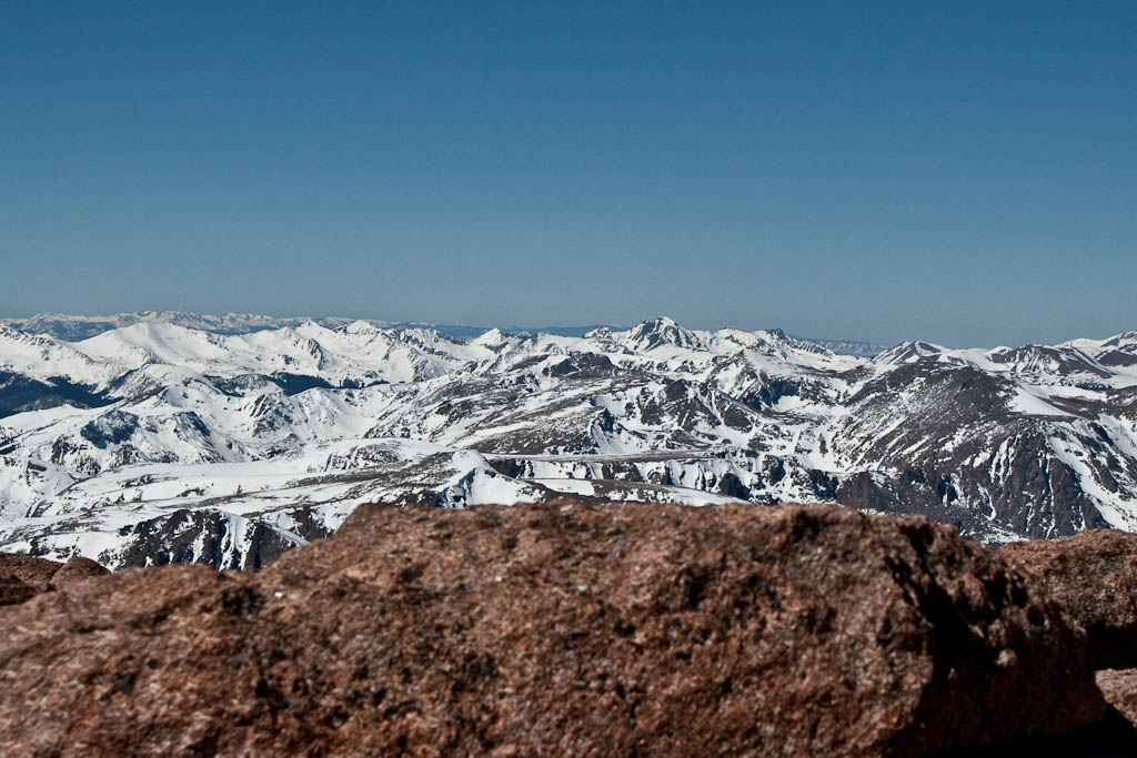
Here’s a look back on the route. Kind of hard to make out, as it’s pretty far off.


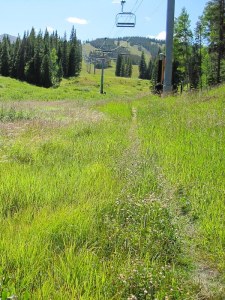
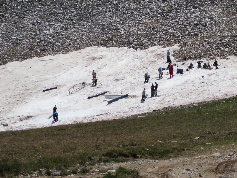
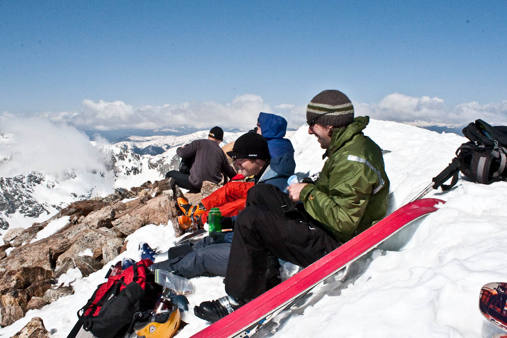
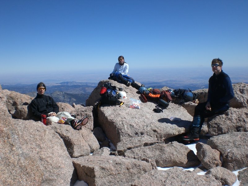
Down lower on Peak 10, I found these guys with a pretty cool park set up. There was also a guy skiing on a different patch of snow. Way to get after it in August, guys.


The trudge down the ski slopes felt never-ending. I wished I could have skied down, especially the farther down I got, as towards the bottom the vegetation got much thicker. There were even marshes with my most hated mountain plants, willows.


Truly an amazing day, probably the most spectacular one I’ve ever spent in the mountains. Words can’t adequately describe the experiences, emotions, and realizations of the day, which is all the more better as it’s absolutely not what I was expecting. I just thought it would be a long, challenging day in the Tenmiles, and I ended up having a near-life experience.

Birthday Camping and Wheeling

Alright, finally back up and running here. These photos are from a 4-wheeling trip to Chinaman Gulch taken last weekend, which coincided with my birthday. I was the designated photog, and did no driving.

After getting home from work, I threw everything in the car, went to Nate’s, and we hit the road for Buena Vista. It was cloudy and rainy on the way up, which made for a spectacular view from just outside of town.

After meeting up, heading to the trail, and setting up camp, it was decided that we should check out the start of the trail before it got dark.

The sunset in the mountains is always beautiful.

Nate’s Stock Cherokee had to use more caution than a built rig would, but made it through without much trouble.


After dinner, we decided to go try the trail. Matt’s built up ’80’s 4Runner had an easier time with things.

Easy cruising for the built-up truck through here.

Until…

Matt decided to have a near-life experience!

Ok, now what?

It was a pretty tight spot, small cliff on one side and heavily vegetated dropoff on the other.

An hour and a half later the system was in place to right the truck. No photos of the actual righting as I was involved.

Yes!


At that point we decided it would be better to head back to camp and try it in the morning.

The end of the Carnage trail (reportedly the second hardest in the state) was right by the start of the Chinaman Gulch trail, so we wandered over and checked it out.

Who could possibly look at this and think “I can drive up that?”

Insanity.

Back to the trail.

And a couple scenic shots.


Matt’s little brother gave it a shot.

This pose looks familiar.
Stock Cherokee!

Looks like the built 4Runner might have a hard time here.

No match for the Stock Cherokee though!

Scout was having a blast, although the heat and the sun started getting to her.

And another scenic.

Almost there…

…and stuck.

Stock Cherokee to the rescue! Note that the Stock Cherokee made it over that obstacle without issue.

Back to camp just in time to catch some showers. Scout took refuge from the sun under Matt’s truck.

All in all, a very fun trip. Until next time…

Second Annual 14er on the 4th!

Last year was Mt. Democrat, a pretty easy hike. This year was Mt. Sherman, which is similarly easy (if not easier). It was chosen for the sake of a girl who bailed at the last minute. Next year we’ll be forced to move on to more difficult ones, which is fine by me. This was about as leisurely a hike as is possible; I felt no effects from thin air (including breathing hard), which has never happened before. This is mind boggling as we were all up pretty late enjoying the camp fire. Anyway, on to the pictures.

We left Denver about 4:30 on Friday, which was a terrible idea. I-70 was a parking lot. A few hours later we grabbed dinner in Leadville, and eventually found the road to the trailhead. It was getting late, but there was plenty of light left for setting up the tent, and taking a couple photos.

The weather was great that night. Cool, but not cold. The company around the campfire was great, of course.

We were up at the crack of 8:30 the next morning and got a super-alpine start around 9:45, just in time to catch several people on their way down the mountain. Here’s the motley crew heading off.

As usual, the alpine meadow was beautiful. It was extra green thanks to all the moisture we’ve gotten this spring.

As we got up to the ridge, the dogs found a few snow patches to play in. Dogs don’t get enough credit on the intelligence side. They love snow as much as I do, and there’s got to be something going on there.

This one is from the summit ridge. Not sure of the elevation, probably somewhere around 13,500′.
An hour and a half of leisurely hiking and we were on top. Someone had taped a miniature American flag to the summit post.
Nate neglected to bring a jacket, and it was cold and windy on top, so Andrew and Katy helped him keep warm.

It felt amazing up there, like standing inside a windy refrigerator. Most other people up there didn’t appreciate it the way I did. After hanging out on top for a while, some rain showed up on nearby mountaintops, so I decided it was time to go. I stashed my camera and moved, so no pictures were taken until I got back to the sunny meadow. There was a stream we crossed at the very beginning, and Scout and I were a ways ahead of the group when we got there, so we decided to soak our feet in the ice cold snow runoff.

I could’ve hung out here all day. Great view, cold stream (20 degrees warmer would’ve been nice, to be honest), and the sounds of nature added up for a serene break spot.


The rest of the folks showed up a few minutes later, and we walked a couple more minutes to the cars, where Nate and Matt had been waiting after practically running down the mountain. We went back to camp, and celebrated with beer, burgers, and hot dogs. Matt had 5, it was ridiculous.

Scout was absolutely exhausted. I put a bowl of food in front of her and she just dipped her head in and nibbled. She’s just
now starting to get back to full energy. I don’t know where I’ll take her next, but I’m sure she’ll be similarly worn out.

All in all, a great couple days. I’ve got a couple big days planned, just not sure when those will happen. Tenmile Traverse anyone?

Ending the Season on Pikes Peak

I thought my skis had been hung up for the year after the trip to Quandary last month. Luckily, I was wrong. Carl emailed on Thursday looking for a partner to ski the Y Couloir on Pikes, which was in good condition thanks to all the cool, wet weather the front range has been receiving lately. We were after the East branch, which is on the left in this photo. It’s skied less frequently than the West branch due to a more difficult entrance and a rock band about 500′ in that frequently requires downclimbing. The reward is a more sheltered and aesthetic line.

It was another early morning at 4:45, although that’s relatively late for June skiing. The plan was to drive to the top, ski down, and climb back up. We were stopped a half mile from the summit by a thin sheet of ice on the road.

This was no deterrent though. We all loaded up and made the rest of the trip to the top on foot. There was a pretty obvious rain crust, and we all hoped our line was sheltered from the rain.

Everyone else was wearing typical black/gray technical clothing. I was a little brighter and more colorful.
The undercast was quite a sight, as it always is.

This is such an amazing place.
Despite getting up to 80 in town that day, things were a little different at 14,000′. A high around 30 and a cold morning with strong winds made it such that quite a few tourists probably didn’t bother to exit the train.

The entrance was exciting. Carl aired into it, and hopefully the picture of that will turn up in a day or two. Here’s me shortly after dropping in.

And here’s Caroline getting ready to drop. She was hesitant, but did fine.


Here’s a great shot Carl took from a little way down the line. So much fun.

Lucky for us, the rock band had a line on skier’s right that was filled in enough to ski through. It was a fun little high-speed maneuver.


Here’s Caroline enjoying the last couple turns of the day.

We stopped skiing when it stopped being fun. The snow was softening significantly and the terrain was flattening out, so we traded our skis for crampons and started heading back up.

Such a beautiful place.
It was cooking in the couloir – about 50F, very intense sun, and no wind. I found a mini under-snow waterfall at the rock bands, which told me it was time to get moving quickly. Free water in the snowpack can be very dangerous. In sections, the bootpack up had meltwater pooling in the footprints, small natural sluffs were coming down the rocks, and a couple ice- and rock-fall incidents telling us we should get out of there. I put a chunk of snow in my helmet to help cool me off and went.

We all made it out in good time. Here’s Caroline pulling herself out of the couloir. In about three vertical feet, it went from roasting with no wind back to 30F and windy. It’s amazing what a terrain feature can do.

Success!
I couldn’t have chosen a better way to end the ski season. Until October…

I had a long weekend

It was a blast but I’m also glad it’s over with. As some of you may know, this Sunday was the Colfax Marathon. I signed up for the half with Nate a few months ago when it was BOGO, and have been half-assedly getting ready for it. That, along with the ill-fated Rainier trip, kept me from getting to the mountains much for a while. I decided to go climb and ski Quandary the day before the race.

Friday night I got to sleep around 10:30, which was a little late given the 3am wakeup call Saturday had in store. Got up, loaded the car, met up with Hans, Mel, Owen, and Aaron at the Morrison Park ‘n’ Ride about 4:15 and we were off. It was raining in Denver, and we were hoping for better conditions in the mountains. We got them.

It was horrendously foggy on the mountain though, and as we approached this CMC group (who absolutely trashed the snowpack by glissading and postholing everywhere), we were getting drenched with sweat. High humidity in the Colorado mountains, especially on spring snow climbs, is exceptionally rare. It was fairly miserable, although it was surreal not being able to see very far around you.
The snow was extremely dusty, and got worse as the day went on due to accelerated melt. Total melt-off is going to be quick this year.

Once we were above the fog, the views were very cool. There was little to no breeze early, so it just sat in the valleys.
Even once we were largely out of the fog, occasional light breezes would push it above us.
Where are we, British Columbia?
A couple hours after starting, we topped out to a beautiful morning. While waiting for the snow to soften up, I took a nice nap. Very refreshing, and necessary for the ski that was about to come.
It turns out we waited too long. When the snow was nice on the summit, it was a horrible slushfest down low. I failed to lock the toe on my Dynafits, and a stationary jump turn resulted in one ski popping off and careening down the mountain a couple hundred feet. I’m told photos of that will be following. I didn’t get any ski photos because I was too busy either enjoying the snow, or being miserable and fighting through it. Having to cross multiple glissade tracks and countless trashed areas didn’t help (thanks a lot, CMC).

We finally made it back down to the car and headed in to Breckenridge for lunch. I had a massive calzone at Eric’s, and was still back to hungry by the time I got home. I cooked up a big plate of pasta and hit the sack at 6:30.

After an amazing evening’s sleep, the alarms went off, again, at 3am. I downed some extra strong coffee, cooked a solid breakfast, got my bag together, and biked down to City Park for the 6am start to the race. I had a strong start to the race, down under a 7:30 pace. I figured it was just excitement and I’d settle down to my 8:00 target, which would get me done just under 1:45. To my surprise, I kept it up through miles 3, 4, 5…soon I was 8.5 miles in with a 7:24 average pace. I kept it up and not much later I was finished, an hour and 38 minutes after starting. 13.1 miles is now my personal record distance, and to do it with 7:27 miles felt great.

After grabbing food and my bag, I went back to the finish to shout at Nate for his finish. He met his goal of sub-two hours, and it was off to the beer garden for some seemingly alcohol-free Michelob Ultra. Shortly thereafter, Amy picked me up for breakfast, and brought me a mini-cake with a great little flag. Thanks hon:


The results:
Overall: 85/2294
Age group: 18/167
Sex: 72/846
Chip time: 1:38:35
Gun time: 1:38:38

More Photos from Longs

I got Carl’s photos from this weekend not long ago, so here they are.

The direct approach to the Trough that Kiefer and I took. It was substantially more difficult than the class 2 bypass on climber’s left (from where this photo was taken). Doing it in ski boots and with skis on my back (which restricted movement pretty heavily) made it a pretty major challenge.

Looking down the Trough. Prakesh is the small dot climbing up.

Here’s me, crossing the Narrows for the first time that day. It was somewhat precarious in ski boots.

Due to not carrying skis or wearing ski boots, Kiefer, Stephanie, and Sean were able to make the summit a little before Carl and I were. Here’s them, making the top.

And here’s me, starting the Homestretch. The near-total lack of snow made this extremely difficult with ski boots on.

Kiefer, Stephanie, and Sean enduring the harsh winter weather.

Carl’s view, getting ready to plod down a few hundred feet to our skis.

Me, skiing down the trough. This might be the first real shot of me skiing this year, and it looks good despite exhaustion and funky snow.

And finally, the hike out from the bottom of the Trough to the point where the snow picked up again.

I expect to get a couple more photos (group summit shots) in the next day or so. Man, what a fun trip.

A Very Long Day on Longs Peak – The Trough

Saturday March 14, 2009
Longs Peak via The Trough, 14,259′
12 miles RT, approximately 5,200′ of elevation gain
Car to car time: 12:45

For a few years now, this route has been on my hit list. Yes, I’ve climbed the mountain a few times before, but always in summer or fall, and never with skis. When I saw a group was forming a few days prior, I checked the weather and jumped on it. In the days leading up, the forecast called for a high in the high-20s around 13,000′ and a 10% chance of snow. On Friday, it was calling for 29F and no snow or wind…perfect.

Friday night, I ate, and ate, and kept on eating until I was stuffed and it was time for bed, around 8:30. At 2:30 the next morning, I’m awakened by my alarm. Sigh…time to get up. Fortunately I had packed the car the night before, so all I had to do was get dressed, eat, and go. I was on the road just after 3am, and pulled into the Glacier Gorge parking lot right around 5. At 5:10, the hudge group (of 6) was off!

An hour and a half later, it started to get light. It was nice to kill the headlamps, and to be able to enjoy our beautiful surroundings.
The sun was making its presence known, though I knew it would be a while until we got any direct sunshine.
We took occasional short breaks, which were helpful in keeping energy up for the long approach.
When I don’t get out like this for a while, I can forget why it’s so amazing. I remembered yesterday morning why I love it so much.
We made great time on the approach. Here’s the group past Black Lake, which only took about 2 and a half hours to get to.
From the same spot. Rocky Mountain National Park is truly amazing.
Not much later we got our first view of the objective. Longs is the big rectangular protrusion, with the Trough cutting down below it. Keyboard of the Winds is just to the right of it.
Here’s the group nearing the end of the approach.
There were several bighorn sheep waiting here, not particularly concerned about us. In this same spot on the way out, a big herd (15-20) ran by. It’s amazing how nimble these things are.
I believe that’s McHenry’s on the left and Arrowhead on the right. I could be entirely wrong though. What really matters is how gorgeous it was. Not a cloud in the deep blue sky. The air was crystal clear and crisp.

This is where the group split briefly. Carl went left of here and had a super-easy time. Stephanie and Sean went to the right and had to backtrack a ways. Kiefer and I went straight through here, and it was a disaster. I was drytooling with my whippet to get through here. Carl got some photos from up above, which I can’t wait to see.
Immediately after that section, we hit the Trough and the real climb began. There was good styrofoam snow most of the way up, though at the top it became extremely rocky. The average pitch of the Trough is 30 degrees, so a pretty mellow climb in good conditions. It’s long though, at about 2,200′. Here’s Sean, enjoying the great snow.
And Carl.
We carried our skis to roughly 13,250′, about 600′ from the top of the Trough. That was the end of the skiable snow, and it was great to get them off our backs.
At 10:52, the sun finally crested the ridge. It was a very welcome sight, and great to get a little bit of warmth finally.
At the top of the Trough is a chock stone that I remembered (from my first two trips up here) as near-vertical. Turns out it’s not, and I scrambled up it with crampons on without an issue (and it was nearly devoid of snow). We took a break here before taking off the crampons, and heading for the narrows. This is the most exposed portion of the route, but wasn’t too bad.
The Homestretch was absolutely miserable in ski boots. What can nearly be walked up in the summer (wearing trail runners) was a fight for survival in AT boots. If it had been snowy (as it is most winters, and as it appeared a few weeks ago) it would have been a straightforward climb up. Nevertheless, at 1:15pm, we hit the summit.
Sean and Kiefer had been there for a little while, enjoying the absolutely perfect weather. Around 30 degrees, calm winds, and not a cloud in the sky.
Some summit shots, from roughly the same point (because I was exhausted).
It’s amazing how big and flat the summit is. We discussed how awesome it would be if there were a summit cone instead of the huge plateau.

Carl touching the official summit.
Meeker, to the south.
Me.
Look how extreme I am!
The descent back to the Trough was miserable. The homestretch took forever, and the narrow, off-camber ledges of the narrows were much more apparent in my exhaustion. I moved slowly, as I didn’t have the energy to be both quick and safe. Finally, we made it back down to the snow, and everything was right with the world.

Shortly thereafter, we got to our skis. The snow was pretty funky. It was a mix of powder, sastrugi, ice hardpack, and breakable crust. Unfortunately, it randomly varied on each portion of the line as well as in vertical space. Fun, but not fast or easy.


At the bottom, we had to take our skis off and carry them a mile or so over rocks and dirt. Once we were finally able to put them on, all was right with the world. I have no more photos from this point, but hopefully will get some from Carl.

The lakes were semi-unpleasant. Long, flat stretches that we had to pole across. I stayed extremely close to the edge, as I heard some popping and cracking as I went over some sections. It seemed like forever, but we eventually got to the trees. It was fast and fun, with enough random obstacles (that were entirely inconsequential on the ascent) to keep things interesting. After ducking fallen trees, jumping rocks, and dropping small cornices for half an hour, we finally were back to the parking lot. It was 5:55pm, a full twelve hours and forty-five minutes after we left. I’m glad to have done it, but that’s one trip I’ll probably never repeat.

Gnarch Radness – Part 2

And now, the rest of the photos.

Nate felt like getting aggressive.

But it didn’t last.

Getting back after it:


Andrew, stylie as always:

Sends it! Smoove…We didn’t see anyone else all day except for one dirt bike as we were almost back to the car. Ace found that he lost all but one bolt holding his bash guard on about a mile from the car. After a little tightening, he was good to go.

After that, it was back to Fruita proper for a lap up 18 Road. I didn’t join, and drove the shuttle, as I was too beat from 16+ miles of biking (on my first time MTBing). At the parking lot, a couple guys and several dogs went out for a lap or two…

…while I took in the scenery. Andrew, Katy, and Nate rolled in a few minutes later. The minor issue with the bash guard turned major as one bolt wasn’t enough to hold everything together. He sheared off the big chainring on the way down, requiring a trip to the shop the next day.

We took off for dinner and a soak in the Glenwood Hot Springs, which were awesome. I’m envious of everyone who lives there and gets to drop in for a soak after a long day of skiing, hiking, climbing, biking, or any one of the many things that are so close to Glenwood Springs.

After a good night’s sleep, it was off to Beaver Creek the next morning. The conditions were horrible – cold, windy, dumping graupel and rime, all on top of a incredible ice crust resulting from weeks of sun, heat, and no snow. Visibility was nil. It was a struggle to make out two chairs ahead of you on the lift. Andrew forgot his boots at home, and I think he probably had a better day as a result.

Despite the crappy skiing, it was an awesome weekend in Colorado, and a great sendoff to the handlebars (which are now gone).