Mt. Sherman – 9/10/06

Originally written 9/10/06

Mt. Sherman, 14,036′
Round trip distance: 5 miles
Elevation gained: 2,000′

Some of you will notice right off the bat that this looks to be about 1/3 the trip I did last week. That would be correct. I planned to hike Mt. Elbert (highest in the state) yesterday, but it was decided late on Friday that I had to work Saturday morning. I woke up this morning about 6:45 and had a hankering to go hiking, so I rolled out of bed, threw together my gear, and was out the door by 7:45. Such a late start means I would have to do something a little shorter than my usual craziness; fortunately, something short and easy is exactly what I was in the mood for today, with a nice scenic drive in and out.

At 9:55 I rolled up to the end of the road, where this locked gate stands, keeping vehicles but not people out of an old mining area. I was by far the last person to arrive, but definately not the last to leave. There was a group I passed about 45 minutes from the summit, and I passed them on the way down not far from where I passed them on the way up. I’m not sure how these people were going so very slowly.

The mountains have been getting dusted with snow since mid-week, and it was still going. Here’s a picture of Mt. Gemini, with the summit poking into the clouds:

After an hour or so, I was up to the saddle between Sheridan and Sherman. Here’s the view to the east:

And to the west:

The weather was changing literally by the minute. It rapidly cycled between heavy clouds overhead, to clouds coming down to where I was, and back to clear. I’ve seen weather move quickly (like on Quandary, from my report last new year’s eve), but never cycling so fast.

Here’s a look up to the ridge the route takes, with my dog wondering what was taking me so long.

This was the first time she’d been in any amount of snow. She walked through a small patch of snow in May and started going nuts, here she went ballistic for a good 30 minutes through the snow, running up and down continuously.

Here’s another picture of Gemini, showing how quickly the weather was changing:

A little higher up the summit ridge, there were a bunch of rocks with some cool snow patterns on them. Also, notice the gray skies again:

The route, heading up into the clouds:

Here’s Gemini, gray and snowy again:

Here’s my awesome dog Scout, sitting for some reason.

Abandoned mine buildings:

With a kid climbing around on them:

From here, I plunge-stepped down a steep scree field, which was a lot of fun. After that it was a quick walk down to the car, with a car to car time of 2 hours, 20 minutes. Real quick, just what I wanted today.

Mt. Meeker and Longs Peak, 9/2/06

Originally written 9/3/06

Stats:
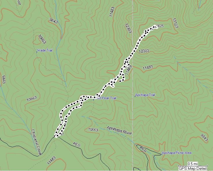
Time: 10 hours (within 3 minutes)
Distance: 14 miles
Total ascent: 6,621′

The weather in Colorado has been turning in the past few weeks, with snow showing up at higher altitudes. This weekend represented what may have been the last chance for the year to go have fun on Longs Peak, an amazing mountain with routes ranging from class 3 all the way up to 5.12.

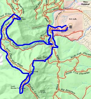
Last year, I went twice in two weeks, and went up the standard route known as the “Keyhole” both times. This time, I went up the “Loft” route, and descended via the keyhole. I also ascended Mt. Meeker, at 13,911′ while I was at it.

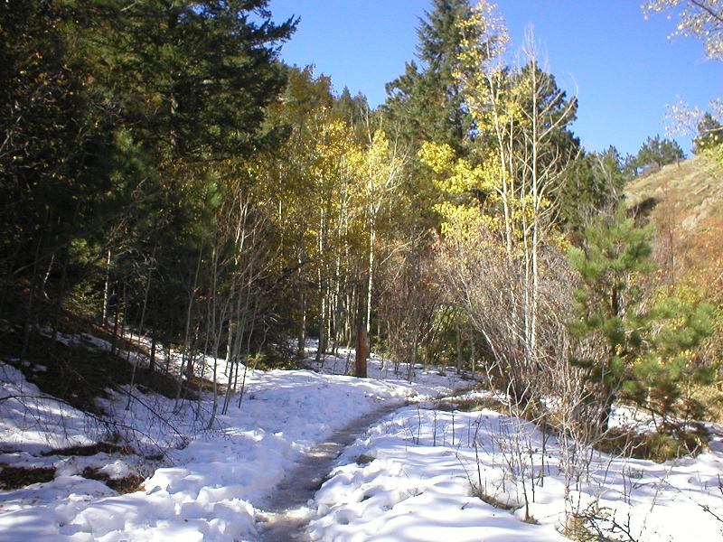
I woke up at 10:50pm Friday evening, ate breakfast, walked my dog (who couldn’t come, since Longs is in Rocky Mountain National Park), and hit the road around midnight. The drive was fairly foggy, since there were some low-lying clouds. I was on the trail at 2am, and the first person to leave that night.

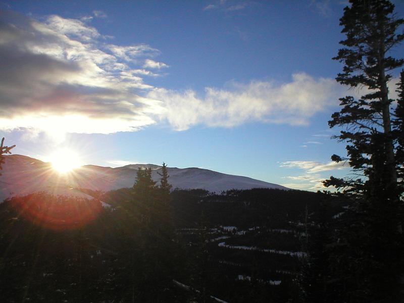
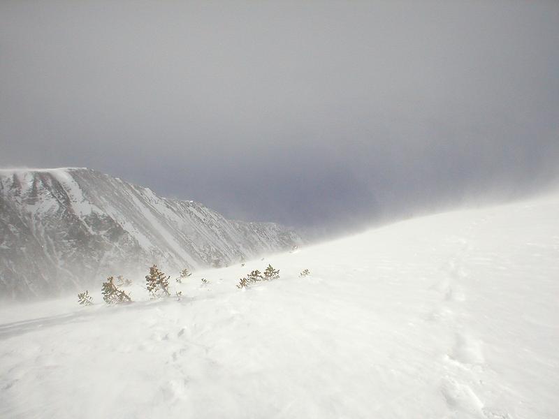
When I hit treeline, the sky was completely clear – not a single cloud in sight. The stars were amazing, although there was no moon. We’re at the first quarter, but the moon set just after midnight, so was of no use to me. I made my way to the trail junction at Chasm Lake, and ensured I wouldn’t see anyone else for several hours by heading away from the standard route (where it branches off to the left, for those viewing the gps track).

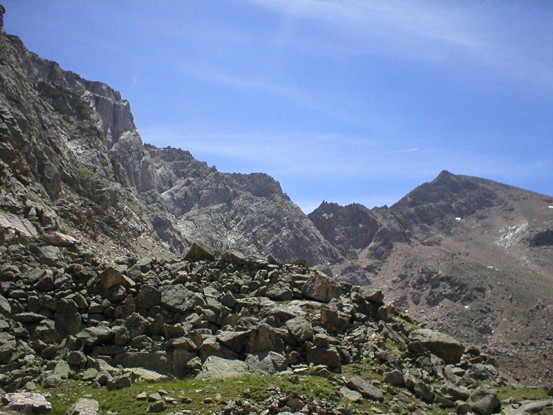
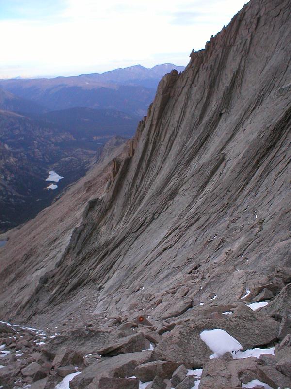
The walk in from there was truly amazing. I could make out the profiles of huge rock towers and walls all around me, and the only sound aside from my footsteps was that of streams and small waterfalls. I wish I could better describe it, but it’s something that truly must be experienced.

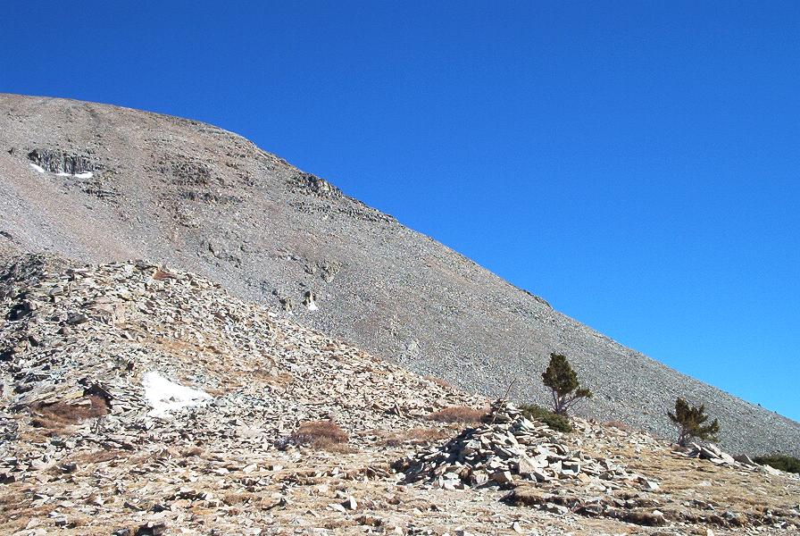
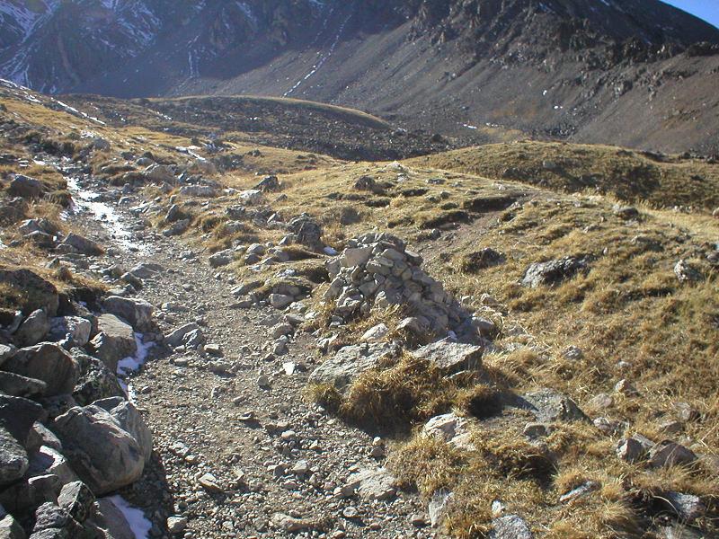
Things started getting rockier and steeper, and before I knew it, I was in the heart of the climb. Ideally, the loft route can be kept at class 3 difficulty. With the only available light being that from my headlamp, routefinding was dicey at best. Add my impatience to the mix, and you’ve got a great potential for getting off-route, and into more difficult terrain. I worked my way into some climbing that was at least some solid class 4. Better yet, I managed to get up to bases of not just one, but two waterfalls, and had to downclimb and work my way back around. A pain, yes, but still fun, so I didn’t mind much.

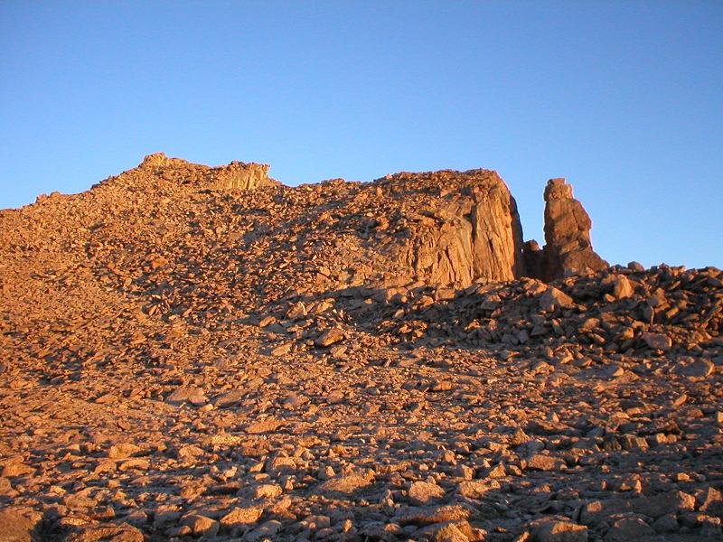
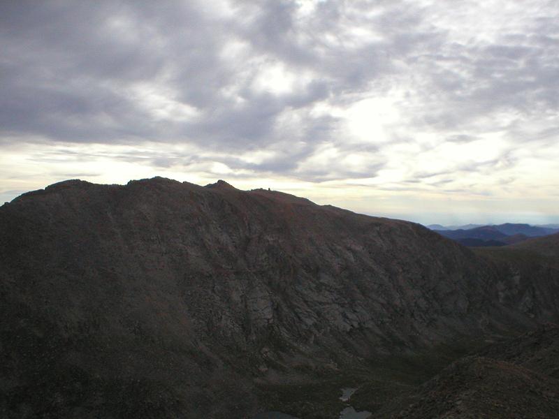
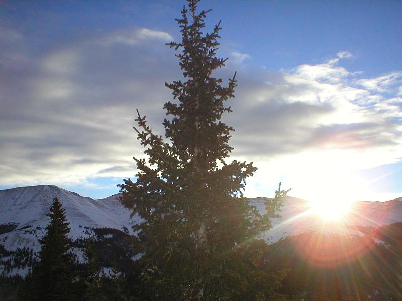
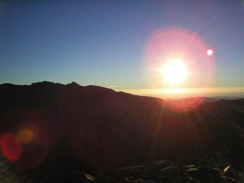
I finally topped out on the loft, and Meeker is a simple 10 minute walk with some very minor scrambling at the top. The summit is also very exposed, which made for some amazing views. Unfortunately, the sun hadn’t quite come up yet, so this is all I’ve got for you from there:

I would have loved to be there for sunrise, but I was starting to shiver and needed to keep moving. I walked back down to the loft, and the sun finally rose.

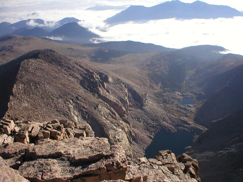
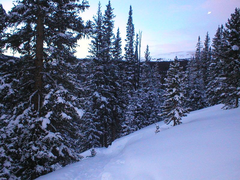
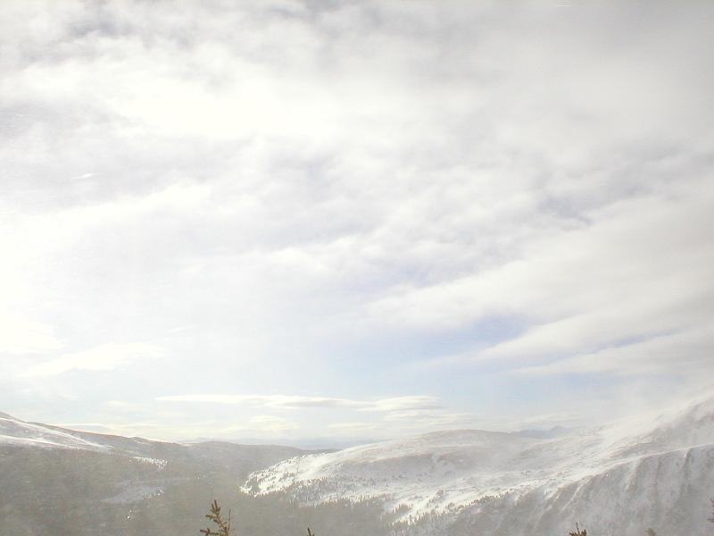
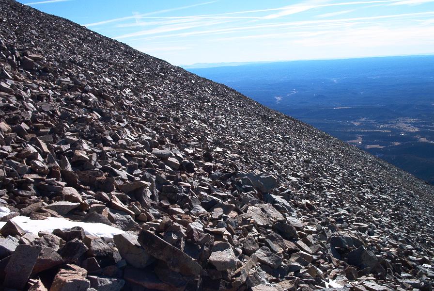
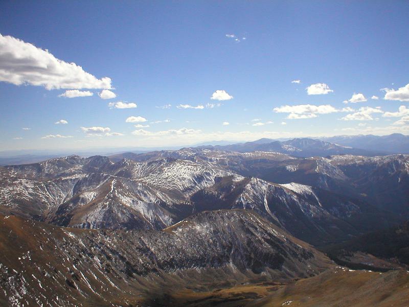
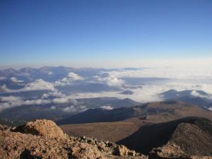
When it got light, the view over the plains was absolutely amazing. Those clouds I drove through 4-5 hours earlier were still there, down between 10-11k feet. Simply beautiful.

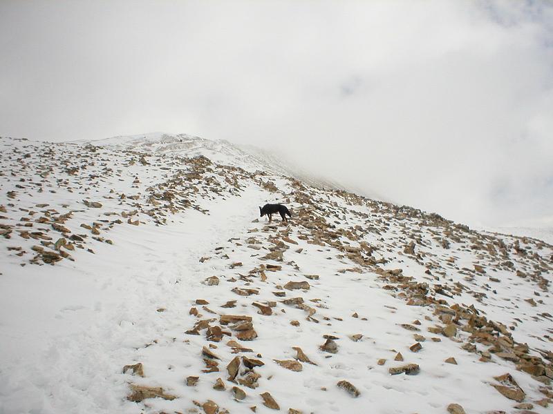
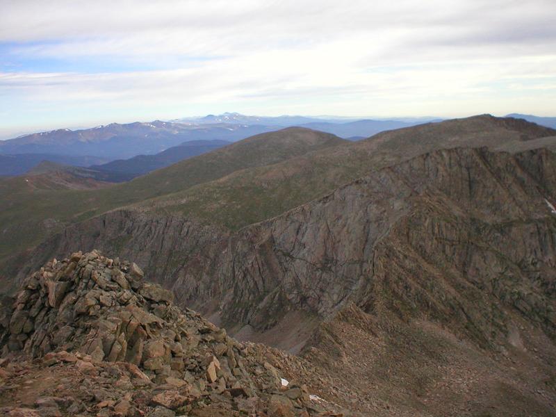
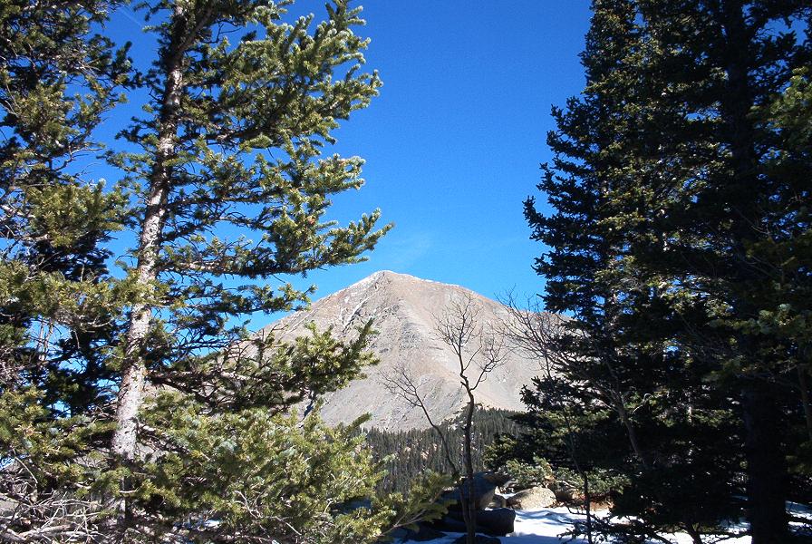
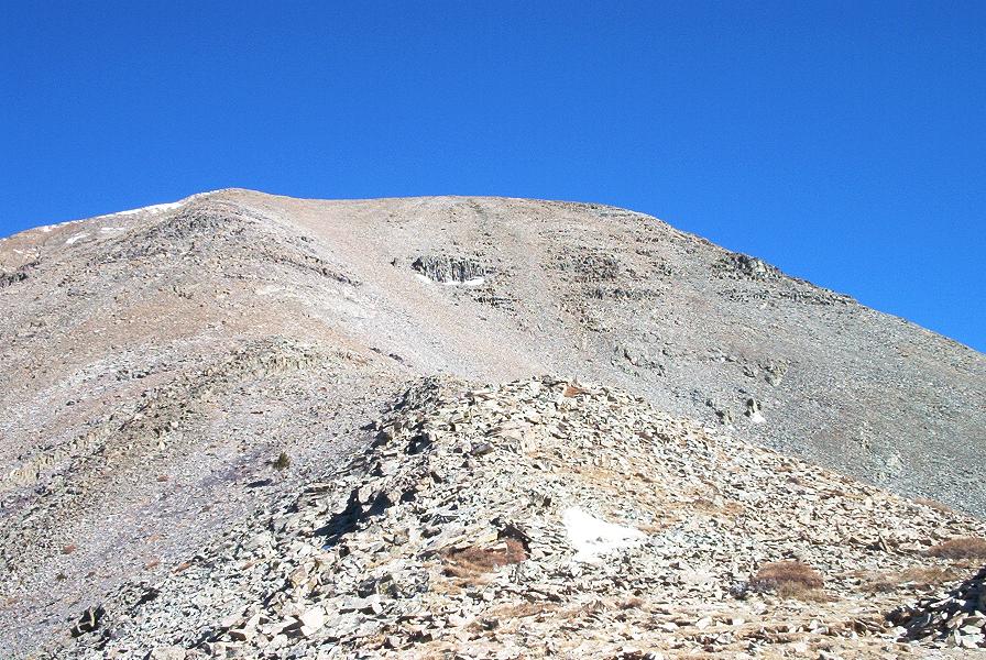
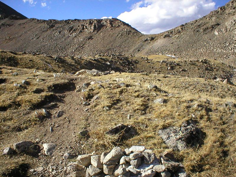
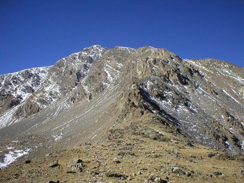
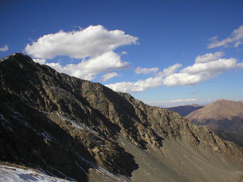
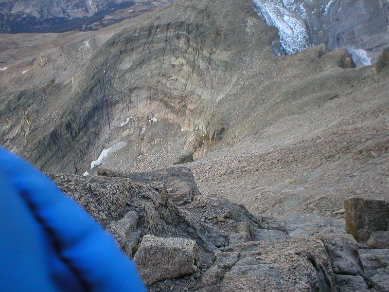
My next goal was Longs Peak, and I didn’t have any solid idea of the exact route to get there. As I got closer, it looked like I could just go straight up and over to Longs from the Loft, but I recalled what looked like a big gap along the way, and tried to reconcile this with the topo map on my gps. Here’s the view from the south, heading towards Longs.

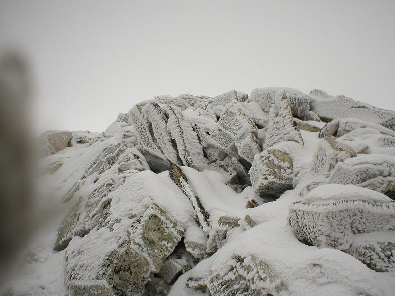
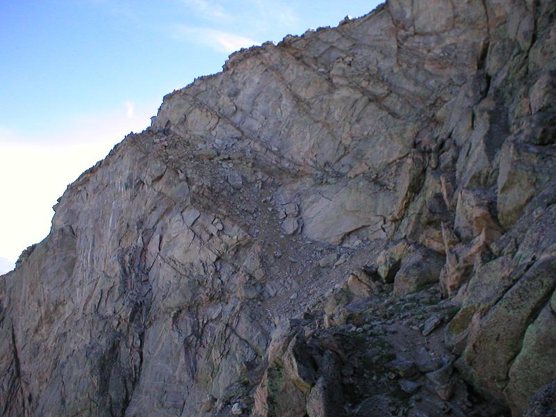
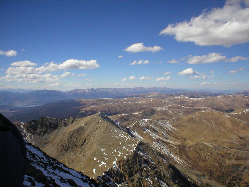
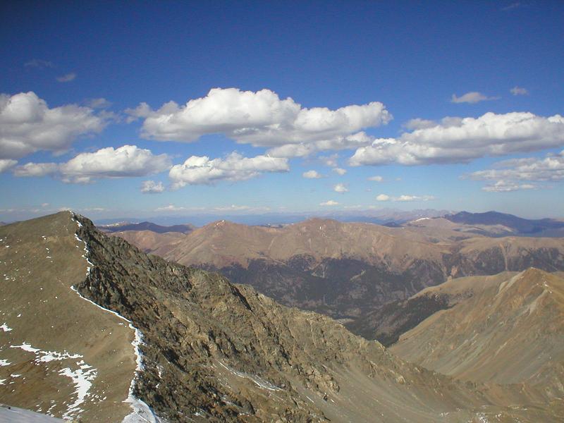
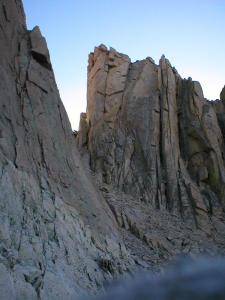
It was hard to do, but I went around to the left, and dropped several hundred vertical feet to make my way around. It was steep but fairly stable, with gorgeous scenery. I finally got a view that made me glad I didn’t just try to go straight up:

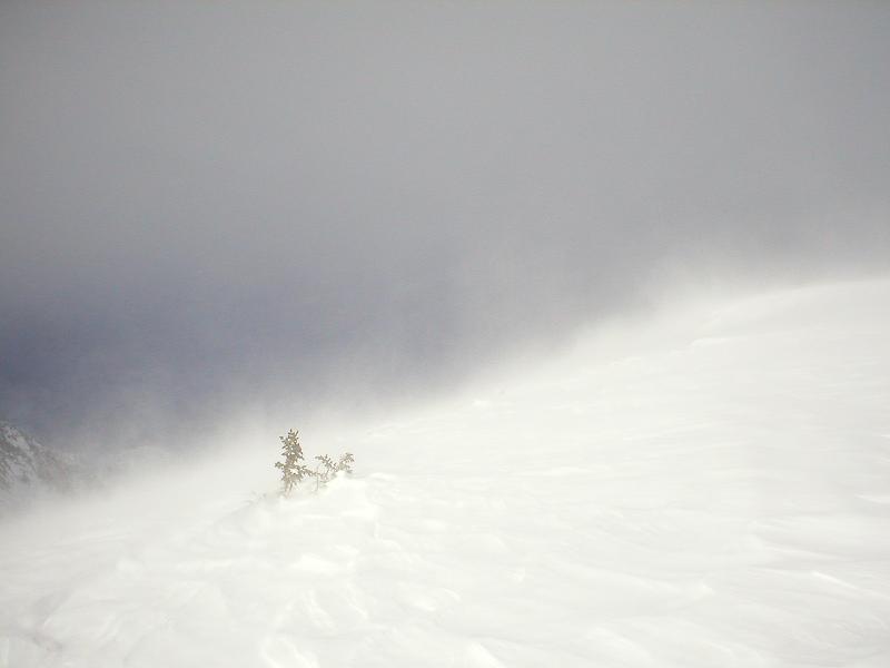
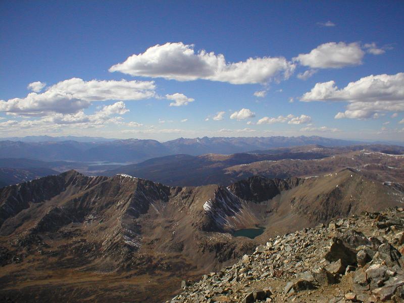
A little farther and I was at the “homestretch,” and joined up to the keyhole route. Still, not a soul in sight. 6 hours on Longs Peak without spotting a single person is truly remarkable. I was over 14,000′ at this point, and made the last 250′ up steadily, expecting to see at least one group on the summit. Nope. Check the register, and I’m the first person there. I guess the clouds blanketing Denver made people assume the mountains would be under blizzard conditions. Not quite true:

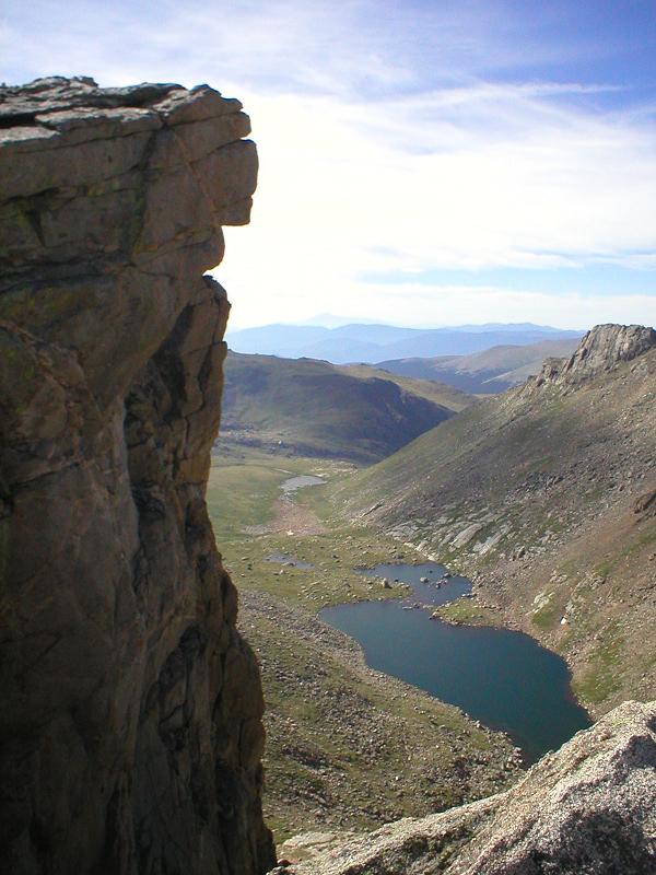
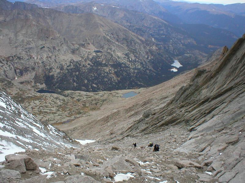
About 15 minutes later, people started streaming onto the top, 7 or 8 in only a few minutes. I started descending, and passed another 10 or 15 people by the time I got back down to the trough. I didn’t take but a couple pictures on the descent, since last year I showed all of you plenty of pictures two weeks in a row. I did, however, get this cool picture of the trough, with clouds creeping back into the valleys:

Once I passed down through the keyhole, I was getting very warm, so I lost the shirt. At some point, I was hopping down rocks, and my tempo picked up steadily until I was at an all out run down the trail. Some old guy told me I was crazy as I blasted by. It was a lot of fun, and helped make the 6 mile slog go by more quickly.

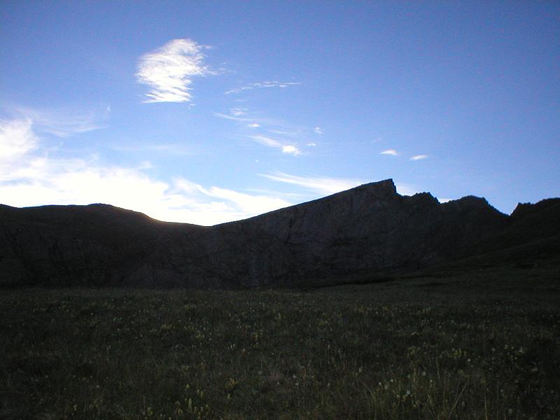
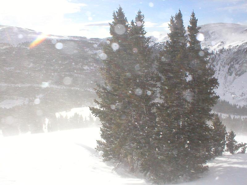
Shortly before re-entering the woods, I caught up to the clouds. It was truly amazing, as they were hanging in one place with only a tiny amount of wavering.

It was a wall of clouds, and a few steps made a difference between clear, warm summer day and cool, cloudy fall day. I made my way back to the trailhead, signed out, and saw that I was the only person who summited and returned so far. The ranger asked me for some information about the mountain, and was surprised to hear that it was bone dry on the standard route; understandable, given how thick the clouds were.

I was pretty sore, so popped a couple ibuprofin, and headed down the mountain. I stopped at a liquor store I used to frequent when I lived in Boulder (Superior Liquors, for those familiar with the area), and picked up a 12er of New Belgium’s “Saison,” their fall harvest brew, for $11. It was a tough call because Sunshine was the same price. Later in the evening I had a couple, and I highly recommend that those of you who have the opportunity to try some do so.

My next adventure will depend on what the weather does, but there’s a good chance it’ll be up Mount Elbert, highest peak in the state.

The Sawtooth – 7/29/06

Originally written 7/29/06

Some of you may remember last year’s report where I intended to climb Mt. Bierstadt, cross the sawtooth ridge, and go up Mt. Evans, but turned around after Bierstadt. Well, I finally did it, and I have no intention of ever going up there again.

I drug myself out of bed at 3am, ate, and was out the door just after 4. I got to the parking lot for the trail at 5:30, but apparently spent so much time screwing around and getting ready, I didn’t get on the trail until 6. It was a very nice morning, and this was the first thing I saw on trail.

I then got a nice shot of the ridge I’d be crossing before too long, backlit by the rising sun.

And what’s this behind me? Oooo…

No pictures on the way up to Bierstadt, because it’s boring and I’ve already been there twice. But from the top..

And my ultimate goal for the day, Mt. Evans.

But it wouldn’t be easy, especially since I had my dog along, and this is how I had to get there:

All in all, it wasn’t too bad. I had to pick up my dog and carry her short distances in a few places, but she handled most of it on her own. No pictures from en-route there because I was too concerned with moving and keeping my dog from falling to stop for pictures.

Towards the end of the route, you switch over to the west side of the ridge, so there was a good photo op there.

And the way out of this mess:

Looks fun…

A nice, loose, steep, highly exposed exit ramp. Outstanding. Well, we made it, and here’s the view back across what we covered:

A beautiful view from the Sawtooth:

While I was here, I figured I should go hop on Mt. Spalding, since it’s a high 13er and I didn’t want to have to come back for that, if I ever decided to start after the 13ers. It was also only about 20 minutes off my route. No pictures, since it was boring.

I finally hopped on the ridge over to Evans, and trudged along for an hour and a half, maybe two. It was long and tiring. And when I got there, I was blessed with this beautiful view:

Sigh.

Anyway, since the cool part of the day was the Sawtooth, I got a picture of me and the dog with the ridge behind us. Everyone was shocked that she made it across the Sawtooth ridge.

After about 10 minutes of heading back from that point, I was able to see just how far I had to go.

Sigh x 2.

Going down the valley that drops down just in front of me in the picture there is very steep, wet, loose, and all around crappy, but it’s the only real option. I’ll spare you the uglyness, and instead focus on the cool stuff.

After getting down that valley, I spent an hour or more bashing willows through a swamp. My shoes got soaked with swamp muck, and at times the willows were over my head, with no game trail to follow, so I just had to bash through while pulling my dog along.

Total Distance: Approx 12 miles
Difficulty: Mostly class 2 with a decent amount of class 3 and even a couple class 4 moves to try to get around some of those goddamned willows
Gross elevation gain: approx 1 mile
Car->Car time: 7h58m

Torreys and Grays Peaks – 7/22/06

Originally written 7/22/06

Yes, it’s been a while since I’ve made one of these. No, I haven’t been completely idle, just busy with work, and I haven’t done anything interesting enough for a thread. Plus, my camera sucks.

So, the story. Yesterday I had to be at work before 5am to make sure we were ready for a concrete pour. Sucked. Went to bed at 8pm, woke up at 5:30am today fully refreshed, so figured it’s a little late but what the hell, I might as well go climb something. My dog needed the exercise anyway, and I hadn’t been mountain climbing in a few weeks now. Got up, coffee, quick breakfast, get dressed, and go.

Got there around 7:45, used the can, and hit the trail.

The trailhead is at 11,240′. I had forgotten how cold high alpine valleys can be in the morning, even in July. The sun was making its way up at this point, with pretty spectacular views.

The sun crested up over the ridge not much later.

I was getting pretty damn warm at this point. Apparently fast hiking with a 30lb pack generates a lot of heat. I was wearing my new REI Mistral pants, which seem to be some pretty great 3-season pants. The thing is, the 3 seasons are fall/winter/spring. Way way way too warm for a summer day with calm winds.

I made my way up Torreys Peak (14,267′) first, sat down, and kicked back for a bit.

In my hand is a New Belgium Trippel, an excellent beer that weighs in at 7.8% ABV. I had two of them this day, roughly equivalent to four american light beers. I enjoyed the view as I drank my beers for a half hour or so.

For some reason, I was able to largely ignore this, which was almost directly behind me:

After a snack, I got up and meandered over to Grays Peak. Nice view from there too.

But then I looked up, and wasn’t too excited about what I saw.

The clouds were swirling and building very, very quickly, so I beat a hasty retreat.

Anyway, I rigged up a google earth file of my track, taken from my gps. I thought some people might appreciate it so [url=http://beanmj.googlepages.com/gtbeer.kmz]here[/url] it is. All my future HAI threads should have these tracks along with them. I’ve got one planned for the near future that should be pretty sweet to look at.

Yes, I’ve done these mountains before, and reported on them with a much more interesting route. Deal.

Dog:

Quandary Peak – 12/30/05

Originally written 12/30/05

Today I attempted to climb Quandary Peak, 14,265′. During the summer, this is a piece of cake, little more than a 3 mile walk to the top. However, it isn’t summer right now. Far from it, the area got a dumping of fresh snow last night, which turned out to cause more trouble than I had expected. Windchill for the time I arrived was predicted to be right around -30F, and I don’t doubt for a second that it was.

According to my GPS, I had a total ascent of 1900′, in 3.0x miles. My highest point was 12,290′. Here’s the track:

I took this very very soon after getting out of the car:

As I was moving through the woods, I heard some elk calls. Never saw them, but still pretty cool, and far preferable to the mysterious meow I heard on west spanish peak.

A few minutes later, the sun came up over the hills:

The snow on the “trail” hadn’t been touched in a while – it showed no signs of anyone being through there, despite all the wind being blocked by trees, and lots of the snowfall caught by branches. Here’s starting to come out of it, and that thing that sort of resembles a trail is where I trudged through the snow:

While I was in the heavy woods, I was mostly able to stay on top of the snow with my snowshoes and poles. Every now and then I’d go in some but it wasn’t horrible. That all changed as soon as I got out of the woods, and into this:

Beautiful, yes, but with almost every step came sinking, anywhere from my knees to my waist – and that was while watching out for the really deep areas.

I started to get up higher, which means stronger winds but also generally less deep snow. Things were going well, until the gusts got stronger and lasted longer. Eventually, the gusts turned into the sustained winds. I looked up, and saw some very dark clouds moving in very quickly. The weather forecasted an opening of a few hours between storms – apparently it was wrong.

When this became all I could see, I knew the weather wasn’t going to let me on to the top of that mountain today. I turned around and literally started running down the mountain:

A short while later, I came across some prints I laid down maybe 15 minutes earlier. This is all that was left of 2-3′ deep digs in the snow:

A couple minutes later, I was tired, and the weather seemed to be letting up, so I stopped for a minute. I noticed a few birds hopping around these trees, wondering what the hell they were doing up there. When the storm caught up to me, about 30 birds took off out of those couple trees:

Well, in the time it took to take out my camera and get a picture, the storm caught up with me, as you can see. I watched these clouds to gauge the storm’s progress, and if I hadn’t seen it with my own eyes, I wouldn’t believe how fast these came tearing across the valley:

I eventually got clear of the storm (dense enough trees), but as you can see in the track, I was at least 1/4 mile away on my descent as I was on the ascent. I took a much more direct route, that happened to have MUCH worse snow. Much of the time on the return trip, I was buried up to my chest. When I was about a 1/4 mi from the car, I took off my snowshoes, strapped them to my pack, and just charged through the snow as best I could. It sucked, it was exhausting, and my clothes filled with snow, but I got back, disappointed that I had to turn around when I was half way to the top.

Sorry I couldn’t provide any summit pictures, those’ll have to wait for summer. I’m still waiting for the weather to do Pikes Peak, with any luck it’ll be nice e
arly next week.

West Spanish Peak – 12/25/05

Originally written 12/26/05

I went out on a hike yesterday to get away for a few hours. I climbed the West Spanish Peak, which marks in at 13,626′, starting under 11,000′ for a gain of 2,700′. Yeah, “only” a mid-13er.

It’s the one on the right. Despite appearances, the one on the left is much shorter, somewhere in the 12,000′ area. Nice snow eh?

Round trip distance ended up right under 7 miles, according to my fancy new gps. The trail was questionable at best, and I spent roughly 3.5 miles trudging through unbroken snow. Here’s the view from a little ways in (ascent route is the big ridge that’s visible between the trees):

When I was moving through the trees, I heard something meow at me. I didn’t see anything, but I know for a fact that I have no interest in meeting anything that lives at 12,000′ and meows, so I grabbed some branches and banged them together for a little bit.

Here’s “treeline.” You can kind of see a trail there. That’s FAR better a trail than what it turns into in a couple hundred feet.

That’s right, snow-covered in october, barren at the end of december. I was kind of pissed about that, because snow could have been a lot easier to go up than this:

Somewhere around 1,500′ from the top, I saw a couple Rocky Mountain Bighorn Sheep. One male with the big curling-around horns, and one female with small ones. They looked at me for a minute then wandered off. There were also the usual marmots scampering around the rocks all over the place. There was a little snow up top though, which wasn’t so much snow as white ice. I had to grab rocks and bash them in for handholds so I wouldn’t slide off the mountain.

I finally made it to the top, and found that I was the first to sign the register since December 2, 2005. Of course, I ran into some jackass that shakes hands like a woman on the way down. Still, it was nice to be the only one out there for so long. I was alone for all but 30 seconds or so of the 4.5 hour trek. Here’s a couple kickass pictures from the summit. The mountain range there is the Culebra Range, which has one 14er in it, and is all privately owned. There are arrangements that can be made, for $100 per person. I’m looking into things. The other picture shows the radial dikes, with the San Juans in the background.

Scenics:

Boulder Hiking – 10/14/05

Originally written 10/16/08

That’s right, nothing really high up there. In fact, the highest I got today was around 8500′ – not even enough to get you breathing hard.

Here’s where I went (started on the top route):

I did Green Mountain, South Boulder Peak (highest point in Boulder), and

Total distance was about 10.2 miles, if I added up the lengths correctly, and car-car time was about 5:15.

Total supplies needed was 3 liters of water, 2 clif bars, and no shirt.

I have this view:

no more than 2 minutes from home. In fact, time from home -> trailhead was 10 minutes of driving.

Fairly early on in the hike I came to this:

That’s right, mid 70s out, I’m in shorts + no shirt hiking and sweating, going through snow. I love this place.

Although it’s only the 2nd highest spot, Bear Peak has the best view:

I realized I was going to run out of water on my hike by the time I hit Green Mountain, when I wasn’t even half done and had 3 hours left, so I was rationing my water pretty hard. About a mile from the car, I ran out. Not sure how this happened, I used about the same amount of water for this as I did on Long’s Peak.

Torreys Peak – 10/08/05

Originally written 10/08/05

I shall be telling this with a sigh
Somewhere ages and ages hence;
Two roads diverged in a wood, and I —
I took the one less traveled by,
And that has made all the difference.

Today I went after Grays and Torreys Peaks. Hit the trailhead about 10:10am. The normal route up is basically a class 1 the entire way. I had planned on just doing that, although had the idea of taking the non-tourist way up in the back of my mind. That alternate route goes up kelso ridge, which is a big ridge connecting Torreys from a mountain called Kelso. Everything I read described it as a class 3 route.

Here’s the start of the ridge, at the bottom of the saddle between them:

Here’s a little bit up the ridge – a very little bit. If you look carefully in the middle, you can see a guy or two. There were 6 or 7 of them going up Kelso Ridge for a bachelor’s party thing.

They had NO idea what they were getting themselves into. For that matter, neither did I. However, they were going ridiculously slow – move for a minute, sit for 5. I wouldn’t be surprised if they need a helicopter rescue sometime tonight.

A while after I left them, I saw this:

As you may be able to tell, it’s a mountain goat. Fatigue/exhaustion and altitude, on their own, can both affect judgement and perception. Together, they are even worse. When I saw two white fuzzballs moving out of the corner of my eye, something popped into my head. “Oh my god, polar bears, they’re going to eat me.” Yep.

There was a lot of very loose, very steep, and very dangerous climbing. This went on for a couple miles. That was nothing though. This was waiting for me at the top:

That’s taken right after crossing it. You go on the left side, jamming your hands into cracks in the wall as hard as you can. If you don’t, there’s a couple hundred feet of air right underneath you. Clearly, it would have been safer to turn back, but that wasn’t really an option. About 10 minutes into the route, you’re essentially committed to going to the top, because you have a 20′ near-vertical wall to scale.

Very shortly after this, you’re at the top – 14,267′. It’s gorgeous from up there.

Of course, no time for much rest, it was 1:45 after I drank water, ate food, and otherwise caught my breath, and I still had another 14er to bag.

Fortunately, there’s only about 500′ of vertical drop and then you go back up, and I was up on Greys in about 45 minutes. The view was unbelievable.

Me with godawful hair on top of Greys, with Torreys in the background:

It had been a long, long hike and I was ready to go home. On the way down, I took this picture of the top 1/3-1/2 of the ridge I had gone up:

Whoever
said that was class 3 needs a kick in the head. It was a 4, with some possibly low-5 sections.

My knees hurt, again. I’m exhausted. Next week: maybe nothing, maybe Pikes Peak (26mi round trip, about a mile and a half vertical gain).

Mt. Bierstadt, 10/01/05

Originally posted 10/01/05

Early this morning I set off to an attempt at two 14ers at once. Mt. Evans and Mt. Bierstadt are very close to each other, and can easily be done together. To do this, you hike up to the top of Bierstadt (class 2 hike, about 3 miles to the top), then cross the sawtooth (Bierstadt is the peak on the right, sawtooth is class 3 climbing):

After you cross the sawtooth, it’s mostly easy stuff from there – head east a mile or two, regain some elevation, and you’re there. Then come back and take an easier and shorter way down, bushwhack through a giant willow field, and you’re home.

I got in the car about 3:40, and headed off to Georgetown, CO. Uneventful drive so far. Once you get into Georgetown, you head up Guanella pass. I don’t have any pictures of it, but to say that the road is in godawful condition is putting it lightly. There are frequent 1′ deep, 3′ diameter potholes. Some bigger, some smaller, but LOTS of them. Apparently they realized this is a problem and decided to shred the road and have been doing “construction” for a couple years now. Still no new pavement, just shitty old potholey road, and dirt. Dirt with gigantic potholes. After 12 miles of that, I got to the parking lot.

Left the trailhead at 5:30, and when I was nearing the summit, my knee started hurting. Not sure why – I didn’t twist it or anything. It hurt a little yesterday but I shrugged it off as not-a-problem. I pushed on to the top anyway. No register that I saw, but I did find the USGS marker:

My knee kept hurting more, so I sat down, ate some food, drank some water, and took some ibuprofin. I looked over to the sawtooth, but didn’t think to get a picture of it from that perspective. “Discretion is the better part of valor” popped into my mind, and I almost immediately knew I wasn’t going to be crossing over today. It wasn’t worth possibly being stuck or falling off the mountain and dying (there are pretty major drops off both sides) to risk it, so I sat back for a few minutes, took in the scenery, and took some pictures:

A real, genuine lens flare, not added in PS:

The Mt. Evans ranger station is the little verticle spike a little left-of-center in the picture.

Here to the west you see Grey’s and Torries peaks (the double one with the saddle). Those are pretty easy, although there’s a more difficult (fun) way to go up that I will possibly be attempting in the next few weeks, depending on weather, school, work, etc.

Looking south, you can see Pikes Peak. That’s down by CO Springs and involves a 26 mile hike round-trip, so I may be doing that one the next time I go visit my parents, which is another 2 hours south of CO springs (go down one day, hike it, sleep in the car, finish the trip – or just do it all at once, we’ll see).

I took a picture of Long’s Peak from the summit, but it’s really small and far away and hard to see.

You may have wondered why my finger was in the picture of the sawtooth up above. Well, this is why:

When I got back to the bottom, my knee was feeling better, so I decided to go bushwhacking in the willows and head over towards the hike up evans. As I was heading over to get up the much easier, not-sawtooth way, I realized I didn’t have enough water left to do it. Apparently I had forgotten to take the camelbak bladder out of the bag when I filled it, which cut its volume by at least 1/2. At this point, I had no choice but to turn around and head back to the car.

So only one successful summit today, and an easy one at that – only about 4 hours start to finish. As disappointed as I am, it’s better to still be alive. I’m sure I’ll end up doing Evans this winter with snowshoes, which will be nice since the snow gets up above the willow height. Those things are THICK and in many places up over 6′ tall. That’s going to be an 8 mile round-trip hike. Should be fun.

Next week: who the hell knows (if anything at all)
Week after: Possibly Pikes Peak, possibly something else.

Longs Peak – 9/24/05

Originally written 9/24/05

All pictures taken from the summit down. I left the trailhead at 2:35am, so it was dark all the way up.

So I did something that could be considered ridiculous. After proving that I am better than a 14,259′ mountain, I decided to do it again. Last time it took exactly 5 hours trailhead -> summit. My goal for this round was 3.5h to the top.

Well, that didn’t happen. The mountain tried to kill me.

At the top of the trough, there’s a final section you have to go through. It’s probably 60 degrees, and is wedged between two rocks at an angle to each other. There are some handholds, but they were full of ice. The genius I was, I tried to go the normal way. Almost made it, but I ended up falling on my back and sliding back down, headfirst for probably 15′. I thought I was going to die, but something stopped me. My headlamp got knocked off. This is the view from roughly where I fell to:

Pretty, isn’t it? Well, this is the direction I was headed (the icy chute on the left of this pic):

This is where that chute continues (that’s where I was wandering around lost for 30 minutes last week):

Now, this scared the hell out of me. I wasn’t even sure I wanted to go on, but I found another way around to get on top of the section that almost killed me.

In the narrows, there’s a cool thing called the “black hearse,” it’s a rock formation that looks like…duh…a hearse. It’s about 2,000′ below me here (in the middle of the pic):

I also saw a weasel (on the way back down):

What the hell is that thing doing up there?

I almost gave up at the homestretch, but I kept pushing through and was rewarded with this, after a climb of four hours and twenty minutes – far slower than my goal, but acceptable considering I almost died:

I gave the ozone layer a good punch to teach nature for trying to kill me. On a side note, those self-heating coffees apparently don’t work at 14,000′. Pissed me off.

On the way back down, I had to cross a section of that ice chute that was covered in about 1/2″ of pure ice – no dirt, snow, just a couple tiny rocks peeking through here and there, ended up sliding on my ass trying not to swing around too much on it:

Fun!

Finally, I got back to the keyhole around 9 (note the killing fields behind me):

2.5 hours later, at 11:33 (8h58m) I was back at the bottom. I’ve got a shitload more pictures of the mountain, other mountains, trees, etc. Even a picture of a vole, although that was so small it didn’t come out too well. I’ll upload more pictures if anyone wants to see them.

Probably gonna be at least a few weeks until I do this sort of shit again.

A couple scenics: